Warm Front Cold Front Combo Showers Thunderstorms Tuesday Warm Front Cold Front Combo Showers Thunderstorms Tuesday Another warm front cold
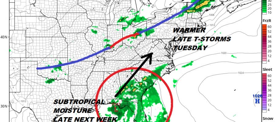
Warm Front Cold Front Combo Showers Thunderstorms Tuesday Warm Front Cold Front Combo Showers Thunderstorms Tuesday Another warm front cold
Weather Front Offshore Slow Improvement GET READY FOR COLDER WEATHER Weather Front Offshore Slow Improvement Yesterday’s slow moving weather
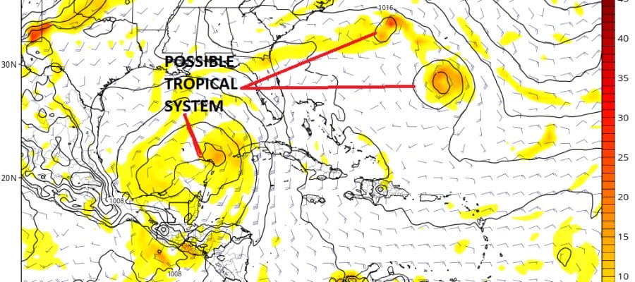
Tropics Quiet & Hostile For Development Until Late Week Tropics Quiet & Hostile For Development Until Late Week For the
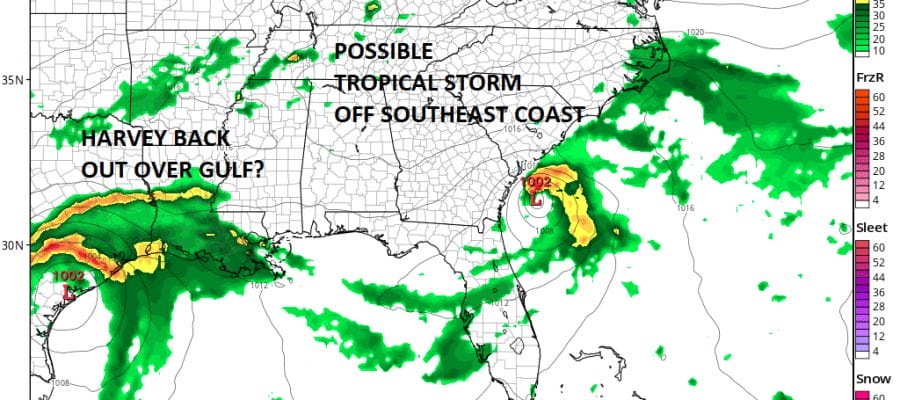
TROPICAL STORM DEVELOPMENT INCREASING CHANCE SE COAST TROPICAL STORM DEVELOPMENT INCREASING CHANCE SE COAST TROPICAL STORM WATCH MAY BE
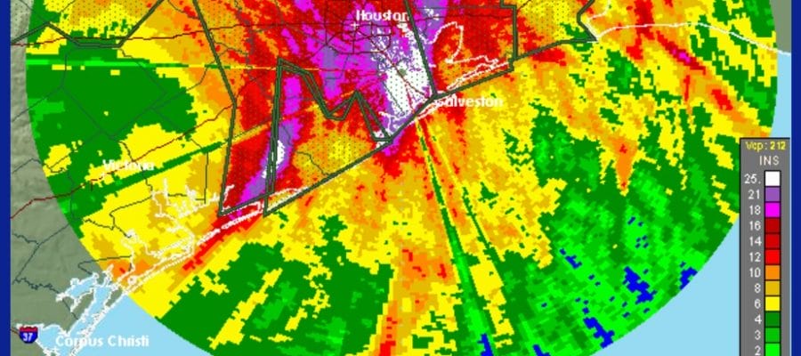
HARVEY EPIC RAINS CONTINUE, WATCHING SOUTHEAST COAST MONDAY HARVEY EPIC RAINS CONTINUE WATCHING SOUTHEAST COAST MONDAY POSSIBLE TROPICAL STORM DEVELOPMENT

Tropical Storm Formation Southeast Coast Possible Monday Tropical Storm Formation Southeast Coast Possible Monday While all the attention has