Tropics Busy For Late May Early June

Tropics Busy For Late May Early June

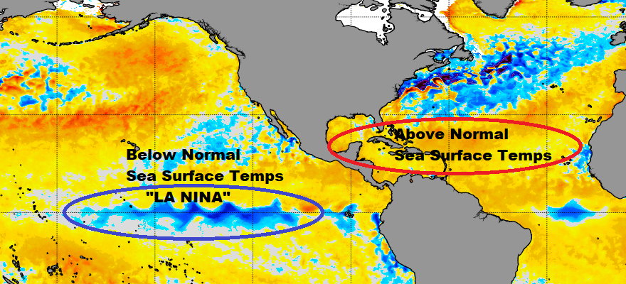
Tropics Busy For Late May Early June The Atlantic hurricane season is off to a fast start with the first
Last Summer Weekend Sunshine Beach Days Autumn Monday Chance Showers

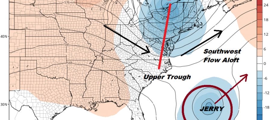
Hurricane Jerry Moving West Northwest Bermuda May See Second Hurricane In Less Than a Week

Hurricane Jerry Moving West Northwest Bermuda May See Second Hurricane In Less Than a Week Satellite pictures this evening showed
Watching Disturbed Weather East of Florida

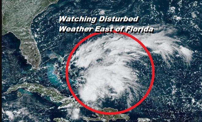
Disturbed Weather East of Florida Watching for Signs of Development

Disturbed Weather East of Florida Watching for Signs of Development Recent satellite pictures of the disturbed weather just east of
Tropical Activity May Pick Up This Weekend & Next Week

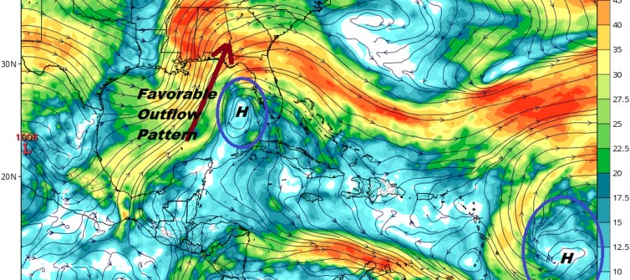
Tropical Activity May Pick Up This Weekend & Next Week

Tropical Activity May Pick Up This Weekend & Next Week Today marks the statistical peak of the hurricane season. There

Hurricane Watch Georgia South Carolina Coasts Dorian Stationary Over Grand Bahama

Hurricane Watch Georgia South Carolina Coasts Dorian Stationary Over Grand Bahama

Hurricane Watch Georgia South Carolina Coasts Dorian Stationary Over Grand Bahama Hurricane Warning Florida Jupiter Inlet to the Georgia Border
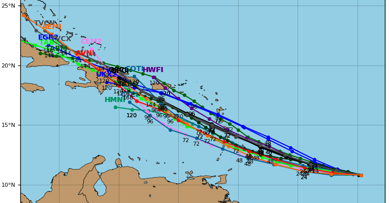
...DORIAN MOVING STEADILY WESTWARD... ...WATCHES WILL LIKELY BE NECESSARY FOR PORTIONS OF THE LESSER ANTILLES ON SUNDAY... SUMMARY OF 1100 PM AST...0300 UTC...INFORMATION ----------------------------------------------- LOCATION...10.9N 50.4W ABOUT 635 MI...1020 KM ESE OF BARBADOS MAXIMUM SUSTAINED WINDS...40 MPH...65 KM/H PRESENT MOVEMENT...W OR 280 DEGREES AT 14 MPH...22 KM/H MINIMUM CENTRAL PRESSURE...1008 MB...29.77 INCHES WATCHES AND WARNINGS -------------------- There are no coastal watches or warnings in effect. Interests in the central and northern Lesser Antilles should monitor the progress of Dorian. DISCUSSION AND OUTLOOK ---------------------- At 1100 PM AST (0300 UTC), the center of Tropical Storm Dorian was located near latitude 10.9 North, longitude 50.4 West. Dorian is moving toward the west near 14 mph (22 km/h). The tropical storm is forecast to move generally west-northwestward at a similar forward speed for the next several days. On the forecast track, Dorian is expected to be near the central Lesser Antilles on Tuesday. Maximum sustained winds are near 40 mph (65 km/h) with higher gusts. Gradual strengthening is forecast during the next few days, and Dorian could be near hurricane strength when it approaches the central Lesser Antilles on Tuesday. Tropical-storm-force winds extend outward up to 25 miles (35 km) from the center. The estimated minimum central pressure is 1008 mb (29.77 inches).

Tropical Storm Dorian Continues West While Florida Low Offshore & Heading Northeast

Tropical Storm Dorian Continues West While Florida Low Offshore & Heading Northeast Tropical Storm Dorian continues on a west to