Tropics Busy For Late May Early June
The Atlantic hurricane season is off to a fast start with the first tropical storm Arthur already in the books. While there isn’t anything important going on at the moment there are a few things that are worth looking at. The first one is a weak low and trough that is over Florida and is producing quite a bit of cloud cover over Florida and the Southeast US along with disorganized scattered showers. If we were deeper into the hurricane season or if this were more of an August set up, it might be more interesting. Weak low pressure is over Florida and about to move offshore. By this time tomorrow it will be along the South Carolina coast and moving northward. No development is forecast though the National Hurricane Center does hold a low 20% chance something could come of it. Upper air winds are strong and that is unfavorable for development. I mention this because some of the clouds and showers are destined for us on Thursday. It will be a minor inconvenience and nothing more.
SATELLITE
The second system of note is actually on the Pacific side which we don’t normal look at but this could be one of those occasional times where something may develop on the Pacific side and then cross over into the Western Caribbean. Widespread disturbed weather is showing up on the satellite picture this evening and conditions are favorable for a tropical depression or even a tropical storm to develop over the weekend. The National Hurricane Center rates this a 70% chance at the moment.
REGIONAL RADAR
The upper flow across the Gulf is weak and shows a general flow from south to north. Also we have noticed that pressures across the lower Gulf of Mexico to the Caribbean and over Central America will be lower than normal as we head through the weekend and into next week.
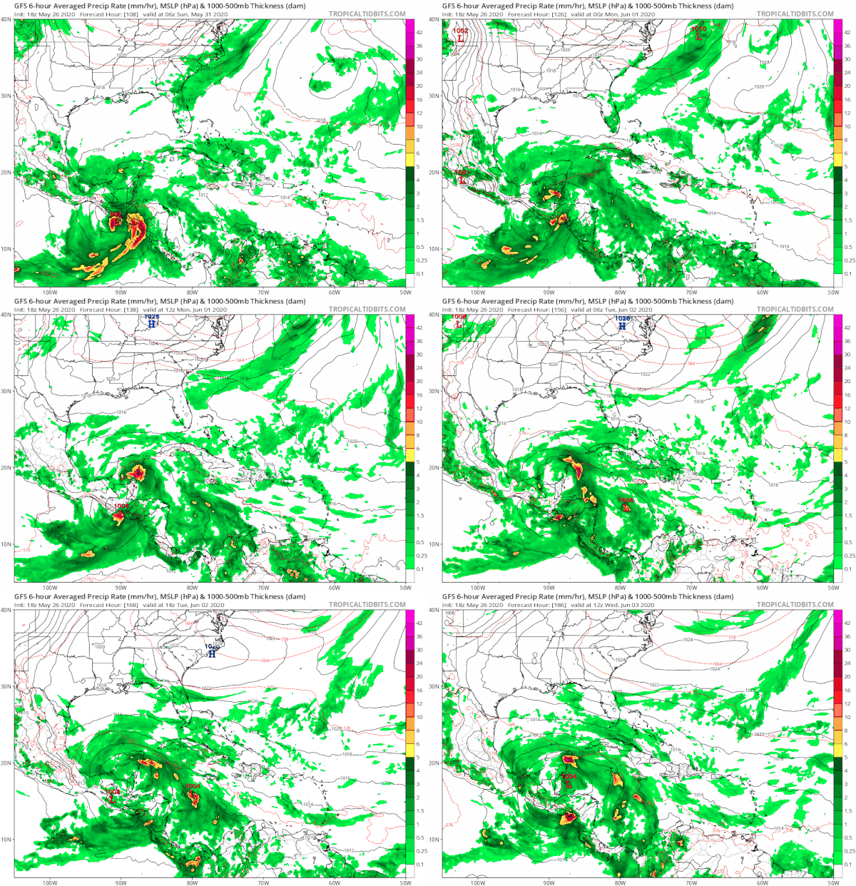
The GFS model has been insisting on something coming from this as the Pacific tropical system moves northward and inland and a large gyre turns over the region over Central America into next week. This creates an environment favorable for disturbed weather to develop across the Western Caribbean into the Bay of Campeche.
Watching the loop of the GFS which carries into the middle of next week shows this spiraling mass of moisture with falling pressures in the Northwest Caribbean. If something forms this time of year, this is the area where you would might see something for late May and early June. It is something to watch for the time being. One thing that strikes me is the early activity may be a signal of an active hurricane season ahead.
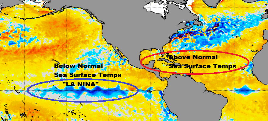
We are seeing above normal sea surface temperatures across much of the tropical and subtropical Atlantic Basin. We are also seeing the development of a “La Nina” signature across the equatorial Pacific. Below normal water temperatures in this region correlate with La Nina conditions. Upper air winds are impacted on the Atlantic side where they are light (less wind shear) and more favorable for tropical storm formation (or least less hostile). The La Nina seems to be the basis for above normal hurricane activity for the Atlantic side. What this doesn’t tell you is when the storms come. It doesn’t necessarily mean we will see storms early. Even the development of Arthur last week is not an indicator of an active season. However the puzzle pieces seem to be pointing to a busy summer and fall.
BE SURE TO DOWNLOAD THE FREE METEOROLOGIST JOE CIOFFI WEATHER APP &
ANGRY BEN’S FREE WEATHER APP “THE ANGRY WEATHERMAN!
MANY THANKS TO TROPICAL TIDBITS FOR THE USE OF MAPS
Please note that with regards to any severe weather, tropical storms, or hurricanes, should a storm be threatening, please consult your local National Weather Service office or your local government officials about what action you should be taking to protect life and property.


