A Nice Warm Afternoon More of the Same Wednesday Watch For Showers Thursday
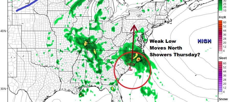
Once again we had a bit of a rough start with low clouds and patchy fog this morning but it did finally burn off to sunshine and we are enjoying a nice afternoon of weather. Temperatures have reached the 70s along the immediate coast while just inland we are seeing highs in the 80 to 85 degree range. All in all a nice day and we will do it all over again on Wednesday. Skies across the Northeast down into Northern Virginia are mainly sunny though there are still some clouds over Southern New Jersey south into Southeastern Virginia. Further south we see disturbed weather from Florida to the Carolinas producing some heavy rains there. We want to keep an eye on this for Thursday. It puts a bit of a wrinkle in the forecast and we have to include some showers at that point.
SATELLITE

REGIONAL RADAR

Low clouds develop again tonight with most lows in the upper 50s and lower 60s. Look for some patchy fog as well. Then it burns off again Wednesday to some sunshine. Highs will be in the 70s along the coast with highs reaching into the 80s again inland.
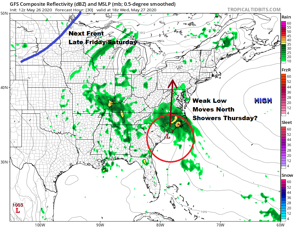
Weak low pressure over Florida is going to crawl mostly northward and by this time tomorrow will be coming ashore along the Carolina coast. It probably doesn’t have time to develop into anything tropical but the rain that is in the Southeast today will move northward for Thursday. The good news is that it will be moving into an area of higher pressures aloft so the rain shield weakens to just a few showers Thursday. Otherwise it will be a warm and humid day overall with temperatures in the mid 70s to lower 80s. I’m not expecting much from this and it is possible that some areas won’t see anything of consequence.
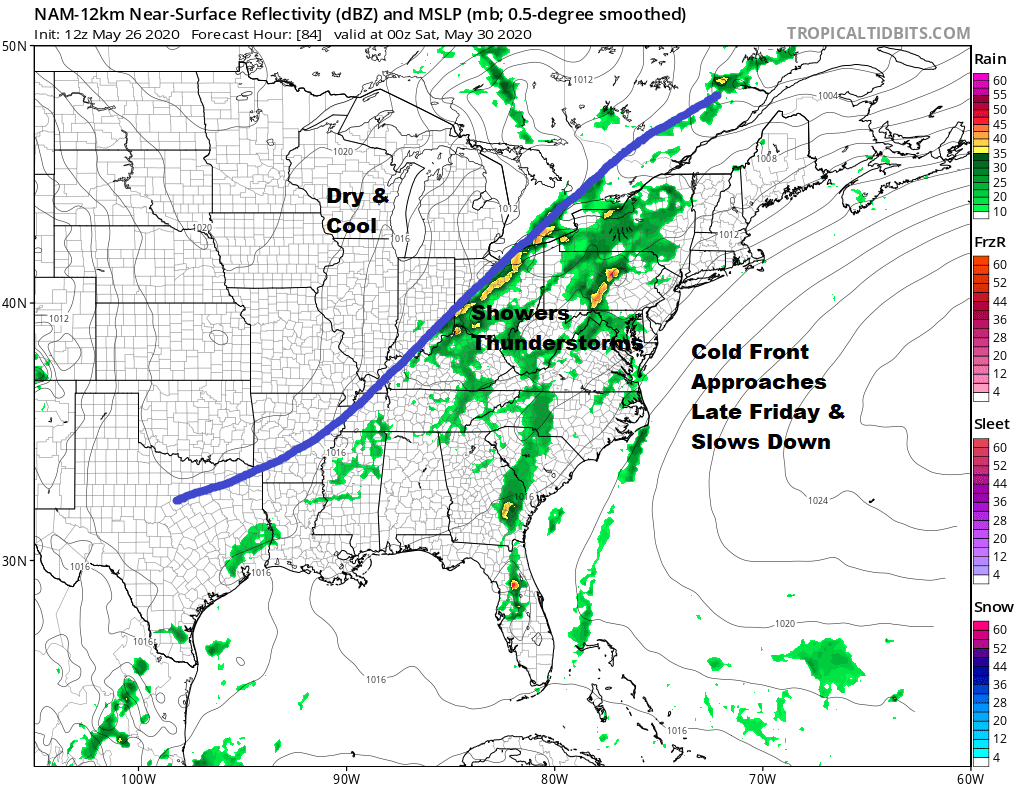
Friday will be a warm humid day as the next cold front approaches but this front is going to slow down as it waits for a strong upper trough to swing it east for Saturday. Much of Friday will be fine. It seems any showers and thunderstorms other than a pop up or two should stay to the west and wait for the front to get closer to the coast. Highs Friday will be in the 80s away from the ocean.

The front will stall overhead Saturday with a bit of a wave that develops on it so that puts us at risk for some showers and thunderstorms until the front clears the coast and weather conditions start to improve. That may have to wait until Sunday which looks to be the better weekend day. We will also look for the possibility of some severe weather Friday night or on Saturday depending on the timing of that front. If it comes through later in the day the risks for severe weather will likely rise.
BE SURE TO DOWNLOAD THE FREE METEOROLOGIST JOE CIOFFI WEATHER APP &
ANGRY BEN’S FREE WEATHER APP “THE ANGRY WEATHERMAN!
MANY THANKS TO TROPICAL TIDBITS FOR THE USE OF MAPS
Please note that with regards to any severe weather, tropical storms, or hurricanes, should a storm be threatening, please consult your local National Weather Service office or your local government officials about what action you should be taking to protect life and property.


