NATIONAL WEATHER SERVICE SNOW FORECAST MAPS
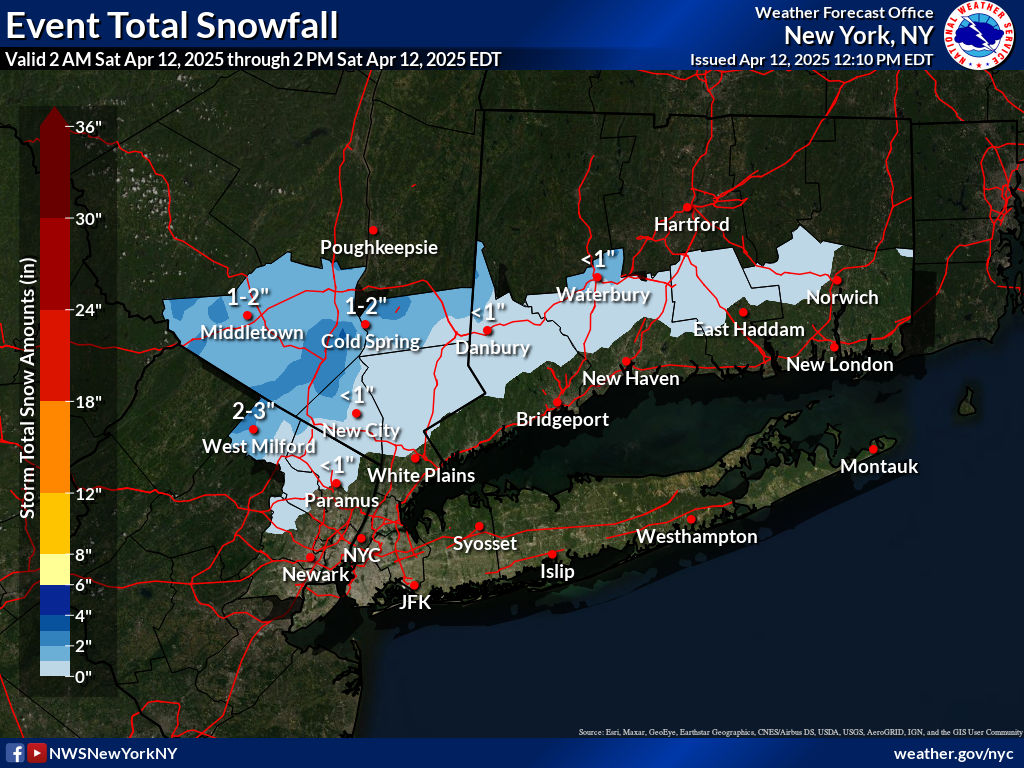
New York City, Ne NJ, HV, LI, Coastal Ct

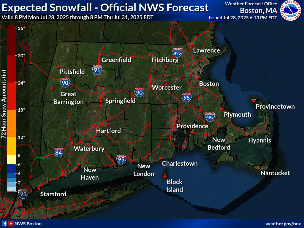
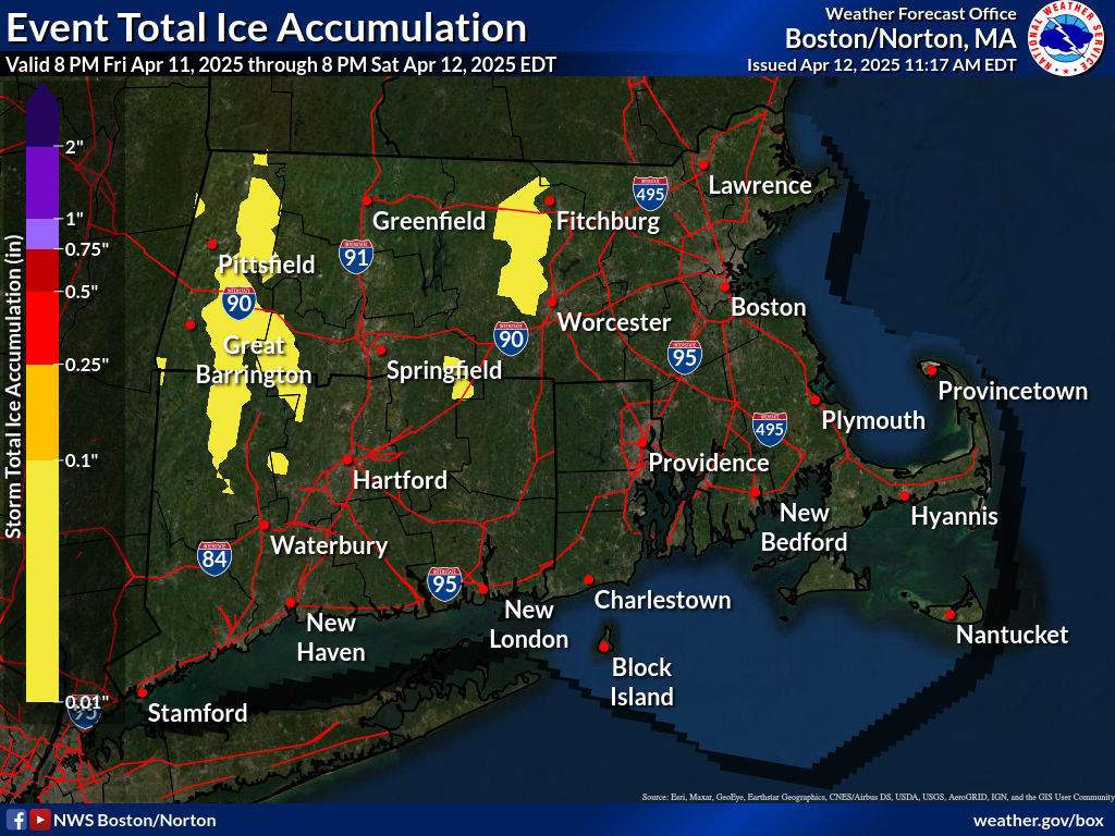
SOUTHEAST NEW ENGLAND
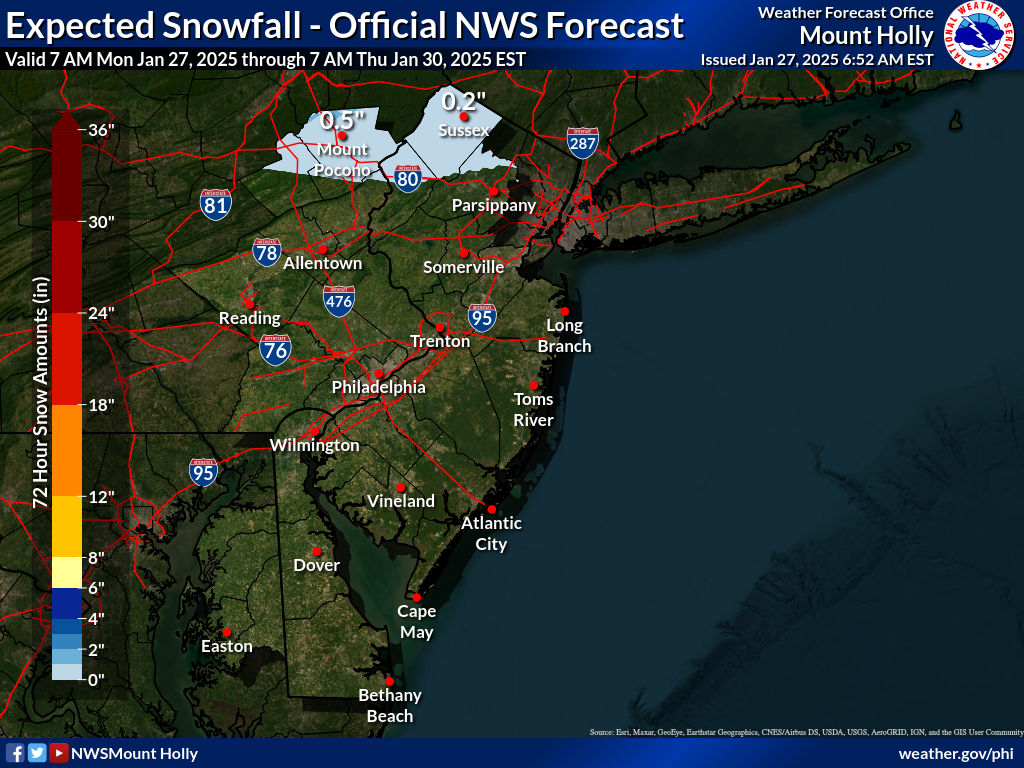
NEW JERSEY & PARTS OF NE PA
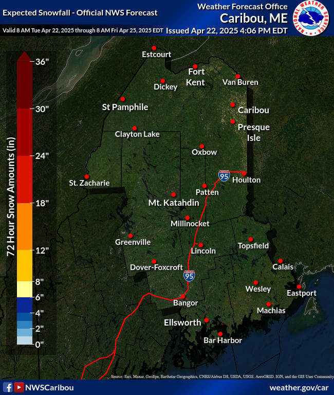
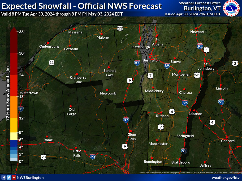
NORTHERN NEW ENGLAND
WESTERN NEW ENGLAND
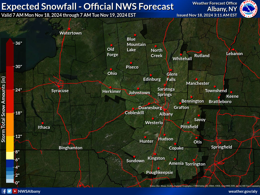
MIDDLE AND UPPER HUDSON VALLEY
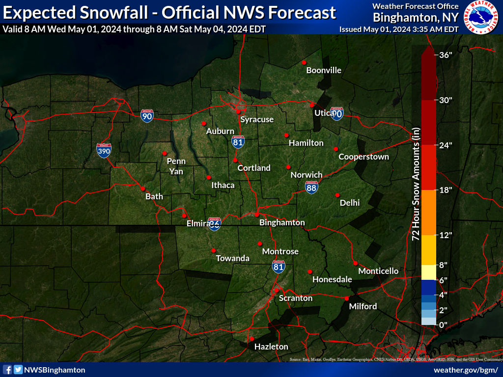
CENTRAL NEW YORK & NE PA
ICE FORECASTS
Southern New England Ice Forecast
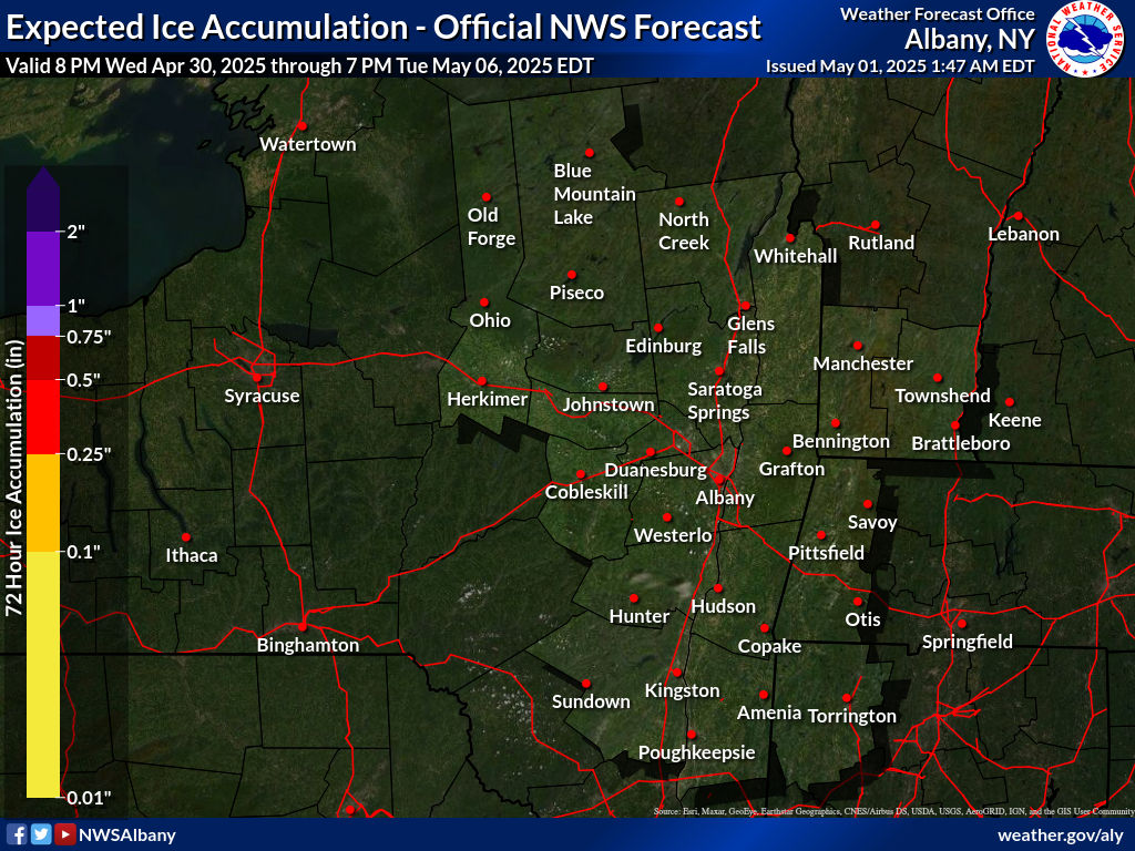
Middle & Upper Hudson Valley Ice Forecast
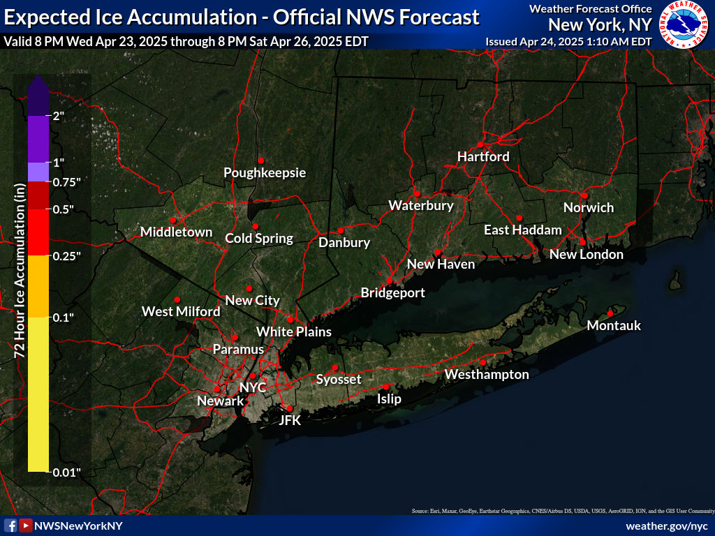
Southeast NY Ice Forecast
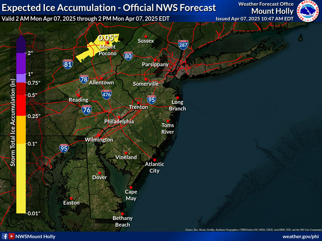
EASTERN PENNSYLVANIA NW CENTRAL & SOUTH JERSEY/DE MD
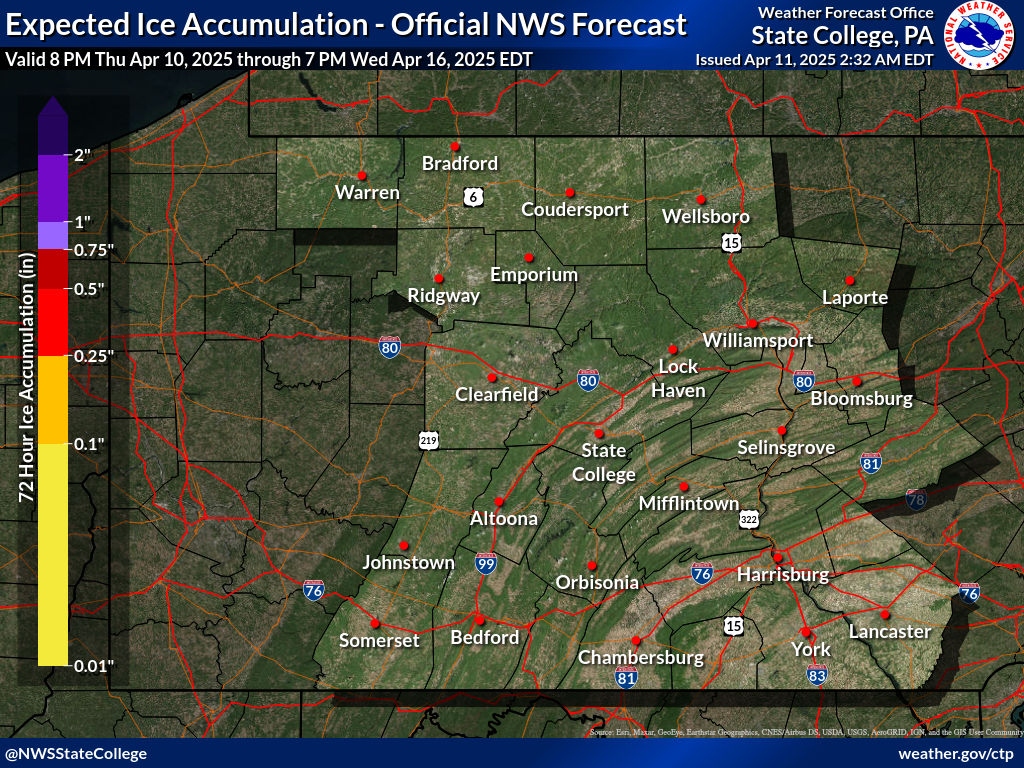
Southern & Central PA
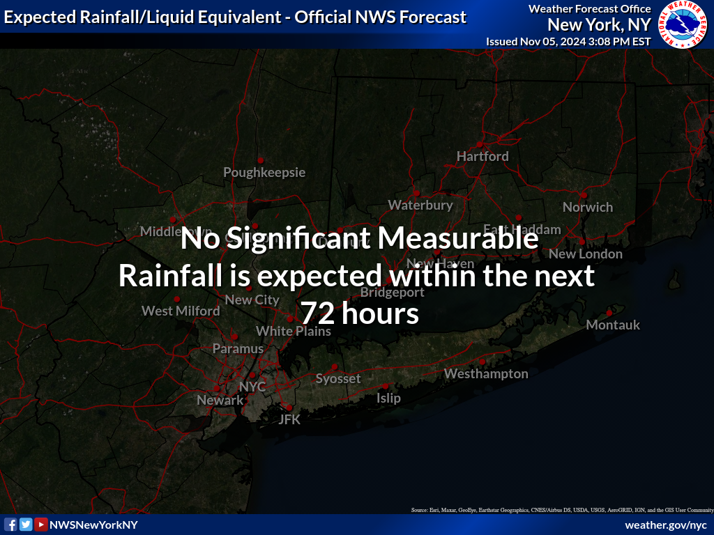
NEW YORK CITY AND VICINITY RAIN FORECAST