Tropical Storm Forming South Carolina Coast Northeast Another Day Clouds To Sun
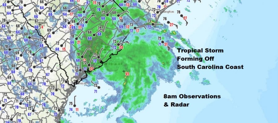
it is rather remarkable that we could see the seasons second tropical storm later this morning and it isn’t even the official start of hurricane season yet. Overnight the system off the Georgia/South Carolina coast has become much better organized and we are seeing tropical storm force winds off the South Carolina coasts. Some buoy reports are showing gusts over 50 mph at times. There also seems to be a fairly well defined core of convection and a circulation center is rather obvious on the radars below. Meanwhile while we have that going on we are starting another day with clouds from Southern New England south into Maryland and Delaware. This should be another case of clouds giving way to sunshine. North and west of NYC the sun is already going to work as skies are clear as you head north.
SATELLITE

REGIONAL RADAR

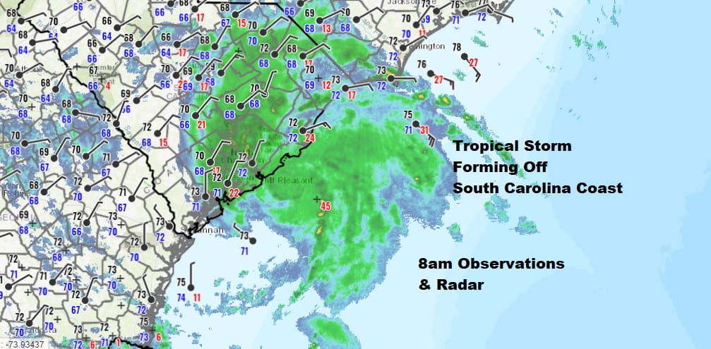
Since our radars are quiet we shifted attention to the Southeast US with the system off the coast moving inland later today. Two local radars are on view from Charleston South Carolina and Wilmington North Carolina. The low is just offshore by about 100 miles and it will be inland this afternoon. If it doesn’t make the criteria for a tropical storm or tropical depression, it will be producing heavy rains and gusty winds along Coastal South Carolina to a small portion of Southwest North Carolina.
LOCAL RADAR CHARLESTON S.C.

LOCAL RADAR WILMINGTON NC

From here the low moves north northwestward and it looks like any showers from this will pass well to our west on Thursday. So for our area it is more of the same. Low clouds and patchy fog will develop tonight with most lows in the upper 50s to lower 60s. Thursday we will see clouds and some sun though we may see more cloud cover than in past days. A passing shower can’t be ruled out. Highs will be mostly in the 70s though cooler along the coast.
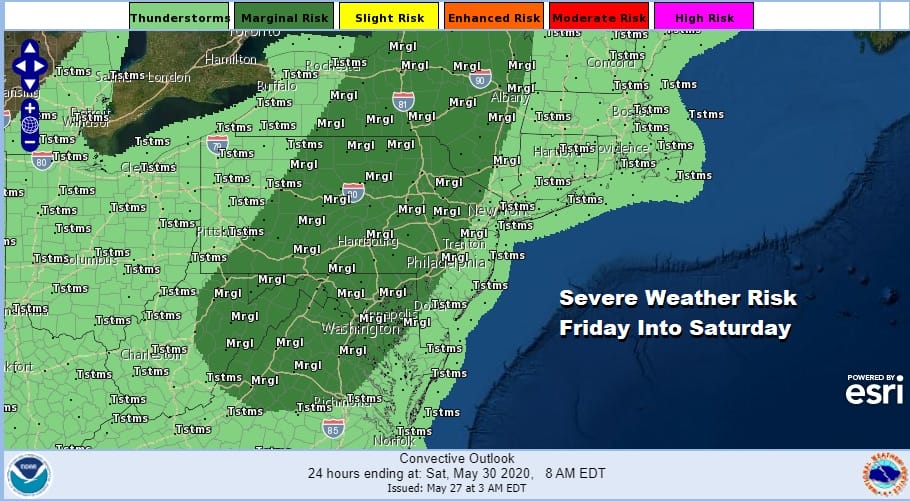
The next cold front starts its approach on Friday which will be a warm and humid day with some sunshine. Highs will reach into the 80s over many areas except right along the immediate coast. Showers and thunderstorms are possible late in the day and more likely Friday night into Saturday morning. The Storm Prediction Center has hoisted a marginal risk for severe weather and we could see this juiced up a bit given the strength of the upper trough moving through.

Some of the models are a little faster with this cold front moving it along. I’m still not completely sold regarding Saturday with the upper trough lagging but there is room for optimism if the front moves offshore and keeps on going. Some sun should return Saturday though we will leave in the chance for a shower or thunderstorm. Highs will be in the 70s. Sunday and Monday will be much cooler as high pressure builds in from the Great Lakes. Sunday we will see highs in the upper 60s and lower 70s. Monday brings a little cooler air re-enforcement and highs will be just in the 60s to near 70.
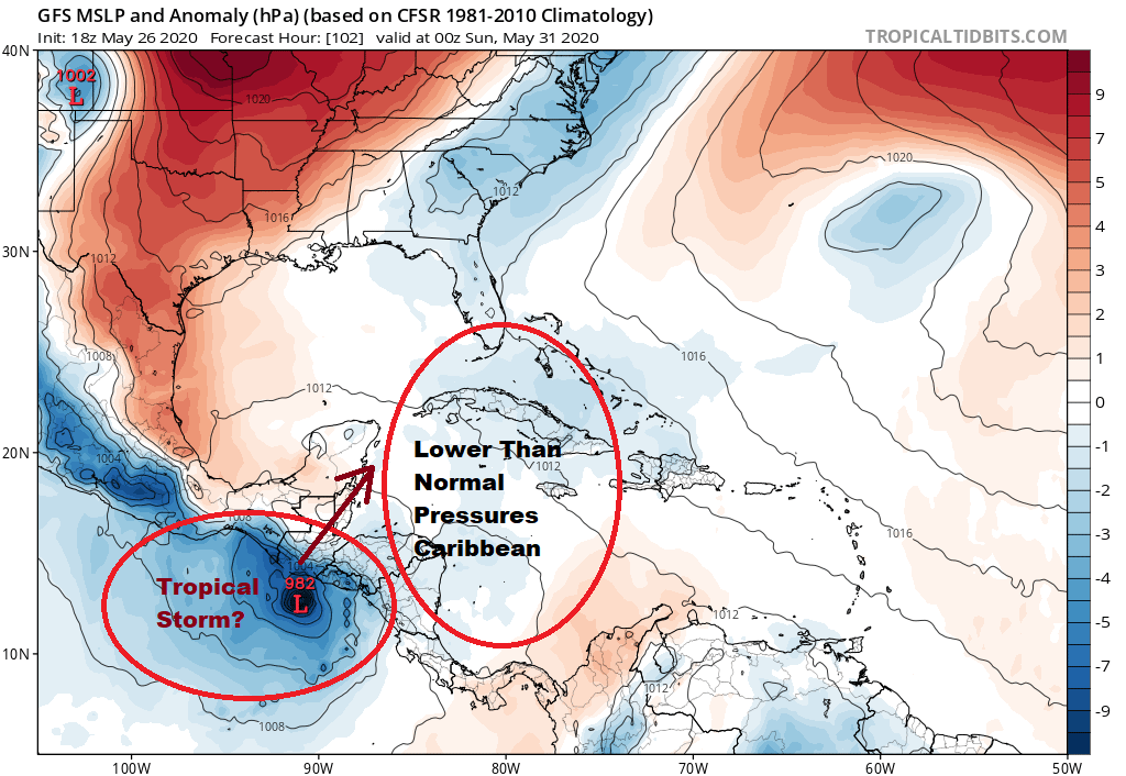
We are going to be watching a tropical storm develop on the Pacific side next week and this could create lower than normal pressure conditions across the Southwest Gulf to the Northwest Caribbean. This time of year, this area has the highest probability of development so we will be watching to see how this evolves. The GFS model has been very bullish on this development with support of the Canadian while the European remains subdued. We will watch this evolve in the coming days.
BE SURE TO DOWNLOAD THE FREE METEOROLOGIST JOE CIOFFI WEATHER APP &
ANGRY BEN’S FREE WEATHER APP “THE ANGRY WEATHERMAN!
MANY THANKS TO TROPICAL TIDBITS FOR THE USE OF MAPS
Please note that with regards to any severe weather, tropical storms, or hurricanes, should a storm be threatening, please consult your local National Weather Service office or your local government officials about what action you should be taking to protect life and property.


