Tropical Activity May Pick Up This Weekend & Next Week
Today marks the statistical peak of the hurricane season. There is a secondary peak in early October and then a gradual decline that follows. Statistics are one of those things that work in the world of forecasting except when they don’t so you have to be careful when referencing them I throw it out there given we are seeing quiet conditions right now. Gabrielle in the North Atlantic has gone to the North Atlantic graveyard so we have no named storms for the first time in a couple of weeks. However this lull may be short lived as we see two chances for development going forward this weekend and early next week.
TROPICAL SATELLITE

The satellite picture shows disturbed weather just east of the Bahamas moving slowly westward. The showers and thunderstorms have increased some since yesterday. However there is no surface low at the moment. Upper air winds aren’t all that favorable for development however when the system heads into the Gulf of Mexico late this weekend and early next week it could be moving into an area of light upper air winds. A surface low is forecast to develop as it heads westward and we could see something pop up in the Gulf of Mexico early next week.
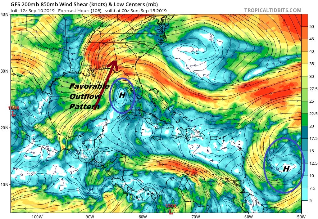
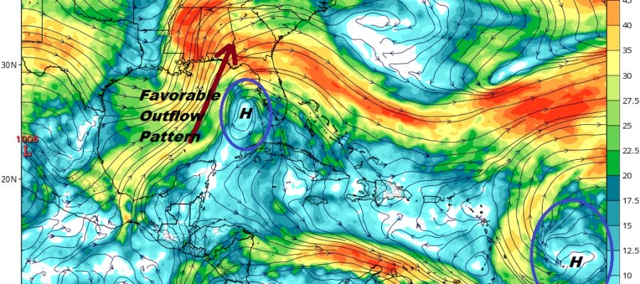
Two areas that will be favorable for development are featured here. What is highlighted are two upper highs; One is in the Eastern Gulf and the other to the East of the Leeward Islands. Weather models are toying with both of these systems in their outlooks and it isn’t worth the time speculating on systems that aren’t even on the map yet. We will be watching of course over the next few days to see where this all takes us. Since I know many of you love to look at long range models throwing category 3 or higher hurricanes in all sorts of threatening locations, I would advise to ignore it all until or if we actually have something to deal with.
MANY THANKS TO TROPICAL TIDBITS FOR THE USE OF MAPS
Please note that with regards to any tropical storms or hurricanes, should a storm be threatening, please consult your local National Weather Service office or your local government officials about what action you should be taking to protect life and property.