Skip to content
Weather Updates 24/7 by Meteorologist joe cioffi

Weather Updates 24/7 by Meteorologist joe cioffi

Weather Blog

  • About
    • Joestradamus
  • LONG ISLAND
  • GFS Model
  • Forecasts
    • Joe’s Forecast
    • New York
    • New Jersey
    • Connecticut
    • Philadelphia
    • SouthEast Pennsylvania
    • South-Central Pennsylvania
    • NorthEast Pennsylvania
  • Winter
    • Snow Forecasts
    • Joe’s Snow Forecast
  • EURO Model
  • Severe Wx
  • Marine Outlook
  • Tropics

Tag: east coast storm

Rain Moving Eastward More Rain Into Sunday We are looking at a rather wet radar to the west as showers are moving across Pennsylvania and heading eastward. This is all part of the process of a storm that is developing in the East Central Plains and heading into the Upper Midwest.  Rainfall amounts should be on the order of  an inch or so between now and Sunday afternoon. Some areas could see locally higher amounts. GFS RAINFALL FORECAST Rain that moves through this afternoon and evening will then move out. There will be a short break and then the final surge of rain arrives late tonight into Sunday afternoon. Temperatures today will be moving up thourgh the 40s and we should reach the 50s at some point today though some areas may not get there until later this evening. US SATELLITE REGIONAL RADAR Watch local radars as they should start loading up with showers very soon. The regional radar shows showers with a few heavier downpours making headway to the east. LOCAL RADAR NEW YORK CITY LOCAL RADAR PHILADELPHIA Once this front goes by weather conditions improve Sunday night. Sunday's highs will be in the 50s. Sunshine is back for Monday through Wednesday with most highs in the 50s. After that the big blocking pattern takes control but we really won't have any idea what that will mean. Weather models show a coastal storm late next week but there is a lot of uncertainty about this and how it plays out. We will examine this carefully later today.

Europe Britain Siberian Cold Snow On The Way

February 24, 2018 joseph blocking, Joestradamus, long range forecast, rain, snow, Uncategorized, winter

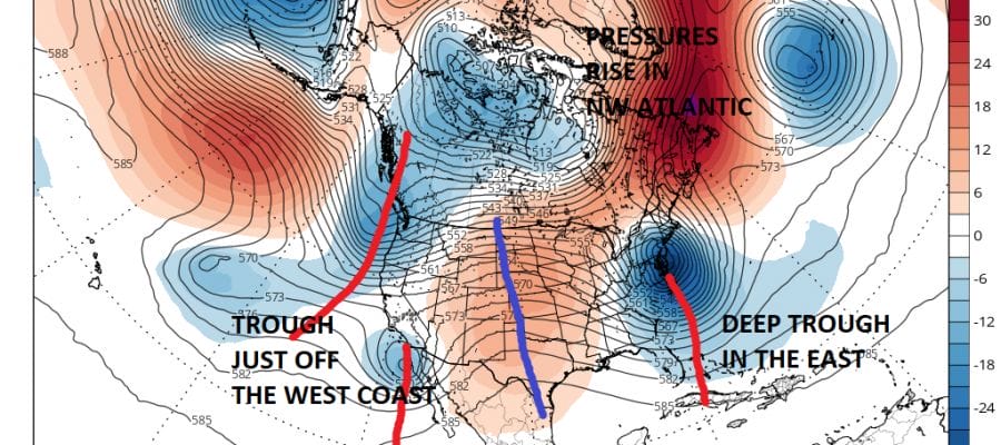
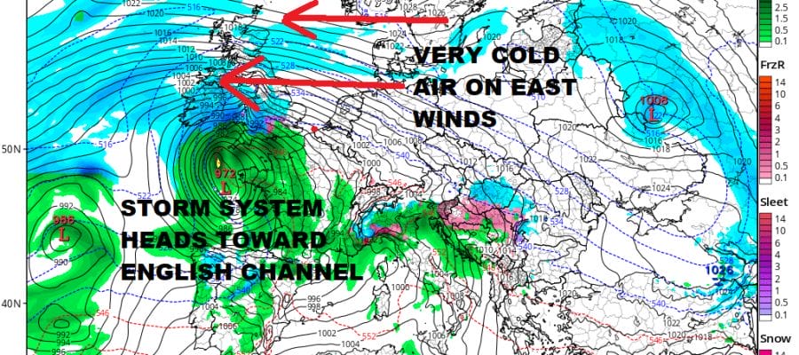
Europe Britain Siberian Cold Snow On The Way Europe Britain Siberian Cold Snow On The Way The continent across the
Continue reading
blocking pattern

Blocking Shifting Westward Pattern Change Looms

November 25, 2017 joseph EURO, GFS, Joestradamus, long range forecast

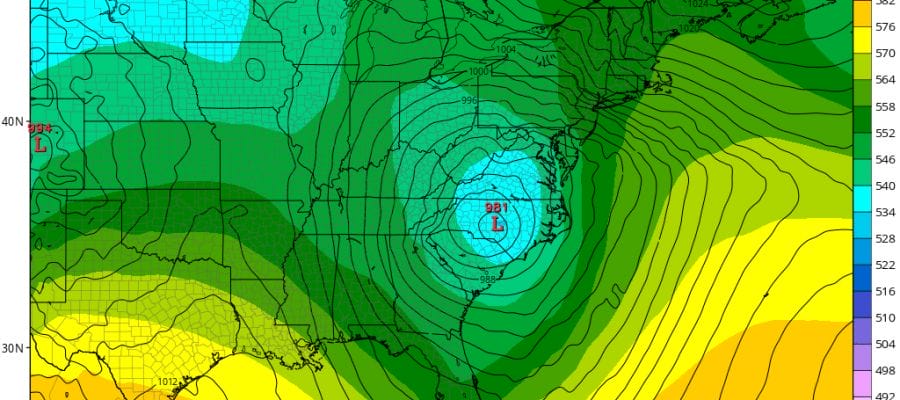
Blocking Shifting Westward Pattern Change Looms   Blocking Shifting Westward Pattern Change Looms Up until now the blocking pattern that
Continue reading
storm threat

Storm Threat Looms Sunday-Tuesday

January 18, 2017 joseph Joestradamus, winter

Storm Threat Looms Sunday-Tuesday NOREASTER STORM THREAT EARLY NEXT WEEK VIDEO ANALYSIS Storm Threat Looms Sunday-Tuesday Noreaster Threat Heavy Rain

Continue reading

Euro Model Very Dynamic Next Week

April 29, 2016 joseph EURO

Euro Model Very Dynamic Next Week MENTION JOE CIOFFI AND GET A 5% DISCOUNT The Euro model is following the

Continue reading

Big Red Flags On European Model

January 19, 2016 joseph EURO, Joestradamus

Big Red Flags On European Model By now you should have gotten wind of the European model this afternoon. There

Continue reading
snow forecast

Snow Forecast For Tonight

January 17, 2016 joseph Snow Forecasts

Snow forecast maps have been few and far between but we have need for one today. Low pressure is moving

Continue reading

Posts pagination

1 2 Next Posts»

Northeast Weather

Recent Posts: NYC WEATHER NOW

Winter Storm Possible Early Next Week

Winter Storm Possible Early Next Week

SUPPORT THE FREE APP. SHOP AMAZON, JUST USE THE SEARCH BAR BUY WHAT YOU WANT! COUPON CODE SUMMER24 GET 10%

Download App For All Devices

snow ice rain

DOWNLOAD FREE APP FOR ALL DEVICES

TOP 100 WEATHER BLOGS ON THE PLANET!

Weather Blogs
Advertise Meteorologist Joe Cioffi
WordPress Theme: Tortuga by ThemeZee.
Weather Updates 24/7 by Meteorologist joe cioffi
Proudly powered by WordPress Theme: Tortuga.