Europe Britain Siberian Cold Snow On The Way
Europe Britain Siberian Cold Snow On The Way
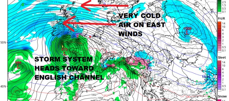
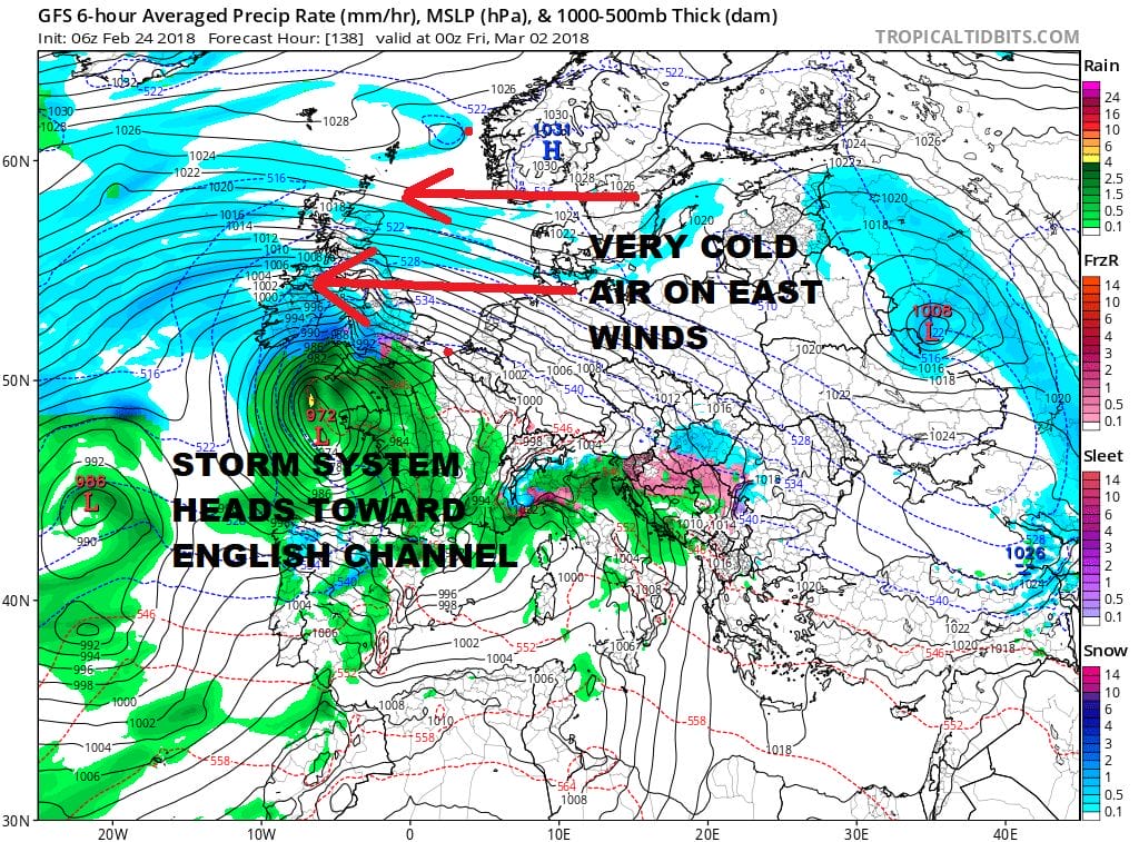
The continent across the Atlantic we know as Europe is about to get a blast of late winter bitter cold air and with that snow is forecast. The GFS snow forecast map snow will impact the entire continent and the British Isles over the next week. The blocking high that is developing between Scandinavia and Greenland is creating an easterly flow of air from Siberia. Eventually the block moves westward and the cold abates but that won’t begin to happen later next weekend.
GFS SNOW TOTALS THROUGH NEXT SATURDAY MARCH FIRST

Also what is a bit unusual is that a storm will be moving northeastward from the Atlantic from offshore Spain and heading into the English Channel. This could create widespread snows across the British Isles. While snow here is not unusual, island wide snowfalls are not regular occurrences in most winters. This will be taking place late Thursday into Friday. While this is going on we may have a storm of our own to deal with.
EUROPEAN MODEL FORECAST FRIDAY MARCH 2 2018
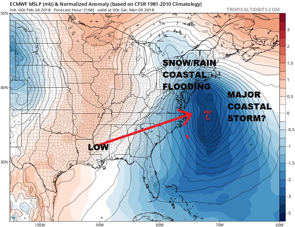
The blocking pattern that is developing will force a major storm to develop off the East Coast late next week but there are a huge number of questions about this and tons of uncertainty including how much cold air (if any) will be around. There is also a full moon late next week so coastal flooding could certainly be an issue. We will need to see more model runs ahead. The strength of the block is key and being that the models all show the blocking to be super strong, this storm could do some strange things along the way. Interesting times ahead for sure!
SHOP THE JOESTRADAMUS STORE
MANY THANKS TO TROPICAL TIDBITS FOR THE WONDERFUL USE OF THE MAPS

GET JOE A CIGAR IF YOU LIKE!
FiOS1 News Weather Forecast For Long Island
FiOS1 News Weather Forecast For New Jersey
FiOS1 News Weather Forecast For Hudson Valley
NATIONAL WEATHER SERVICE SNOW FORECASTS
LATEST JOESTRADAMUS ON THE LONG RANGE