
Rain Moving Eastward More Rain Into Sunday
Rain Moving Eastward More Rain Into Sunday
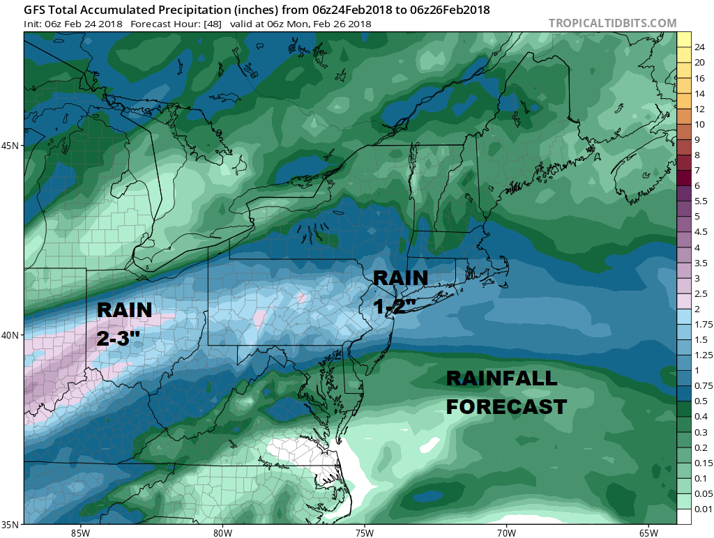
We are looking at a rather wet radar to the west as showers are moving across Pennsylvania and heading eastward. This is all part of the process of a storm that is developing in the East Central Plains and heading into the Upper Midwest. Rainfall amounts should be on the order of an inch or so between now and Sunday afternoon. Some areas could see locally higher amounts.
GFS RAINFALL FORECAST
Rain that moves through this afternoon and evening will then move out. There will be a short break and then the final surge of rain arrives late tonight into Sunday afternoon. Temperatures today will be moving up thourgh the 40s and we should reach the 50s at some point today though some areas may not get there until later this evening.
US SATELLITE

REGIONAL RADAR

Watch local radars as they should start loading up with showers very soon. The regional radar shows showers with a few heavier downpours making headway to the east.
LOCAL RADAR NEW YORK CITY

LOCAL RADAR PHILADELPHIA


Once this front goes by weather conditions improve Sunday night. Sunday’s highs will be in the 50s. Sunshine is back for Monday through Wednesday with most highs in the 50s. After that the big blocking pattern takes control but we really won’t have any idea what that will mean. Weather models show a coastal storm late next week but there is a lot of uncertainty about this and how it plays out. We will examine this carefully later today.
 GET JOE A CIGAR IF YOU LIKE

FiOS1 News Weather Forecast For Long Island
FiOS1 News Weather Forecast For New Jersey
FiOS1 News Weather Forecast For Hudson Valley


