Blocking Shifting Westward Pattern Change Looms

Blocking Shifting Westward Pattern Change Looms
Up until now the blocking pattern that has developed across the North Atlantic has not had the impact that some of you may have expected (or wanted judging from Facebook comments). The block as been primarily East based or closer to Eastern Greenland. As a result the cold air has been moving into Europe while here in the Eastern US it is has been dry with occasional shots of cold air followed by brief warm ups. Weather models are now beginning to show that this pattern will be shifting westward and this has serious implications on the weather along the East Coast as we head into the month of December.
BLOCKING PATTERN GFS SUNDAY 11/26/2017
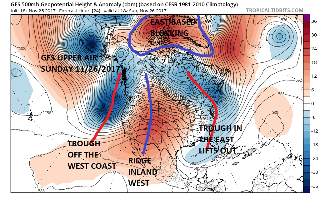
Here is the GFS model above and you can see the blocking is well to the northeast. This position doesn’t prevent troughs in the East from lifting out as the one moving through Sunday morning will do. We have trough off the West coast with a ridge just inland of the coast. Once that East Coast trough lifts out temperatures will moderate this week to above average. However all the models then begin a wholesale rearrangement of the upper air pattern in the Atlantic as the highest pressures begin to shift westward
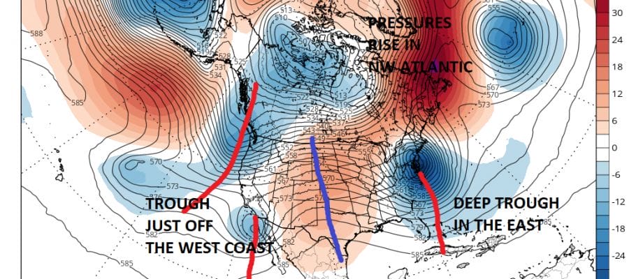
GFS JET STREAM PATTERN SATURDAY 12/02/2017
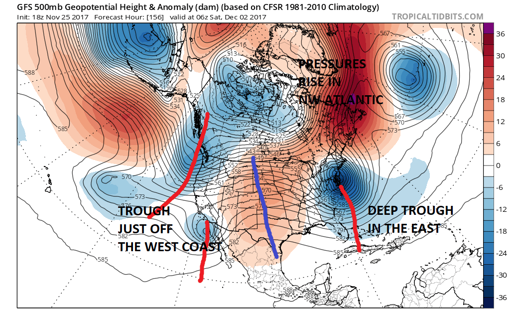
This shifting westward brings about a major change in the weather pattern in the East making it much more active and potentially stormy. Another big difference in the models is that the trough in the west remains just off the coast rather than inland which creates plenty of room for something to develop in the East.
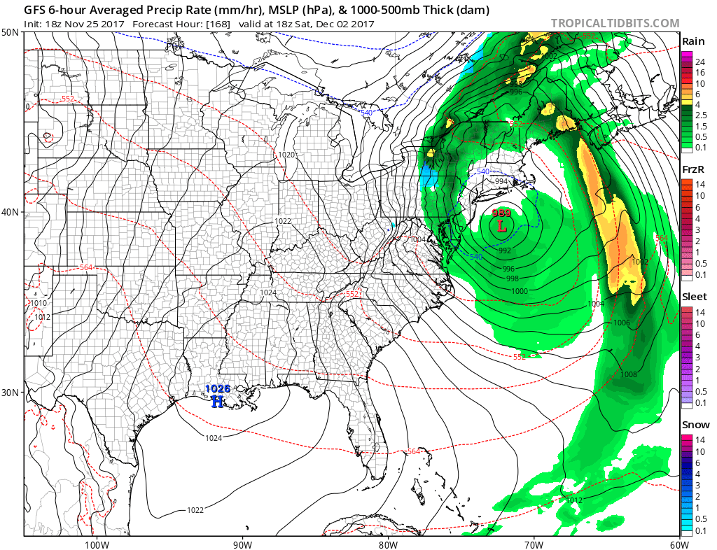
GFS SURFACE MAP SUNDAY DECEMBER 3 2017
EUROPEAN MODEL SUNDAY DECEMBER 3 2017
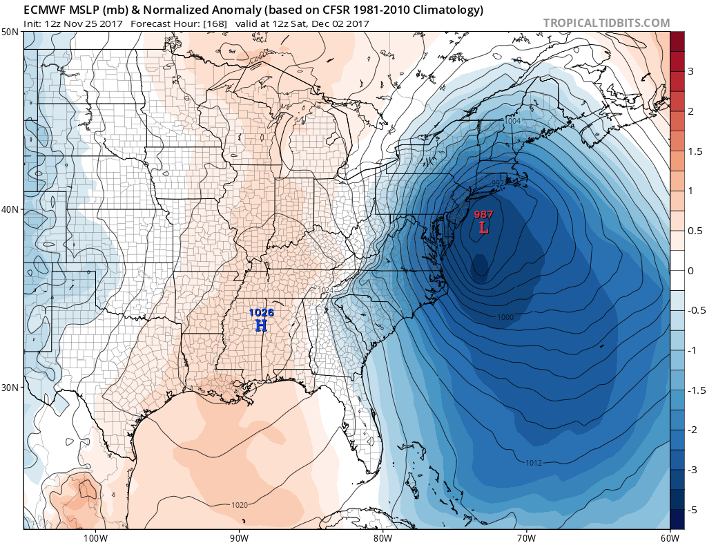
The European weather model is remarkably similar to the GFS model which gives us confidence that the models are on to something. One thing both models agree on is that there is a genuine lack of cold air which would make this a rain and wind event for the area.
If the higher than normal pressures in the Northwest Atlantic hold on for the longer term eventually it will get cold enough for snow rather than rain but that is going to take more time.
GFS BLOCKING PATTERN JET STREAM TUESDAY DECEMBER5, 2017
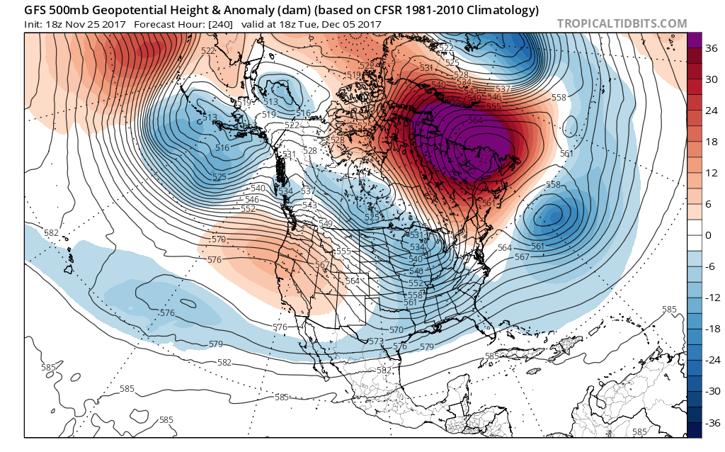
Looking at Day 10 on the GFS we have a massive blocking upper high in the Northwest Atlantic. The European model also has a similar look to it though the high is somewhat further east for the same time frame. This may turn out to be a rather interesting month of December ahead.
MANY THANKS TO TROPICAL TIDBITS FOR THE WONDERFUL USE OF THE MAPS

GET JOE A CIGAR IF YOU LIKE!
<
FiOS1 News Weather Forecast For Long Island
FiOS1 News Weather Forecast For New Jersey
FiOS1 News Weather Forecast For Hudson Valley
NATIONAL WEATHER SERVICE SNOW FORECASTS
LATEST JOESTRADAMUS ON THE LONG RANGE
Weather App

Don’t be without Meteorologist Joe Cioffi’s weather app. It is really a meteorologist app because you get my forecasts and my analysis and not some automated computer generated forecast based on the GFS model. This is why your app forecast changes every 6 hours. It is model driven with no human input at all. It gives you an icon, a temperature and no insight whatsoever.
It is a complete weather app to suit your forecast needs. All the weather information you need is right on your phone. Android or I-phone, use it to keep track of all the latest weather information and forecasts. This weather app is also free of advertising so you don’t have to worry about security issues with your device. An accurate forecast and no worries that your device is being compromised.
Use it in conjunction with my website and my facebook and twitter and you have complete weather coverage of all the latest weather and the long range outlook. The website has been redone and upgraded. Its easy to use and everything is archived so you can see how well Joe does or doesn’t do when it comes to forecasts and outlooks.
Just click on the google play button or the apple store button on the sidebar for my app which is on My Weather Concierge. Download the app for free. Subscribe to my forecasts on an ad free environment for just 99 cents a month.
Get my forecasts in the palm of your hand for less than the cost of a cup of Joe!