
DOWNLOAD MY NEW FREE JOESTRADAMUS WEATHER APP FOR ALL DEVICES
THE APP IS ABSOLUTELY FREE TO ALL BUT CONSIDERING SUBSCRIBING TO PATREON FOR A WEATHER EXPERIENCE FREE OF ADS, EXCLUSIVE VIDEOS FOR MEMBERS ONLY AND MUCH MORE…STARTS AT $2 A MONTH..MESSAGE ME AT ANY TIME
Winter Weather Advisory Tonight South Jersey Southeast Pennsylvania
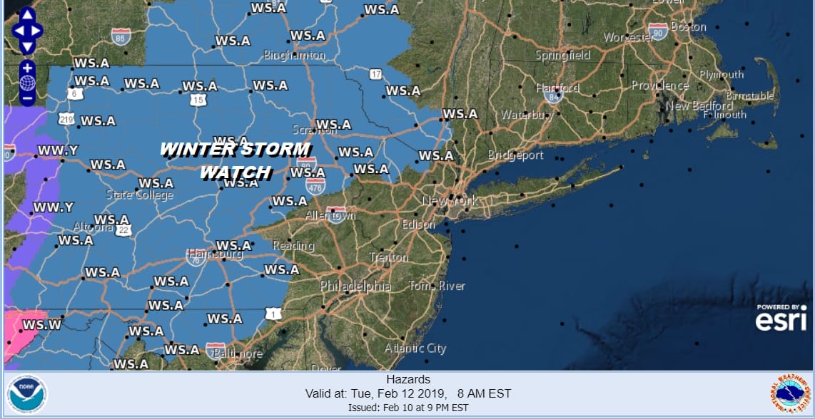
Winter Storm Watch Tuesday NW Jersey, NE Pennsylvania,
Hudson Valley Orange County North & West
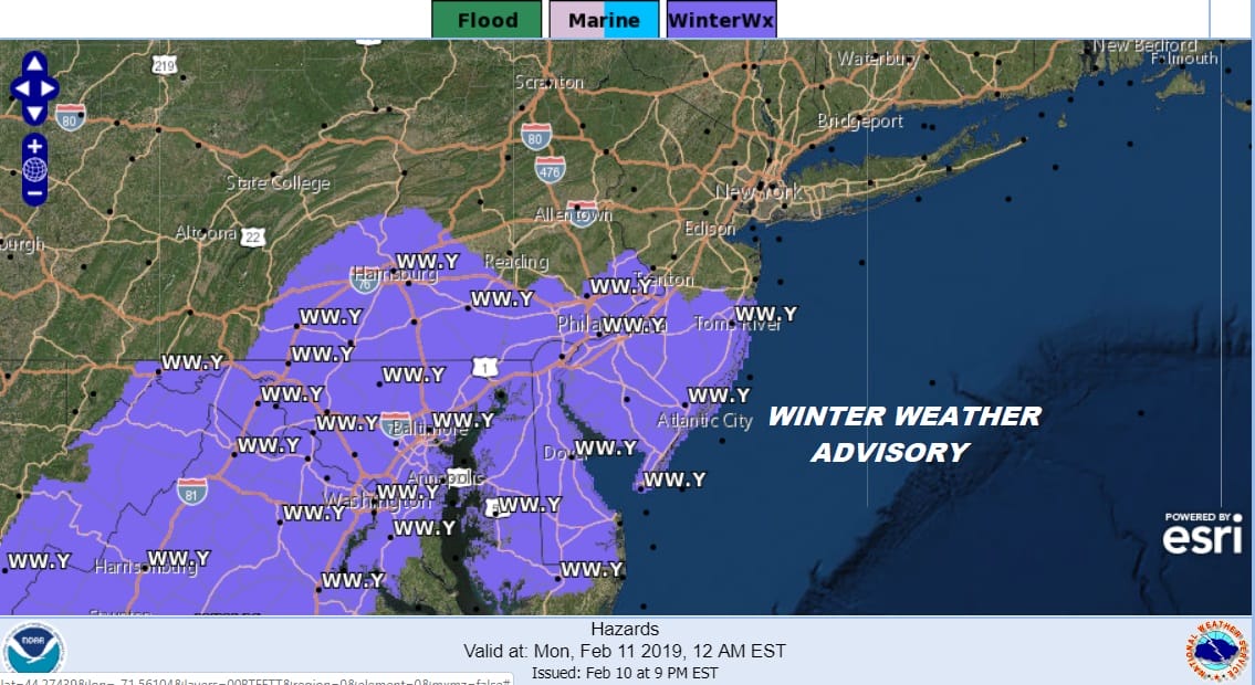
For tonight into Monday morning we have Winter Weather Advisories in effect for the southern half of New Jersey and throughout much of Southeastern Pennsylvania. 2 weather systems are approaching. This one is the weaker of the two and we can see clouds spreading eastward on the satellite and on the regional radar snow is showing up moving eastward across the state. My snow forecast for this system remains the same with the chance for some upside in the boxed area in Southeast Pennsylvania and in the Southern Counties of New Jersey.
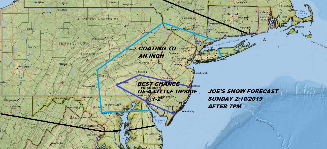
Precipitation is streaking eastward and should be arriving shortly if not already in Southeastern Pennsylvania and into Southern New Jersey in the next several hours.
EASTERN SATELLITE

REGIONAL RADAR

Snow is also showing up on the local radars including areas in Northern New Jersey though the air is very dry. Much of what is on the northern end of this is drying up do to very low dew points in the dry air mass that covered us on Sunday.
LOCAL RADAR NEW YORK CITY

LOCAL RADAR PHILADELPHIA


This will play out overnight and most of it should be over with by daybreak or shortly afterwards. Then expect a lull until late Monday afternoon when snow redevelops over Southern Pennsylvania and Southern New Jersey. Winter Storm Watches are posted for tomorrow night in much of Eastern Pennsylvania and then they go up in Northeast Pennsylvania, Northwest New Jersey and the Hudson Valley for Tuesday,
Tuesday we will see snow overspread the area in the early morning hours across New Jersey and shortly after daybreak from NYC north and east. Then we wait until a change over to sleet occurs by midday and then a change to rain from south to north during the afternoon and early evening. Accumulations are going to be tough to figure since it will be a combination of snow and sleet. For now my early call snow/sleet forecast remains the same and we will fine tune this on Monday.
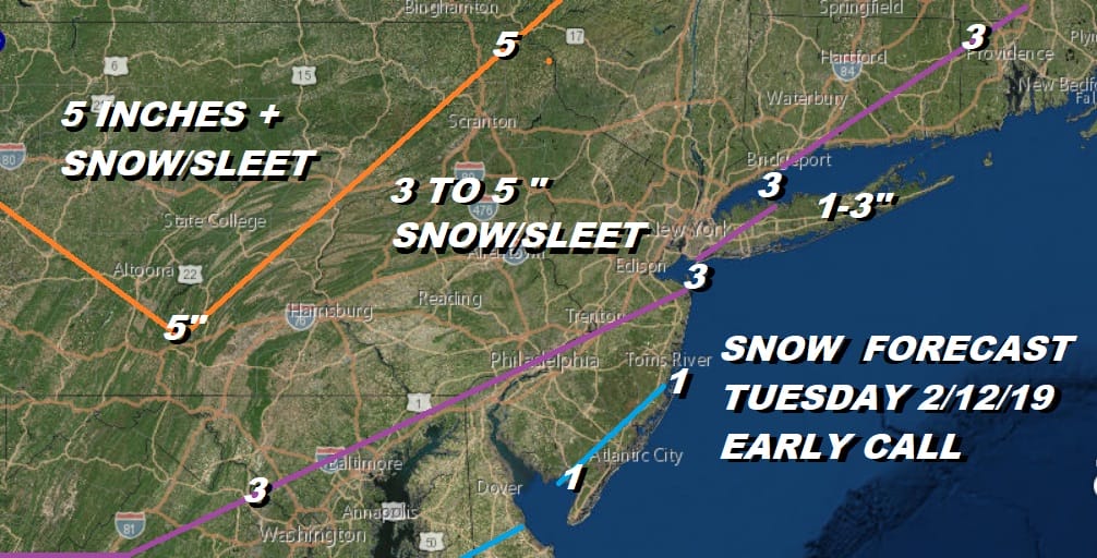
An early look at the NAM model tonight shows some consistency with prior runs. The map below is a snapshot of what is happening at 1pm Tuesday. It depicts a large area of sleet covering much of the area. The sleet rain line makes it to NYC by 6 or 7pm.
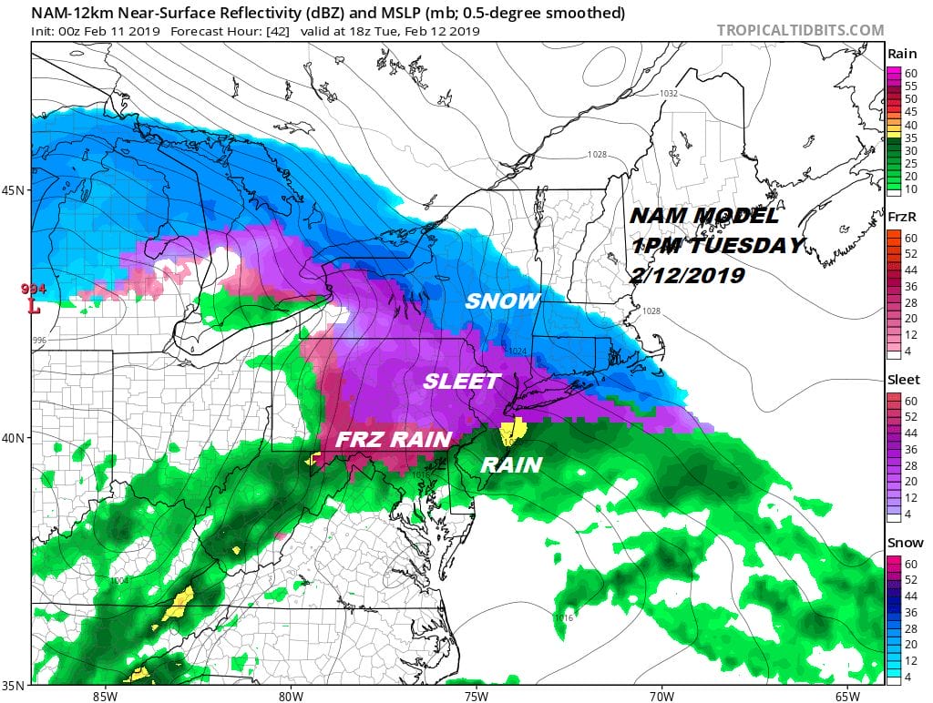
The snow accumulation will hinge on a little extra cold air keeping it snow for an hour or two longer. The change to sleet and then rain is inevitable with the low tracking to the west and the lack of a well defined secondary low. Rain should end Tuesday night and weather conditions will improve on Wednesday.
MANY THANKS TO TROPICAL TIDBITS FOR THE USE OF MAPS
Please note that with regards to any tropical storms or hurricanes, should a storm be threatening, please consult your local National Weather Service office or your local government officials about what action you should be taking to protect life and property.


