Weather Improves Later Today Showers Likely Saturday But No Washout
Weather Improves Later Today
Showers Likely Saturday But No Washout
The wave of low pressure that brought some showers overnight to some (but not all) areas from Eastern Pennsylvania to Southern New England is now moving out to the east. We still have clouds around this morning. The northern edge of the cloud cover it gradually going to sink southward today so we should see decreasing clouds and an increasing amount of sunshine as we head into midday and this afternoon. Temperatures will be in the warm 80s and humidity levels will drop off somewhat. It will take longer for the dry air to find its way into Southern New Jersey, Southeastern Pennsylvania and Long Island but eventually it will get there. High pressure is building down from the Great Lakes and this will gradually turn the wind to the northeast tonight and to the east on Friday.
EASTERN SATELLITE

REGIONAL RADAR

The bulk of the showers are out to the east though the local radars are still picking up a few spot showers here and there that are very light. They should be gone before too long this morning.
LOCAL RADAR NEW YORK CITY

LOCAL RADAR PHILADELPHIA


We continue to see a persistent weather boundary to the south that is separating us from the hot humid air that typically likes across the Southern US this time of year. The frontal boundary is about to buckle yet again as low pressure heads out of the Middle Mississippi Valley and heads for the Great Lakes. This will bring an increase in cloud cover on Friday with highs mostly in the 70s.
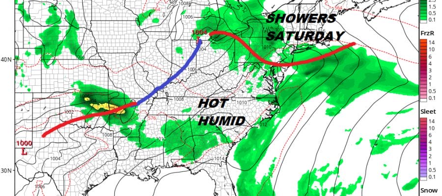
GFS FORECAST SATURDAY JUNE 23, 2018 8AM

The issue for Saturday is that warm front to the south. Ahead of it there are likely to be some showers but they will be of the on and off variety and it will not be a washout on Saturday. However when we don’t have showers we will be sitting in lots of clouds and an onshore flow which will make things rather gloomy. Temperatures will be in the 70s. The second half of the weekend looks a bit better as this system will be out of the way but Sunday morning and another front will approach Sunday night.
GFS SUNDAY JUNE 24 2018 2PM
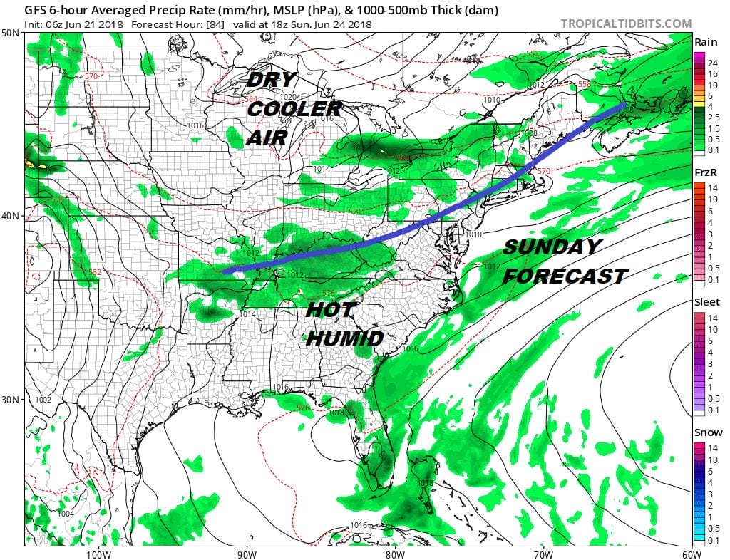
There should be enough dry air in between the Saturday system and the front for Sunday night to produce a half way decent day on Sunday though it won’t be picture perfect with clouds and some sun with highs in the 80s. My thinking is that any showers stay away until later in the day inland and to the coast in the evening and they should be scattered in nature. The next high with dry air builds in for Monday and Tuesday with temperatures a bit on the cool side of average. Then later next week a ridge of high pressure aloft builds into the Eastern US which should bring very warm humid conditions here late in the week and for the first few days in July.
 GET JOE A CIGAR IF YOU LIKE

LATEST JOESTRADAMUS ON THE LONG RANGE


