Snow Threat 2 Sunday Blocking Strength Remains Key

Snow Threat 2 Sunday Blocking Strength Remains Key
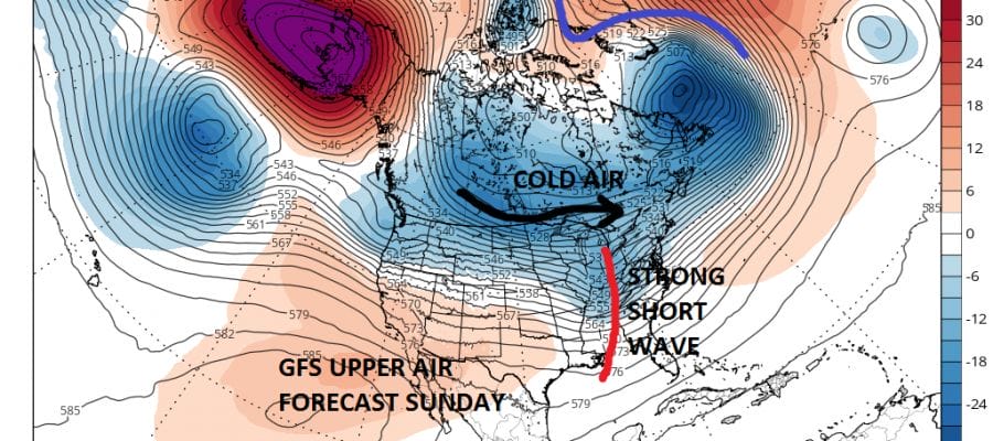
As we move further out in time variations in weather models grows wider. Like the first weather system Friday, the developing block in Greenland will remain key. If the block is too strong that will bring cold dry air into the Northeast and suppress any weather systems coming out of the Plains further south. If the block is weaker the storm system will be further north. The European and GFS both have different views on the strength of such models. Also key will be the strength of the short wave trough moving across the Ohio Valley.
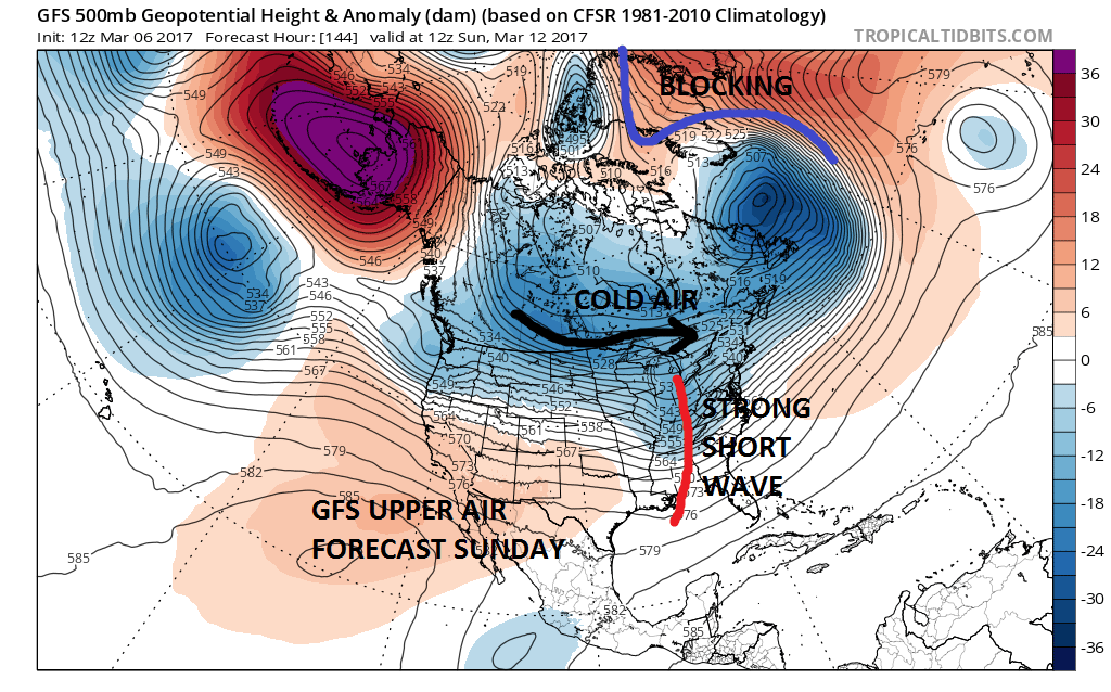
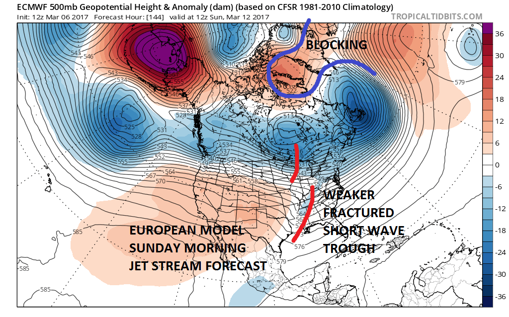
Both models handle the block pretty much the same way so attention then focuses on the upper air disturbance that is moving across the Ohio Valley. Here is where the differences lie today where the European has a very fractured look to the short wave trough while the GFS has a deeper (more intense) system. The result is that the GFS is further north while the European is suppressed and further south.
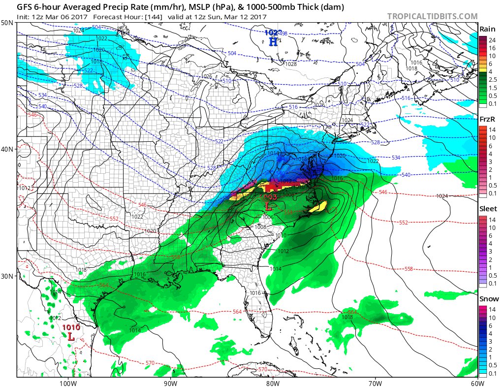
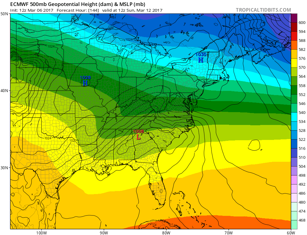
While we can’t see the precipitation on the European maps we can see the surface with the high in upstate NY. That cold dry air suppresses snow to where the northern edge gets into Southernmost New Jersey and Southern Pennsylvania with the heaviest snow well south. Now we are 6 days away and the tendency this winter is for systems to correct northward as we draw closer. We will be watching for this going forward. As far as the first snow threat for Friday here is JOESTRADAMUS’s post on the first system.
MANY THANKS TO TROPICAL TIDBITS FOR THE WONDERFUL USE OF THE MAPS

GET JOE A CIGAR IF YOU LIKE!
SNOW REMOVAL COMPANIES FOR YOUR WINTER NEEDS
LONG ISLAND ROCKLAND COUNTY Connecticut

![]()

ROCKLAND COUNTY TRI STATE SNOW REMOVAL JOHNSTOWN PA


FiOS1 News Weather Forecast For Long Island
FiOS1 News Weather Forecast For New Jersey
FiOS1 News Weather Forecast For Hudson Valley
NATIONAL WEATHER SERVICE SNOW FORECASTS
LATEST JOESTRADAMUS ON THE LONG RANGE
Weather App

Don’t be without Meteorologist Joe Cioffi’s weather app. It is really a meteorologist app because you get my forecasts and my analysis and not some automated computer generated forecast based on the GFS model. This is why your app forecast changes every 6 hours. It is model driven with no human input at all. It gives you an icon, a temperature and no insight whatsoever.
It is a complete weather app to suit your forecast needs. All the weather information you need is right on your phone. Android or I-phone, use it to keep track of all the latest weather information and forecasts. This weather app is also free of advertising so you don’t have to worry about security issues with your device. An accurate forecast and no worries that your device is being compromised.
Use it in conjunction with my website and my facebook and twitter and you have complete weather coverage of all the latest weather and the long range outlook. The website has been redone and upgraded. Its easy to use and everything is archived so you can see how well Joe does or doesn’t do when it comes to forecasts and outlooks.
Just click on the google play button or the apple store button on the sidebar for my app which is on My Weather Concierge. Download the app for free. Subscribe to my forecasts on an ad free environment for just 99 cents a month.
Get my forecasts in the palm of your hand for less than the cost of a cup of Joe!
![]()
