
Flash Flood Watch Severe Weather Risk Beautiful Weekend
Flash Flood Watch Severe Weather Risk Beautiful Weekend

We have already seen some flash flood warnings that have been issued for parts of Central New Jersey. The tropical air mass that has saturated our atmosphere with tons of available moisture now has a mechanism to work with to set off some strong thunderstorms between now and mid afternoon. The satellite loop and the regional radar both show a developing area of downpours and thunderstorms across Pennsylvania that is moving eastward. A lead area this morning has played its way through Central New Jersey and it is now about to move offshore but not before pounding a few more areas in Monmouth and Ocean Counties with heavy rain.
EASTERN SATELLITE

REGIONAL RADAR

Meanwhile the regional and local radars show the next area about to bring some heavy downpours to parts of the Hudson Valley, Eastern Pennsylvania and Northern New Jersey. This area expands considerably in the next few hours and this afternoon as it moves across Southern New England and Long Island. 2 to locally 3 inches of rain is not out of the question here from any of these thunderstorms moving through today.
LOCAL RADAR NEW YORK CITY

LOCAL RADAR PHILADELPHIA


All of this ends later this afternoon from west to east as weather conditions will improve rapidly. Skies clear tonight and the humidity plummets as high pressure builds in from the Great Lakes. This sets up a beautiful weekend of sunshine and low humidity. Saturday’s highs will be in the 70s to near 80. Sunday the humidity remains low with sunshine taking highs back into the 80s.
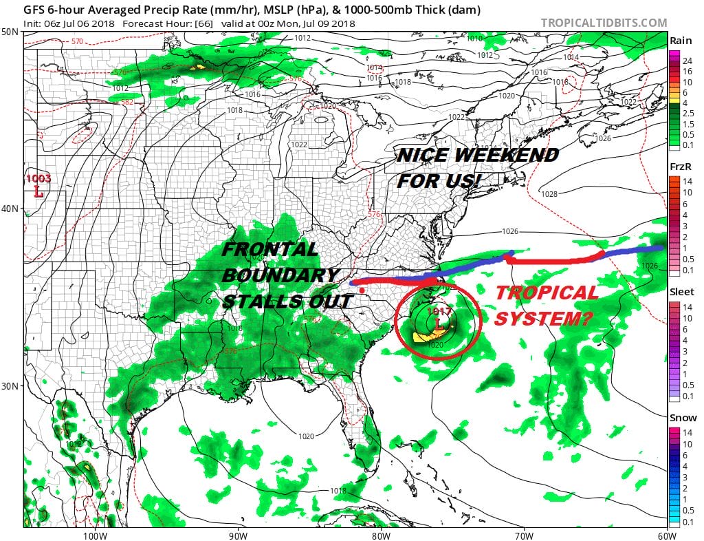
The front is going to stall out somewhere off the North Carolina coast. Disturbed weather offshore between the South Carolina coast and Bermuda has increased overnight and has become better organized. The National Hurricane Center rates this an 80% chance of developing into a tropical depression over the next few days. Check out our latest post regarding this disturbance.
Also we have the season’s first hurricane in Hurricane Beryl which is a very tiny hurricane in the Tropical Atlantic. It is moving west toward the Leeward Islands and JOESTRADAMUS has more on this system as well.
 GET JOE A CIGAR IF YOU LIKE

LATEST JOESTRADAMUS ON THE LONG RANGE