Disturbed Weather Off Southeast US Coast Better Organized
Disturbed Weather Off Southeast US Coast Better Organized
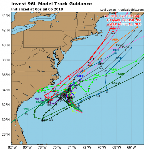
We continue to watch low pressure off the Southeast Coast of the United States, about 1/2 way between the South Carolina and Bermuda. During the overnight we have seen an increase in the amount of convection closer to the weak low level circulation. Conditions here remain favorable for development and the National Hurricane Center now rates this at an 80 percent chance of developing into a tropical depression or a tropical storm over the next several days. To the northwest you can see the clouds with the cold front beginning to sweep to the East Coast to bring an end to the heat and humidity for us
EASTERN SATELLITE
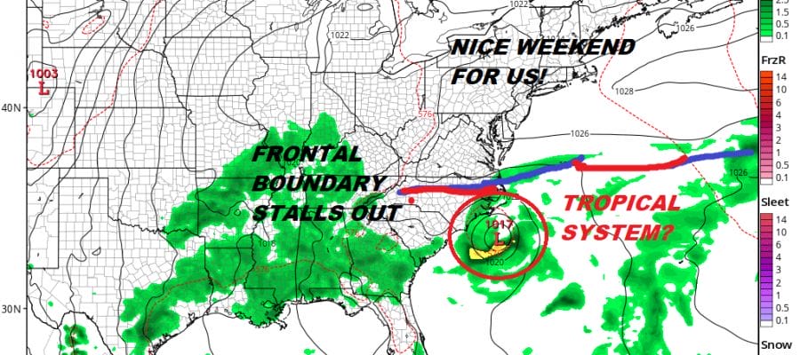
It seems that models are trending toward the idea that the cold front that moves through the Northeast and southward into the Middle Atlantic States stalls out across the Carolinas over the weekend. The system offshore gets trapped underneath and lingers off the Southeast Coast and the jet stream to the north never gets far enough south to pick that low up and kick it out to the northeast. This could pose a problem for the Carolinas if this lingers there into next week
GFS FORECAST 8PM SUNDAY JULY 8, 2018
For now we have to sit back and wait to see if the thunderstorms begin to concentrate themselves around the low pressure center offshore. Weather models would suggest that a second trough coming along by Tuesday or Wednesday would carry this system away to northeast eventually however I would suggest that we are very early in the game here.
Meanwhile in the Tropical Atlantic we have the season’s first hurricane in Hurricane Beryl. It is a very tiny hurricane in size as the entire storm is only about 60 miles across with top winds of 75 mph. JOESTRADAMUS has more on Hurricane Beryl as it makes its way westward toward the Leeward Islands.
 GET JOE A CIGAR IF YOU LIKE
LATEST JOESTRADAMUS ON THE LONG RANGE


