
Winter Weather Advisory NE Pennsylvania Catskills
Winter Weather Advisory NE Pennsylvania Catskills
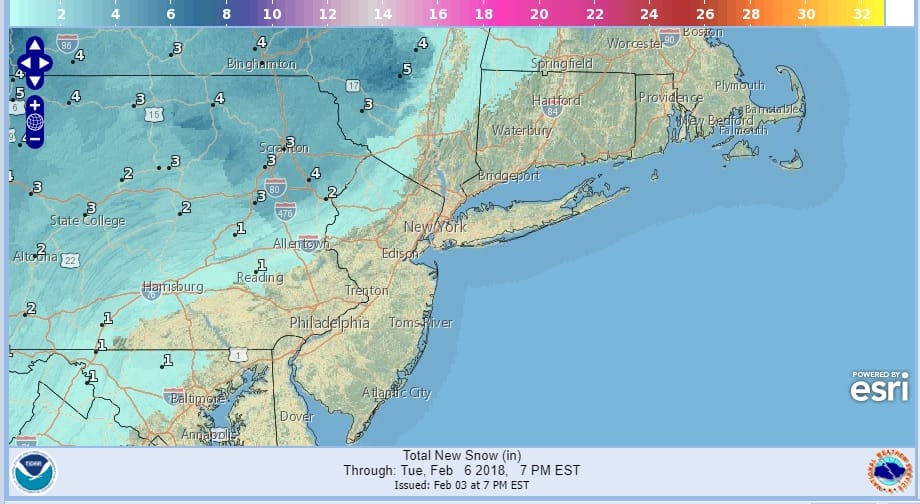
Winter Weather Advisory has been posted for Northeast Pennsylvania & the Catskills in NY. For the vast majority of our area this is a rain event. In the lower Hudson Valley and in Northwest New Jersey we could see a few hours of snow or a mix that goes over to rain. North and west of there is where there might be some accumulation of snow before a change to rain occurs. The map above shows the National Weather Service snow forecast for this event.
Clouds are beginning to gather across the area on the satellite and they extend back westward into the Ohio & Tennessee Valleys. Precipitation is beginning to develop to the west but nothing should arrive here until later Sunday morning.
US SATELLITE

REGIONAL RADAR

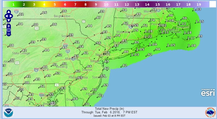
This all should be underway by midday. Rain develops at the coast and a mix inland that goes to rain. Snow well inland should go to a mix or just rain at some point during Sunday evening. Along the coast Sunday evening as low pressure develops along the coast, some heavy downpours will develop. Rainfall amounts in some areas in Southern New England and on Long Island should be around an inch or so.
This should all come to an end during Sunday night. Monday and Tuesday will be dry and colder with some sunshine. Highs both days will be in the 30s. Then the next front approaches Tuesday night which will stall just to our south with another wave of low pressure developing for Wednesday. This at the moment looks like rain along the coast with some snow inland.
 GET JOE A CIGAR IF YOU LIKE

FiOS1 News Weather Forecast For Long Island
FiOS1 News Weather Forecast For New Jersey
FiOS1 News Weather Forecast For Hudson Valley


