Winter Weather Advisory Flood Watch Continues Overnight
 CLICK TO ANIMATE
Winter Weather Advisory Flood Watch Continues Overnight
Flood Watch continues through tonight and the Winter Weather Advisory begins late tonight in the hours before daybreak as colder air will arrive. Temperatures that are now in the 50s and 60s will fall rapidly to near freezing or below in the advisory area and it should happen before the precipitation cuts off during the morning hours. This could create some icing conditions. Weather models are slightly more aggressive with the arrival of the cold air. Advisories are posted for Eastern Pennsylvania (except the Southeast) Northwest New Jersey (Sussex & Warren Counties) and the Hudson Valley north and west of Route 84 as well as Connecticut north of Route 84. Areas just to the south of this region should keep an eye on thermometers as the southern and eastern flank of freezing temperatures could drift south and eastward toward Route 287 in Westchester and along and north of Route 80 in New Jersey.
7AM FORECAST TEMPERATURES SATURDAY MORNING

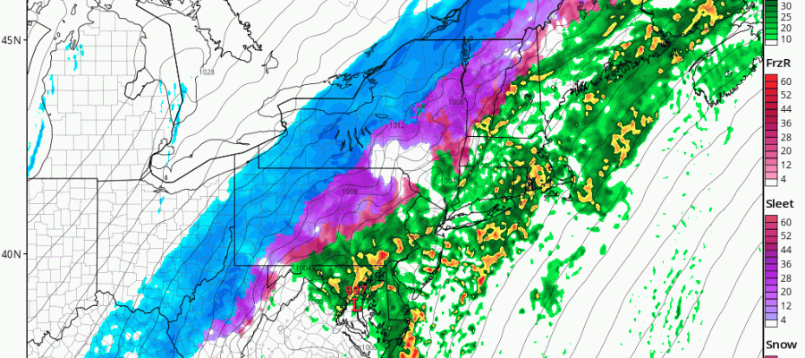
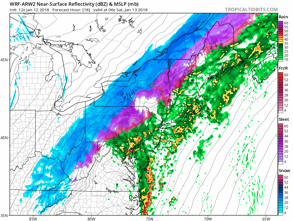
Meanwhile we have heavy rains on the radar moving through Eastern Pennsylvania, New Jersey northeast into the Hudson Valley. The rains will spread to Eastern areas this evening and overnight. Then it will be a matter of how fast the cold arrives Saturday morning before all the precipitation ends.
REGIONAL RADAR

LOCAL RADAR NEW YORK CITY

LOCAL RADAR PHILADELPHIA


For the rest of the day Saturday temperatures will continue to fall dropping into the 20s by evening. Then temperatures plunge to the single digits and low teens. Some below zero temperatures could show up in areas north and west of the coast.
SUNDAY MORNING 7AM TEMPERATURES
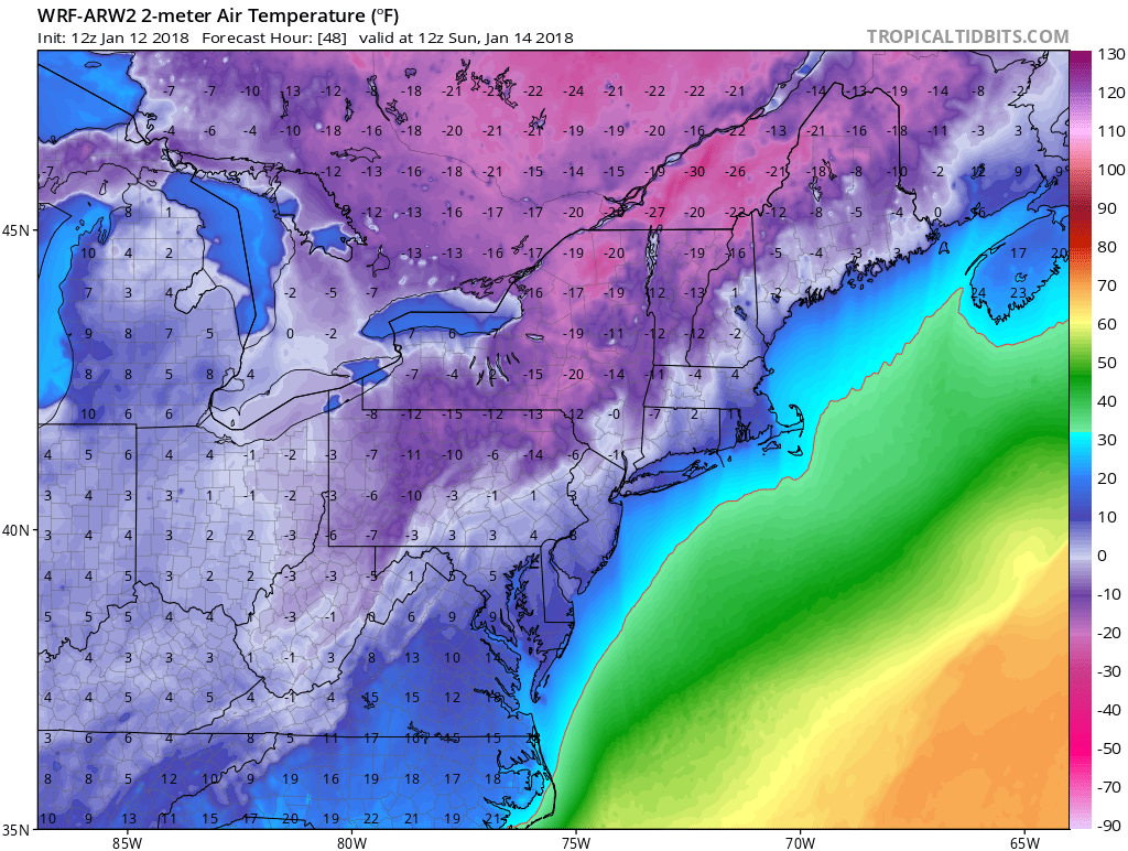
Sunday’s highs will be in the low to mid 20s and then it is back down to the single digits and teens Monday. Sunshine will be with us Sunday and Monday and we should head up to the upper 20s to lower 30s Monday afternoon.
EUROPEAN MODEL WEDNESDAY JANUARY 17 2018
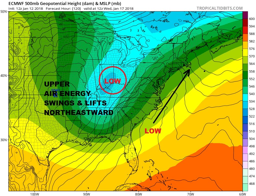
Tuesday through Thursday it gets complicated with a weak system moving through This could produce a period of snow Tuesday afternoon into Tuesday night. Then the question becomes whether a stronger storm develops to our south offshore and moves up the coast later Wednesday into Thursday. This system needs to be watched given the recent model errors of being too far south and east. The European model at the moment is the most aggressive with this. Other models less so due to major differences in the Western US that would produce a weaker system offshore. We will speak more to this over the coming days.
 GET JOE A CIGAR IF YOU LIKE

FiOS1 News Weather Forecast For Long Island
FiOS1 News Weather Forecast For New Jersey
FiOS1 News Weather Forecast For Hudson Valley


