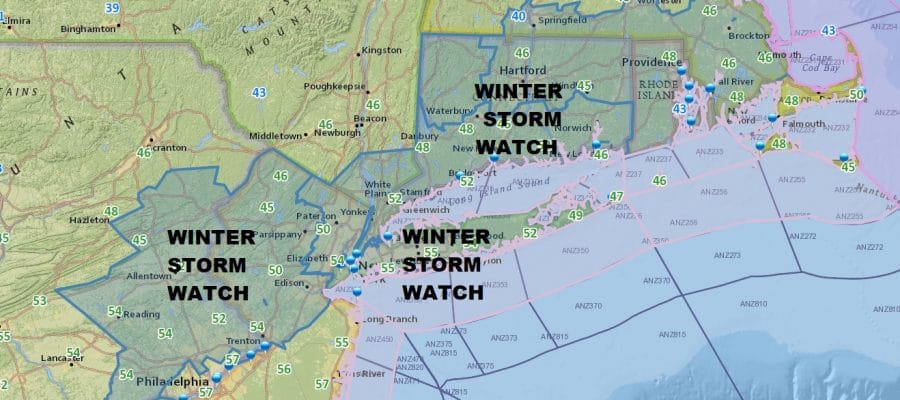
Winter Storm Watch Late Saturday Early Sunday Morning
Winter Storm Watch Late Saturday Early Sunday Morning
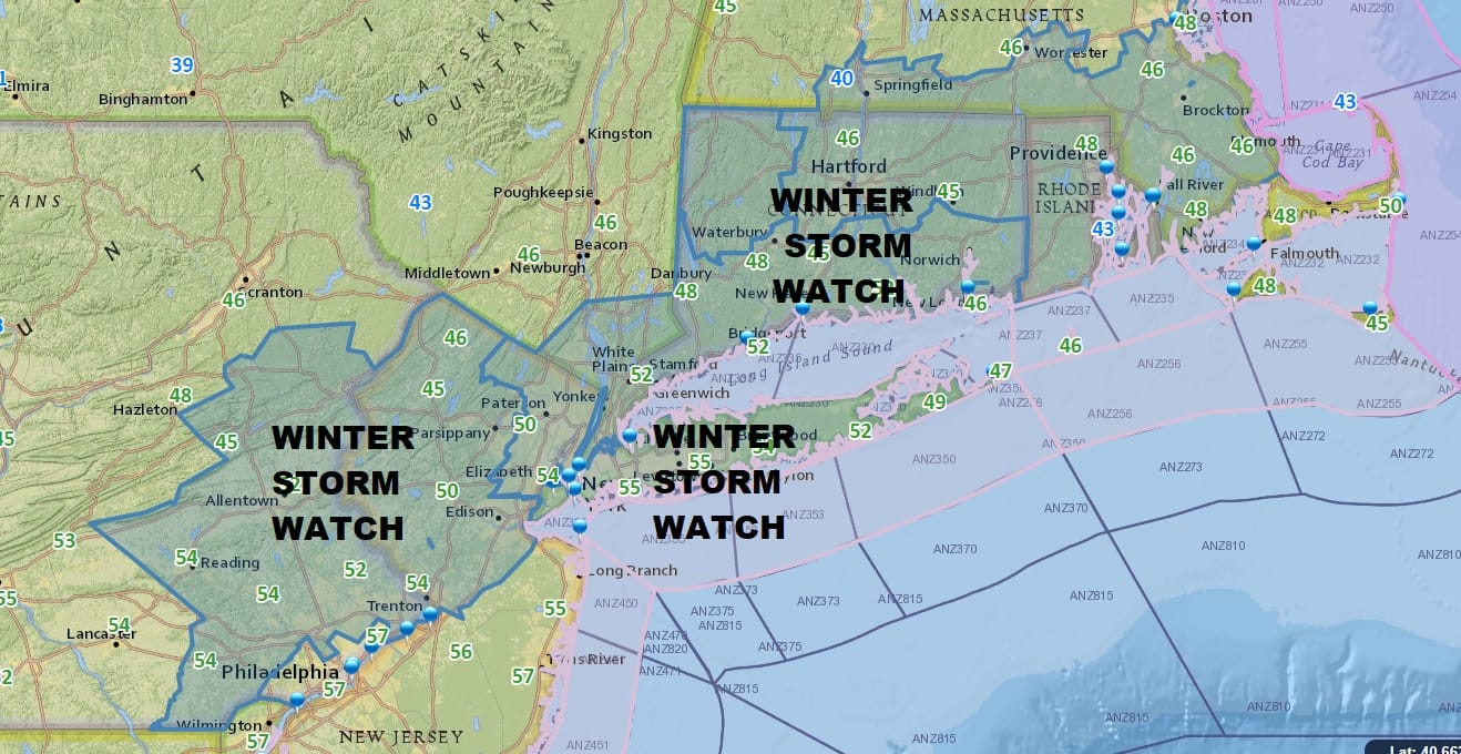
With regards to Saturday the National Weather Service has posted Winter Storm Watch from Southeast and Eastern Pennsylvania across the northern half of New Jersey along and north and west of the NJ Turnpike, NYC, Lower Hudson Valley south of Route 84 (for a change), Long Island, All of Connecticut, Rhode Island and much of Southeastern Massachusetts. This is for a quick thump of snow developing Saturday evening and ending before daybreak Sunday. Even though the Weather Service is going for amounts significantly higher than I am, I am going to leave my numbers alone for now.
JOE’S SNOW FORECAST MAP FOR LATE SATURDAY INTO SUNDAY MORNING
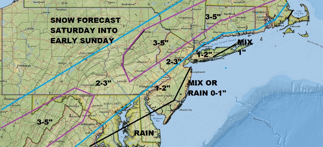
The NAM model last night painted an extremely aggressive outcome with what could be an area wide 6 to 8 inch snowfall but none of the other weather models went in that direction so I’m leaning away from the aggressive view for now and staying with this forecast. I think we all know there is upside risk so im playing it safe for the time being.
Meanwhile this morning a cold front is moving through with some showers showing up on the radar after getting showers and some heavy downpours overnight. Temperatures are beginning to ease north and west of the coast and we will see temperatures easing their way back into the 40s before too long everywhere. Showers may linger in some areas into early afternoon.
US SATELLITE

REGIONAL RADAR

On the regional radar you can see there is one band of rain moving through now and a second are to the west that looks rather impressive in Western Pennsylvania. We will keep our eyes on this as it moves east. It should weaken as it nears the coast.
LOCAL RADAR NEW YORK CITY

LOCAL RADAR PHILADELPHIA


Weather conditions will improve tonight as skies clear and it will be cold with lows in the teens and lower 20s by Saturday morning. Sunshine starts Saturday with arriving clouds and highs in the 30s. Snow develops during the evening. The key to how much will be whether we get a solid development of precipitation Saturday night. The developing storm along the Delaware coast is forecast to intensify rather quickly. This is critical on 2 fronts. One is this needs to happen to pinch off any warm air trying to move in from off the ocean. The other is the snow itself which would develop overhead rather rapidly. This is why I’m being cautious right now and leaving amounts alone. We will see what the new model cycle brings us later today.
Regardless weather conditions improve rapidly Sunday with sunshine and highs reaching the 40s. Monday we will have arriving clouds with highs reaching the 50s. More rain or showers are likely Monday night into Tuesday when temperatures are likely to reach the 60s. Snow melts!
 GET JOE A CIGAR IF YOU LIKE

FiOS1 News Weather Forecast For Long Island
FiOS1 News Weather Forecast For New Jersey
FiOS1 News Weather Forecast For Hudson Valley


