
Winter Storm Warnings Catskills Berkshires Advisories NE Pennsylvania
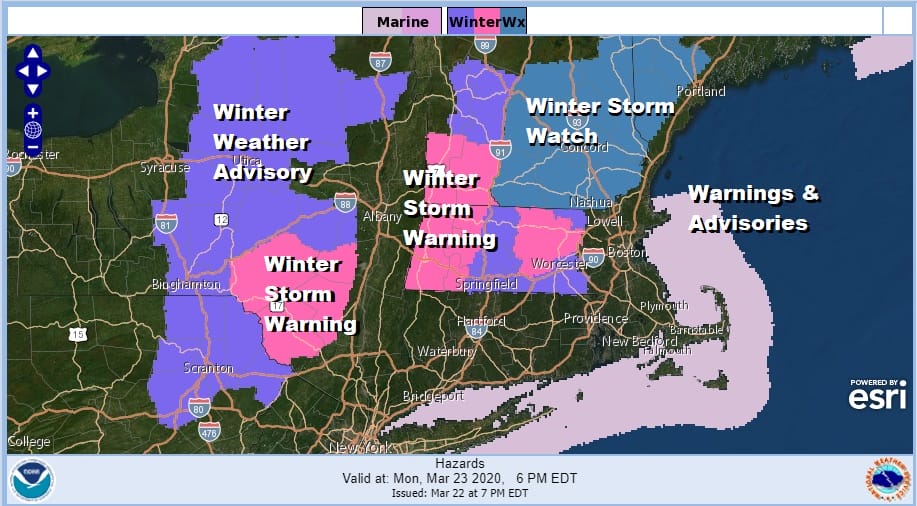
What we are seeing here is a typical spring snow system for the interior Northeast. These systems are elevation driven and usually have a minimal amount of cold air to work with. Nonetheless Winter Storm Warnings are up for the Catskills northward with Winter Weather advisories to the west into North Central New York. Advisories also extend into Northeastern Pennsylvania. Winter Storm Warnings are up for the Berkshires in Massachusetts and points northward with Winter Storm Watches extending into Maine.
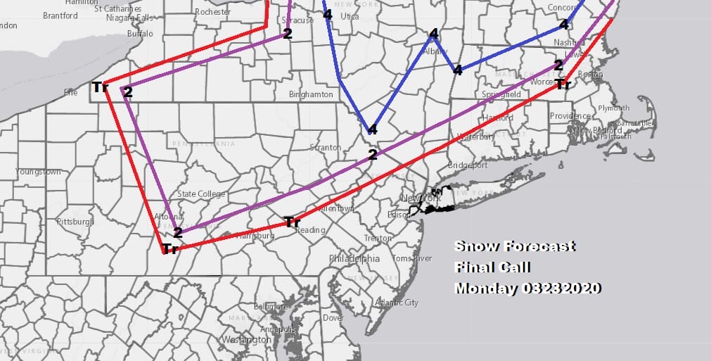
This was my final call snow forecast map from earlier today which remains unchanged. It is possible that in areas where we have warnings up that some spots could see up to 6 inches in the higher elevations of the Catskills as well as the areas in New England. For most of you a bit of wet snow could be there at the start of precipitation tomorrow morning and perhaps some areas in Northwest New Jersey and in the Hudson Valley north of Route 84 could see a light accumulation from this. Roads are likely to be wet since this occurs during the daytime.
SATELLITE

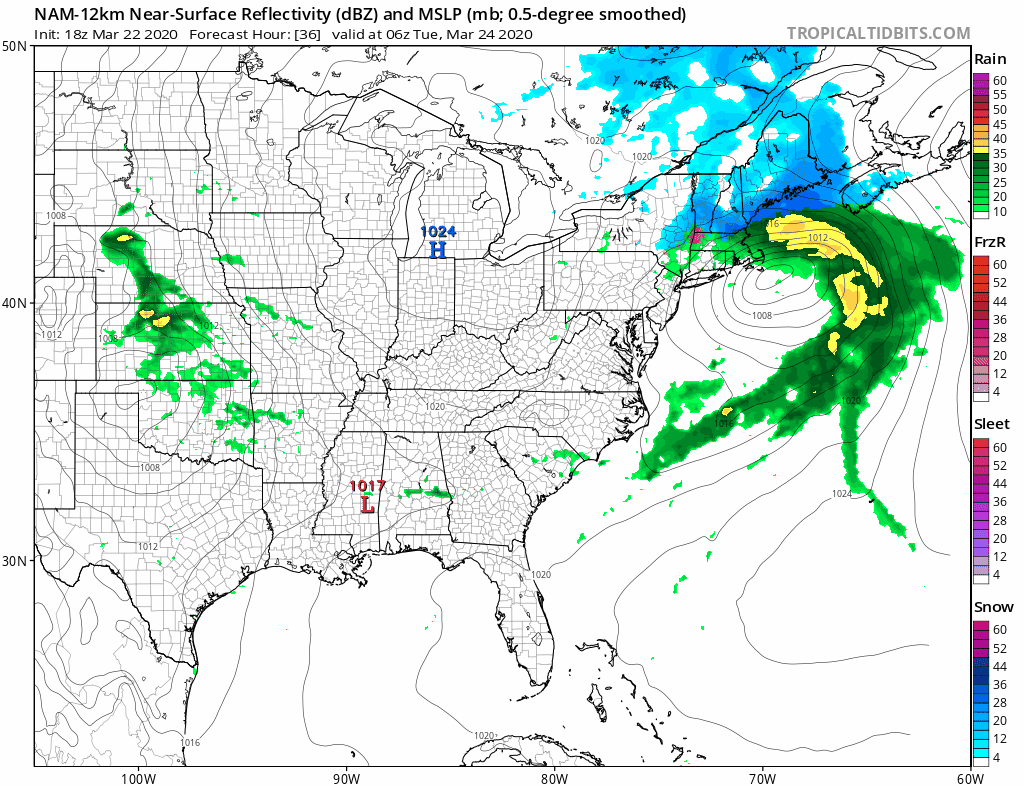
Clouds are starting to roll in on satellite pictures this evening and we are seeing the beginnings of some rain appearing on the regional radar in Ohio and about to move into Western Pennsylvania. Much of the overnight will be dry with precipitation arriving in the morning hours before day break in Eastern Pennsylvania and shortly afterward in areas east to NYC and mid to late morning in Southern New England.
REGIONAL RADAR

Gradually we will see this all turn to rain from south to north as the day wears on. Central and South Jersey will be rain probably from the get go as well as Southeastern Pennsylvania. Areas north of NYC get their cheap thrill only to see it go over to rain rather quickly. The system moves out during the evening hours from southwest to northeast. Precipitation amounts will be from 3/4 inch to 1.25 inches.
 Tuesday brings a break with some sunshine with highs reaching into the 50s. Then here comes the next storm system with a cold rain for Wednesday. Overall this will be a busy week because another weather system will be on its way for Friday.
BE SURE TO DOWNLOAD THE FREE METEOROLOGIST JOE CIOFFI WEATHER APP &
ANGRY BEN’S FREE WEATHER APP “THE ANGRY WEATHERMAN!
MANY THANKS TO TROPICAL TIDBITS FOR THE USE OF MAPS
Please note that with regards to any severe weather, tropical storms, or hurricanes, should a storm be threatening, please consult your local National Weather Service office or your local government officials about what action you should be taking to protect life and property.


