WINDS GUSTY SLOW IMPROVEMENT COASTAL STORM DEPARTS
WINDS GUSTY SLOW IMPROVEMENT COASTAL STORM DEPARTS
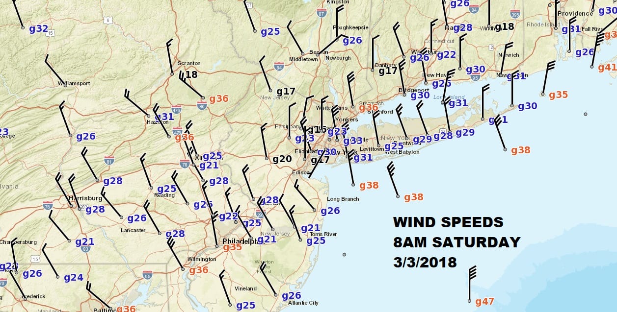
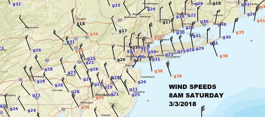
Yesterday’s incredibly powerful coastal storm is finally moving away to the south southeast. It remains impressive on the satellite picture below and the circulation of this system is huge. Winds that gusted to near hurricane force near our shorelines and to nearly 100 mph off the coast of Southeastern New England have been slowly diminishing from the extremes of yesterday but they are still on the order of 20 to 30 mph sustained with higher gusts and this will continue today into tonight. The proximity of the storm to the coast will probably keep coastal areas and areas just inland on the edge of cloud cover for while today. Not too far to the west is dry air. The air behind this storm isn’t all that cold so highs today will be in the 40s.
US SATELLITE

REGIONAL RADAR

Radars are still picking up on some precipitation rotating on the west side of the storm but these areas should not come anywhere close to us.
LOCAL RADAR NEW YORK CITY

LOCAL RADAR PHILADELPHIA


There are no weather issues tonight or for Sunday although clouds will be occasionally coming in from the northeast around the western edge of the ocean storm. Highs will be in the low to mid 40s Sunday. There might even be a few snow showers in eastern areas Sunday evening. Monday is looking nice with some sunshine. Then the next storm system comes in from the northwest. With the blocking pattern in place this system will find its way to the east coast with the primary dying out to the west and a secondary storm forming to our south. This opens the door to the chance of snow or rain or both here Tuesday night into Wednesday. We will go into greater detail on this system later today.
 GET JOE A CIGAR IF YOU LIKE

FiOS1 News Weather Forecast For Long Island
FiOS1 News Weather Forecast For New Jersey
FiOS1 News Weather Forecast For Hudson Valley


