Weather Pattern Change Coming As Ridge Breaks Down

Weather Pattern Change Coming As Ridge Breaks Down
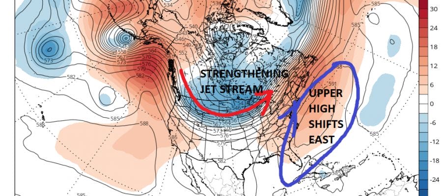
We have seen an upper high dominating the weather in the Eastern US for the last 2 weeks with a trough and a shot of cold air that was sandwiched in between this past weekend. The upper high is building again but this time it will break down a bit faster as there are changes going on across the upper pattern in North America.
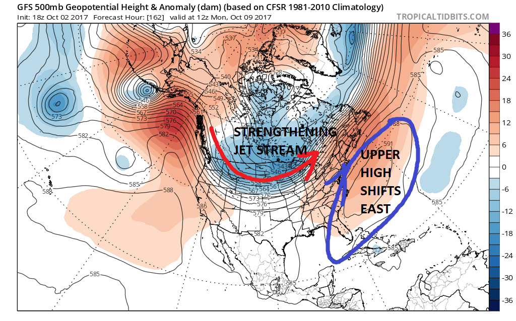
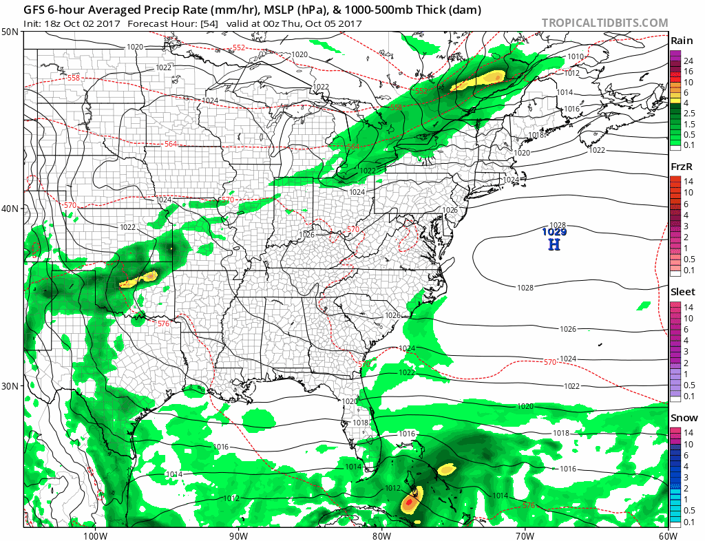
While the ridge breaks down in the Eastern US it does not break down completely. Rather it shifts off the east coast. Meanwhile the strong jet in Canada begins to gradually shift southward. The flow in between might allow for some tropical moisture to move northeastward and bring us some much needed rain here late next weekend or early next week. The GFS model this afternoon went that route as it brings the rain up the Eastern Seaboard. We have not seen a widespread rain event here for the last several weeks and the area has become very dry.
GFS MODEL THURSDAY THROUGH SUNDAY CLICK TO ANIMATE
Beyond early next week, we will see that Canadian jet become more active which will bring cold fronts through every few days and a couple of shots of cool autumn air behind each one. The ridge does not completely disappear but it least it will be weak and flat enough to allow weather systems to start moving along. This at least will begin to open up the spigots of colder Canadian air to move southward as it is supposed to do this time of year.
MANY THANKS TO TROPICAL TIDBITS FOR THE WONDERFUL USE OF THE MAPS

GET JOE A CIGAR IF YOU LIKE!
SHOP THE JOESTRADAMUS STORE FOR MUGS T SHIRTS WITH MORE COMING
FiOS1 News Weather Forecast For Long Island
FiOS1 News Weather Forecast For New Jersey
FiOS1 News Weather Forecast For Hudson Valley
NATIONAL WEATHER SERVICE SNOW FORECASTS
LATEST JOESTRADAMUS ON THE LONG RANGE
Weather App

Don’t be without Meteorologist Joe Cioffi’s weather app. It is really a meteorologist app because you get my forecasts and my analysis and not some automated computer generated forecast based on the GFS model. This is why your app forecast changes every 6 hours. It is model driven with no human input at all. It gives you an icon, a temperature and no insight whatsoever.
It is a complete weather app to suit your forecast needs. All the weather information you need is right on your phone. Android or I-phone, use it to keep track of all the latest weather information and forecasts. This weather app is also free of advertising so you don’t have to worry about security issues with your device. An accurate forecast and no worries that your device is being compromised.
Use it in conjunction with my website and my facebook and twitter and you have complete weather coverage of all the latest weather and the long range outlook. The website has been redone and upgraded. Its easy to use and everything is archived so you can see how well Joe does or doesn’t do when it comes to forecasts and outlooks.
Just click on the google play button or the apple store button on the sidebar for my app which is on My Weather Concierge. Download the app for free. Subscribe to my forecasts on an ad free environment for just 99 cents a month.
Get my forecasts in the palm of your hand for less than the cost of a cup of Joe!