Warm Weekend Ocean Wind Holds Temperatures Down Today Heat Humidity Begin Monday
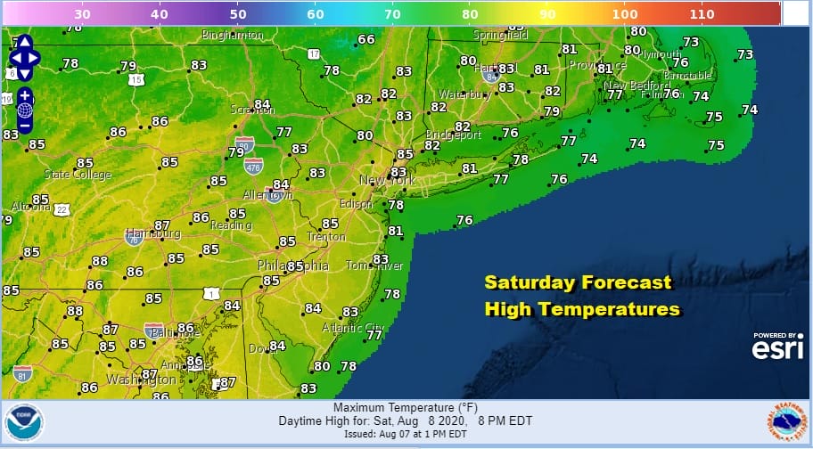
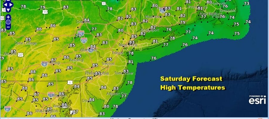
Morning clouds have given way and we will see increasing amounts of sunshine this afternoon. We are being given a little break in the temperatures thanks to an east wind and the lack of morning sun. But for the rest of the day it will be a mix of clouds and sun and temperatures will be topping out in the lower 80s on average with 70s at the shore. It is a decent start to the weekend and other than a stray shower or thunderstorm the rest of the day is rain free.
SATELLITE

REGIONAL RADAR

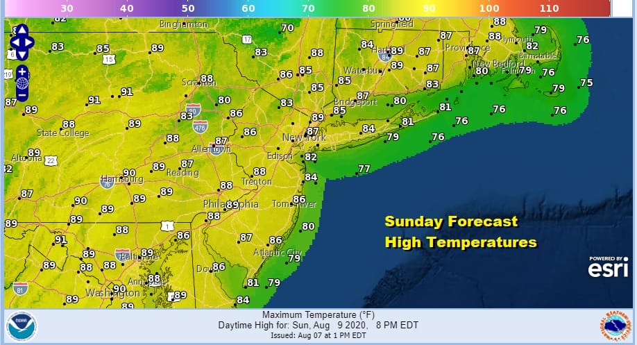
We will lose the onshore flow overnight and that will hold the temperatures up with some low clouds developing. Lows will be mostly in the upper 60s to mid 70s. Then it is on to Sunday with a southwest flow bringing sunshine very warm and humid conditions for Sunday. Again there is the outside chance for an isolated shower or thunderstorm but for most it is a rain free day with highs in the mid to upper 80s.
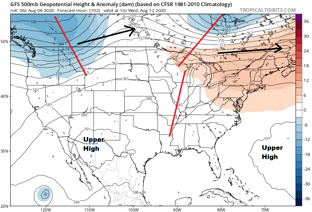
The new week begins with very warm to hot conditions for Monday and Tuesday. We will be seeing high humidity and sunshine taking temperatures to the upper 80s to lower 90s. The dominant upper air pattern this summer has been an east west ridge across the southern half of the US with the Canadian jet stream lying just to our north and that settles in again for the next week to 10 days. When the Canadian jet is strong enough it will sink south for a day or so and then retreat back northward.
Other than a scattered shower or thunderstorm the next chance for anything rain wise will come later this week as a weak short wave stalls a frontal boundary nearby. This might open the door for some showers and thunderstorms late Wednesday and then if the front does indeed stall out, it could mean a better chance for showers and thunderstorms late this week. Temperatures Wednesday will be in the upper 80s to near 90. Temperatures might be nudged a little lower by Friday. No tropical storms or hurricanes are on the map this weekend and the tropics look to be quiet for this coming week.
BE SURE TO DOWNLOAD THE FREE METEOROLOGIST JOE CIOFFI WEATHER APP &
ANGRY BEN’S FREE WEATHER APP “THE ANGRY WEATHERMAN!
MANY THANKS TO TROPICAL TIDBITS FOR THE USE OF MAPS
Please note that with regards to any severe weather, tropical storms, or hurricanes, should a storm be threatening, please consult your local National Weather Service office or your local government officials about what action you should be taking to protect life and property.


