Very Warm Humid Weather Saturday Into Next Week No Issues In The Tropics
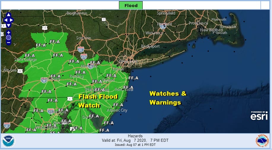
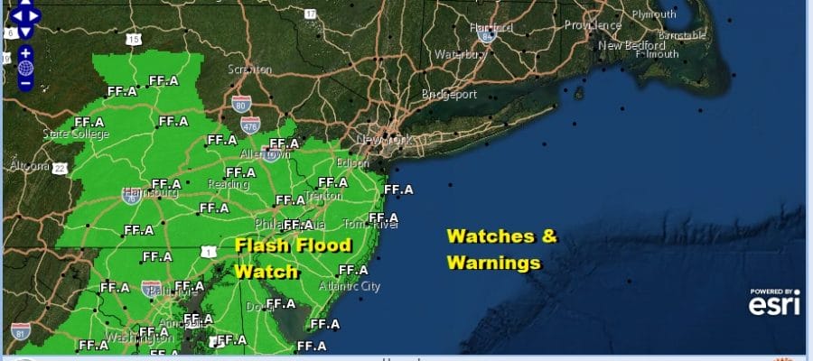
We are headed into another weekend and the weather pattern is shaping up to be a very warm and humid one especially Sunday and into the first half of next week. We have nothing major to worry about other than what is left of today into tonight. There is a marginal risk for severe weather this evening in Southern New Jersey and Southeastern Pennsylvania. We also still have a flash flood watch through late tonight from Central and South Jersey and the Eastern half of Pennsylvania as well as Maryland, Delaware, and Northern Virginia. The ground remains saturated so any scattered thunderstorms that pop up in these areas could quickly create some flooding so beware of this into tonight.
SATELLITE

REGIONAL RADAR

Some areas did see heavy downpours earlier today and now we see patches of heavy thunderstorms in East Central Pennsylvania moving eastward. A few scattered cells are also popping up on the regional radar as well. This will be the story into tonight until the stalled frontal boundary starts to move east and gradually weaken. Lows by morning will be in the 60s to near 70.
LOCAL RADAR NEW YORK CITY

LOCAL RADAR PHILADELPHIA


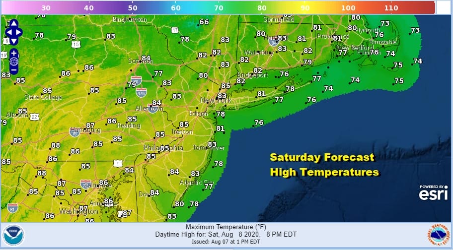
Saturday begins a stretch of very warm and humid weather. We will see clouds giving way to sunshine. Highs Saturday will be in the low to mid 80s. While there is the chance for a scattered shower or thunderstorm, most of you will likely escape it. The best chances will likely be inland.
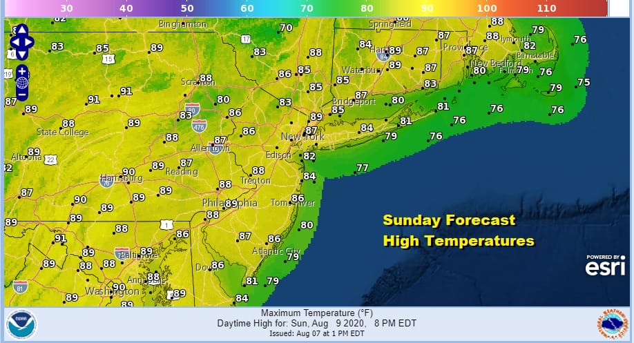
Sunday we will start taking temperatures up a notch or two with highs in the mid to upper 80s. We will see a fair amount of sun and again the chance for a scattered shower or thunderstorm though for most it should be a miss.
Next week we will be under a ridge of high pressure aloft that will lie across the Southern US and out into the Atlantic. This sets us up for very warm to hot weather at least into Thursday. The chances for any any downpours will be slim to none through Wednesday other than an isolated pop up. Highs will be in the upper 80s to lower 90s each day with nighttime lows in the upper 60s to mid 70s. It will be the typical August dog days getting underway. As far as the tropics go after this record breaking start it seems that they are taking a bit of a break at the moment. Action could shift into the Eastern Pacific for a week or two where the activity this season has been minimal. This should be a temporary shift that might last a week or perhaps 2 before activity resumes in the Atlantic Basin.
BE SURE TO DOWNLOAD THE FREE METEOROLOGIST JOE CIOFFI WEATHER APP &
ANGRY BEN’S FREE WEATHER APP “THE ANGRY WEATHERMAN!
MANY THANKS TO TROPICAL TIDBITS FOR THE USE OF MAPS
Please note that with regards to any severe weather, tropical storms, or hurricanes, should a storm be threatening, please consult your local National Weather Service office or your local government officials about what action you should be taking to protect life and property.


