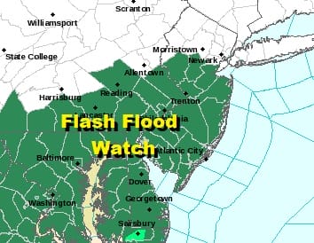
Flash Flood Watch Central South Jersey Southeast Pa Weekend Outlook Very Warm Humid

Soaked grounds from the rainfalls of Tropical Storm Isaias means that it won’t take much in the way of rain to create a flooding situation especially in areas to the Southwest and west of the coast so Flash Flood Watches are posted.
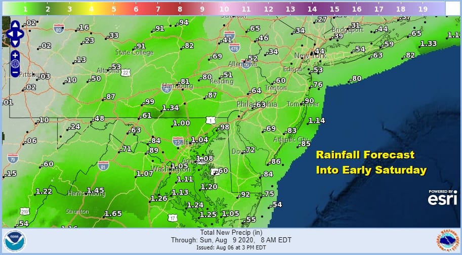
Rainfall forecast amounts aren’t all that high and they are driven by thunderstorms and heavy downpours that are developing on the radars this evening. A little bit of a dry slot has developed this evening on the satellite and areas to the north of NYC have enjoyed a rather decent day of sunshine and lower humidity. Areas to the south of NYC particularly in South Jersey and Southeast Pennsylvania are sitting with higher dew points and rather uncomfortable conditions though clouds at least held the temperatures down a bit as we topped out just in the low to a few middle 80s.
SATELLITE

REGIONAL RADAR

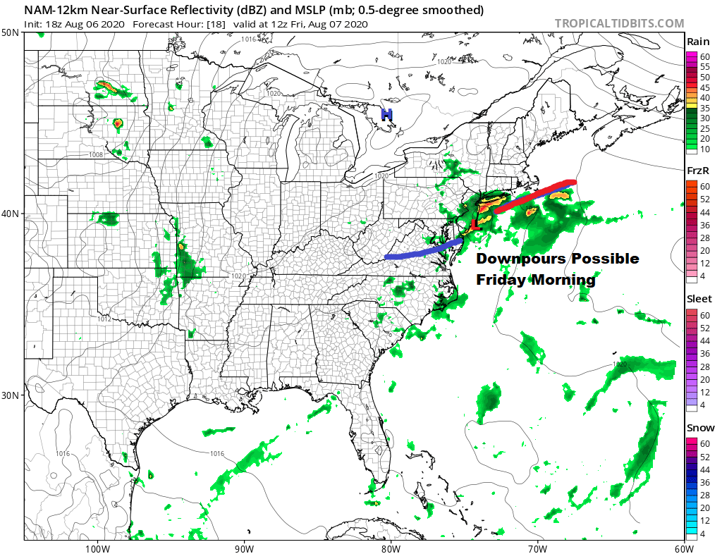
We aren’t seeing wide spread activity on the radars though in those lines that have developed there are a few heavier thunderstorms and they could be big rain producers in local areas. This is all due to a stalled frontal boundary across the Middle Atlantic and Southeastern US and a wave that is rippling along it.
LOCAL RADAR NEW YORK CITY

LOCAL RADAR PHILADELPHIA


It will be a warm and humid night and we will see a wave push up some showers and thunderstorms overnight into Friday morning as the NAM model shows us. Some folks seem the and some won’t so it will be matter of watching the radars overnight.
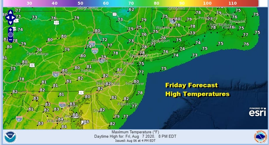
Once the wave goes by we will have leftover clouds around with a bit of an onshore flow keeping clouds in. There could be some scattered showers or a thunderstorm later in the day into Friday night. Temperatures will be mostly in the upper 70s to around or just over 80.
This is going to leave us in a warm and humid air mass for the weekend with some sunshine developing Saturday with highs reaching the low and middle 80s. Sunday we will take it a little higher with highs in the mid to upper 80s. There will be the odd chance for a thunderstorm or a downpour scattered around on either day. Overall it would be exactly as you expect for the second weekend of August.
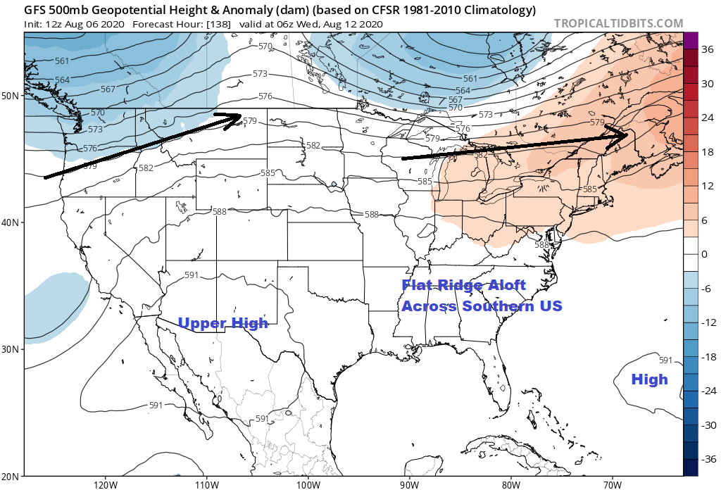
Next week the jet stream goes back to what it was before Isaias where we head this east west ridge of high pressure across the Southern US extending out into the Atlantic and a west to east jet stream across Southern Canada that every once in a while noses southward. It is a mid summer pattern for sure so look for highs in the upper 80s and lower 90s probably Monday through Wednesday with minimal shower or thunderstorm activity to worry about. The next front probably arrives late next week and there is nothing at the tropics at the moment that poses any threat. Since we have seen 2 tropical storms in the last 4 weeks it is something we should watch for as we head in the peak of hurricane season.
BE SURE TO DOWNLOAD THE FREE METEOROLOGIST JOE CIOFFI WEATHER APP &
ANGRY BEN’S FREE WEATHER APP “THE ANGRY WEATHERMAN!
MANY THANKS TO TROPICAL TIDBITS FOR THE USE OF MAPS
Please note that with regards to any severe weather, tropical storms, or hurricanes, should a storm be threatening, please consult your local National Weather Service office or your local government officials about what action you should be taking to protect life and property.


