Warm Weather Continues 2 More Days
Warm Weather Continues 2 More Days
We are beginning to see the high over the Eastern US getting a bit dirty with more in the way of clouds around today but there still we be some sunshine. it will be another very warm day across the area with highs a few degrees lower than yesterday as we head for upper 70s to a few middle 80s in the warmest spots. The next cold front is beginning to make a little headway into the strong upper high and we should finally see a break in all this on Thursday. Hurricane Maria continues its slow march northward. Notice there is very little going on west of the center as far as rain goes. Tropical Storm Warnings remain in effect for the Outer Banks of North Carolina.
SATELLITE LOOP

…MARIA CONTINUES TO MOVE NORTHWARD…
SUMMARY OF 800 AM EDT…1200 UTC…INFORMATION
———————————————-
LOCATION…33.3N 73.1W
ABOUT 190 MI…305 KM SE OF CAPE HATTERAS NORTH CAROLINA
MAXIMUM SUSTAINED WINDS…75 MPH…120 KM/H
PRESENT MOVEMENT…N OR 360 DEGREES AT 7 MPH…11 KM/H
MINIMUM CENTRAL PRESSURE…970 MB…28.65 INCHES
WATCHES AND WARNINGS
——————–
CHANGES WITH THIS ADVISORY:
None.
SUMMARY OF WATCHES AND WARNINGS IN EFFECT:
A Tropical Storm Warning is in effect for…
* Bogue Inlet to the North Carolina/Virginia border
* Albemarle and Pamlico Sounds
A Storm Surge Watch is in effect for…
* Cape Lookout to Duck
REGIONAL RADAR

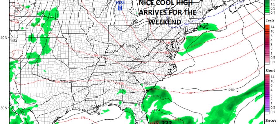
Wednesday we can throw in the idea of a few passing brief showers in the mix but they should be widely scattered. Temperatures Wednesday will be in the mid 70s to lower 80s. Then finally we will cool down Thursday and that cool air should last into the weekend. A large high will build in and it should be dry right through Sunday with sunshine. The only chance for showers could come Friday evening as a secondary cold front moves through but even here it won’t amount to much. Highs Thursday will be in the 70s and Friday should be in the low to mid 70s. Saturday and Sunday highs look to be in the upper 60s and lower 70s.

There will be lower pressures in the Southwest Atlantic late this week and weather models do pop up a low off the East Coast of Florida that will probably move westward into the Gulf of Mexico. Conditions for development into a tropical system are marginally favorable for development but there are upper air issues with wind shear so for now we are not overly worried about this forming into a tropical depression or tropical storm.
 GET JOE A CIGAR IF YOU LIKE

FiOS1 News Weather Forecast For Long Island
FiOS1 News Weather Forecast For New Jersey
FiOS1 News Weather Forecast For Hudson Valley


