WARM HUMID CONDITIONS INTO THURSDAY
SHOWERS & DOWNPOURS AHEAD OF COLD FRONT
MICHAEL TO PASS SOUTH & EAST OF NJ LONG ISLAND
COOL AUTUMN AIR ARRIVES THIS WEEKEND
Nothing worse in my view than waking up to a stale upper high in the Eastern US in October. The air just has that muggy feel to it that just hangs all day. We start the day with low clouds but the deck has thinned out considerably this morning in some coastal areas and we should see that trend spread its way inland this morning with skies becoming partly sunny. A weak warm front is pretty much dissolving as it moves northward with no serious impact we will just be in warm humid conditions into Thursday. Highs today will be in the 70s to near 80 and highs Wednesday will be into the 80s. Nights will be warm and humid with low clouds and patchy fog and drizzle developing in some areas with lows in the 60s.
EASTERN SATELLITE

REGIONAL RADAR

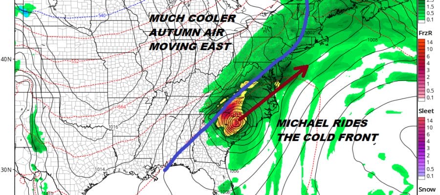
Now we move into Thursday where we will be dealing with an arriving cold front coming in from the west and Hurricane Michael which will inland in the Southeast US and moving northeastward as a tropical storm. We will be getting some showers and heavy downpours and thunderstorms from the front as it moves through Thursday evening.

The issue is whether the ridge off the East Coast which is weakening holds on a bit longer and slows the front down slightly. Right now we seem to be threading a fine needle here at least on the GFS which brings the front through just enough to keep Michael’s rains just offshore. It should be noted that the GFS is the furthest northwest with Michael while the European & NAM models have it further southeast with no impact here other than over the coastal waters.
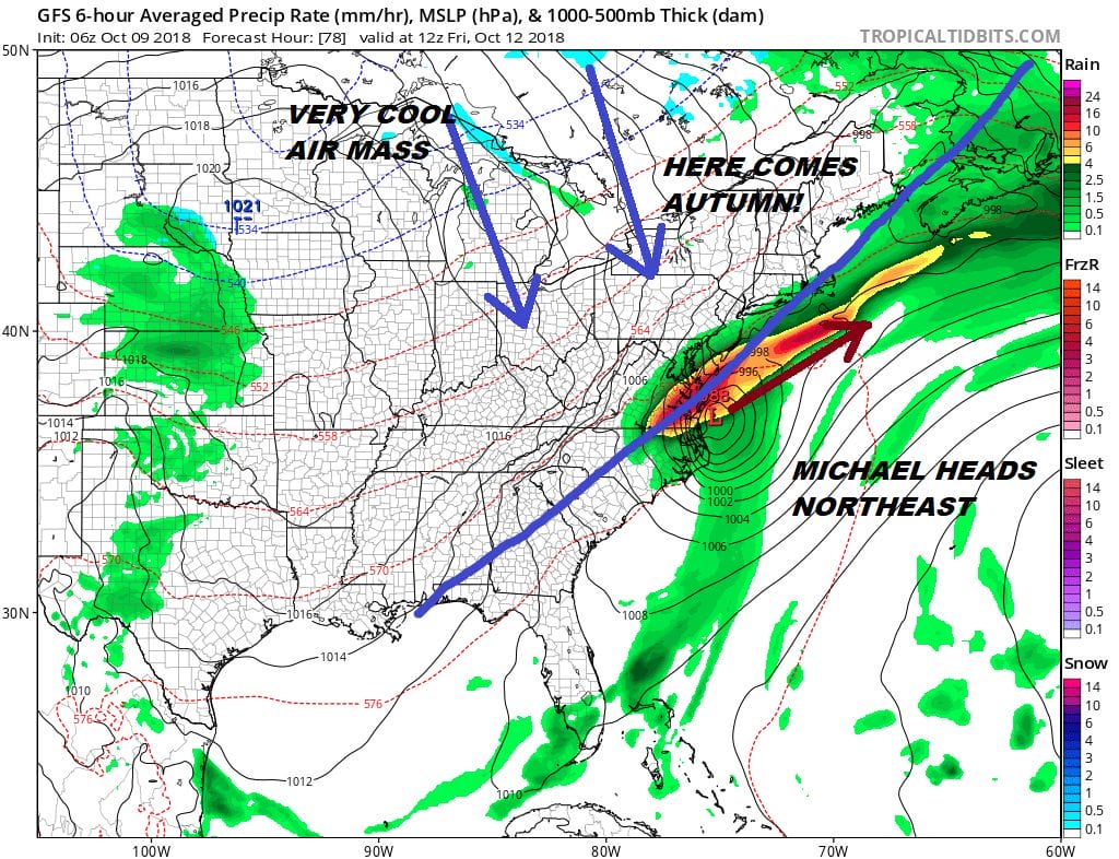
Heavy rains from Michael will impact the Middle Atlantic states and the northern fringe gets very close to Southern New Jersey and Long Island as the map for Friday morning shows. Once it pulls out far enough to the east weather conditions will improve on Friday with leftover clouds giving way to some sunshine. Dew points will plunge with temperatures in the 70s but then the temperatures will drop as well as we head to the 40s in many areas by Saturday morning.
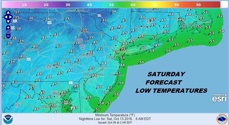
The weekend will be cool with some sunshine Saturday and highs will only make it back to the upper 50s and lower 60s. Sunday morning will be a chilly morning indeed with lows in the 30s inland and low to mid 40s coast and warmer urban locations. Sunday we will see sunshine giving way to arriving clouds with highs in the upper 50s and lower 60s. Another front approaches with the chance for showers late Sunday night and Monday so the weekend itself though cool will have no rain issues.
As for Hurricane Michael this morning we will be updating the latest on Michael a little later this morning. Additional coverage on Hurricane Michael is available on the PATREON platform.
SUBSCRIBE TO PATREON FOR A WEATHER EXPERIENCE FREE OF ADS, EXCLUSIVE VIDEOS FOR MEMBERS ONLY AND MUCH MORE…STARTS AT $2 A MONTH..MESSAGE ME AT ANY TIME

MANY THANKS TO TROPICAL TIDBITS FOR THE USE OF MAPS
Please note that with regards to any tropical storms or hurricanes, should a storm be threatening, please consult your local National Weather Service office or your local government officials about what action you should be taking to protect life and property.
LATEST JOESTRADAMUS ON THE LONG RANGE

