Warm Humid Saturday Warmer More Humid Sunday Humidity Breaks Midweek
The humidity came back to day in a big way as dew points climbed up through the 60s. Add temperatures in the 80s to the mix along with filtered sunshine through high clouds and we had a warm humid Saturday. As we head into the evening hours and the first part of tonight we have some scattered thunderstorms on the radars that will disappear and then it is a very warm humid night with lows in the upper 60s to mid 70s
SATELLITE

REGIONAL RADAR

Radars are picking up some widely scattered thunderstorms. They appear more numerous north in Upstate NY and Central New England but for our area most of you won’t have to deal with anything of consequence. Areas south of NYC aren’t seeing much on radars this evening.
LOCAL RADAR NEW YORK CITY

LOCAL RADAR PHILADELPHIA


On to Sunday which will be a steamy day of hazy sunshine and high humidity and again the risk for some scattered thunderstorms in the afternoon and evening. Highs will be in the upper 80s to near 90 degrees. Thunderstorms will be a bit more numerous but still scattered in nature and chances are most of you won’t seem much.
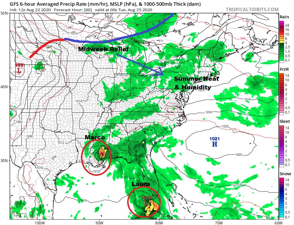
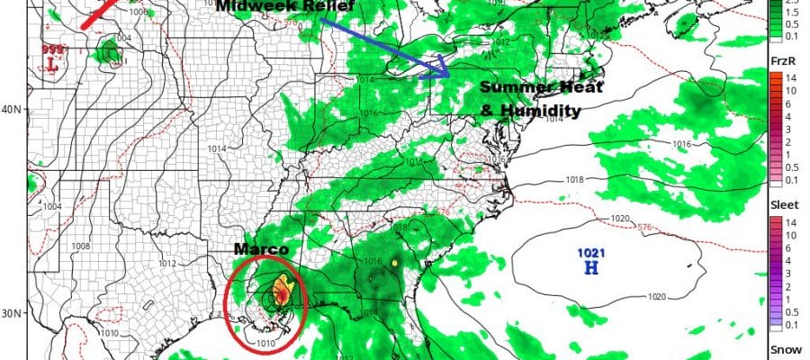
Monday’s weather map is a rare one indeed with two tropical systems in play. Marco will have moved inland. The models have shifted east as these storms respond to the strong upper high in the Atlantic over and east of Florida. Laura follows right behind it in the Florida Straits contemplating a turn to the northwest and north. It will likely make landfall on the Gulf Coast 24 hours behind Marco. Meanwhile we continue in summer heat and humidity with highs in the upper 80s to lower 90s and the chance for a scattered thunderstorm.
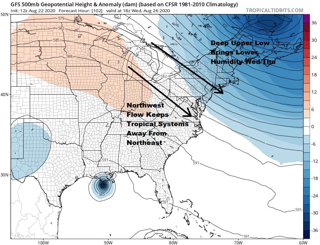
Both tropical systems will likely rain themselves out in the Lower Mississippi Valley and Gulf States thanks to a deep trough in Eastern Canada and a screaming northwest jet stream from the Great Lakes to the Mid Atlantic Coast. This acts as a brick wall and will keep these systems from making it here.
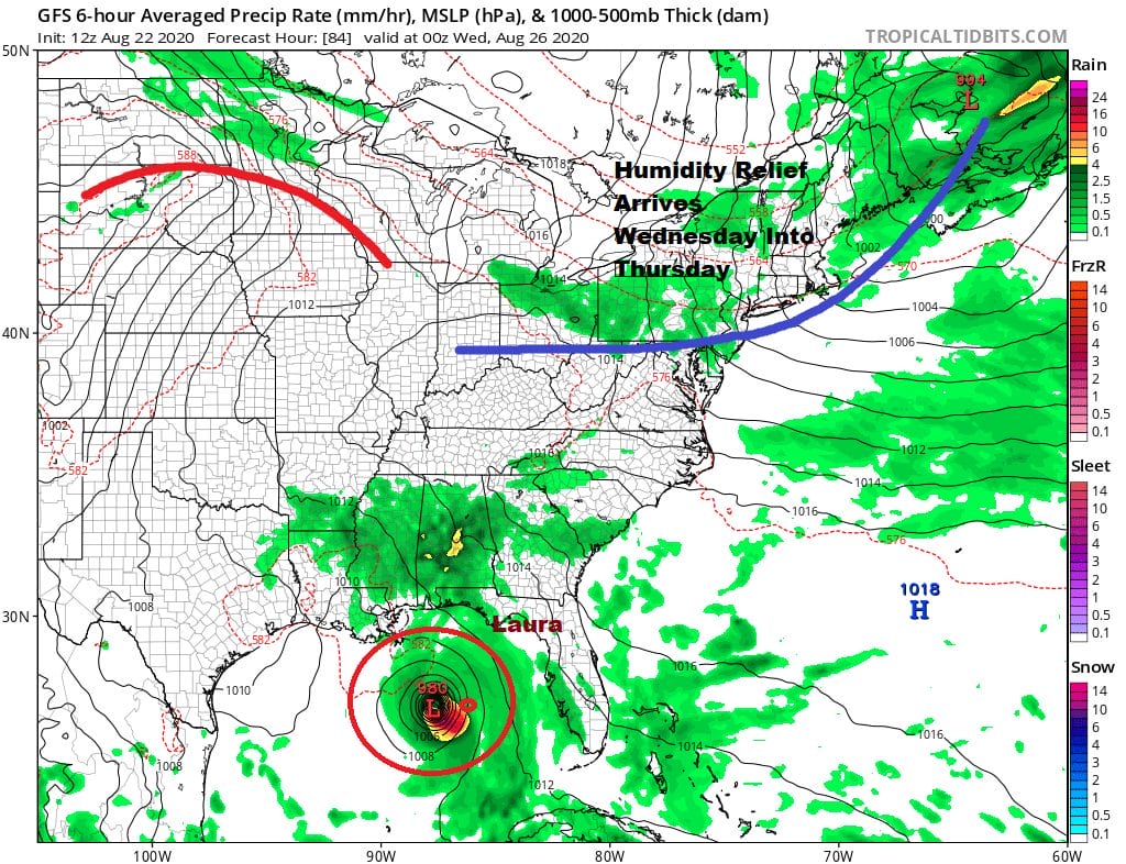
Tuesday will be the last hot humid day of this current streak with highs in the upper 80s to lower 90s and the chance for a thunderstorm. Then the cold front moves through and high pressure builds in from the north with sunshine and low humidity for Wednesday and it should hold on for Thursday though we will see it pull out and it turns very warm and humid next Friday. An even stronger cold front approaches late Friday into Saturday followed by what should be a delightful air mass behind it to finish off the month of August.
BE SURE TO DOWNLOAD THE FREE METEOROLOGIST JOE CIOFFI WEATHER APP &
ANGRY BEN’S FREE WEATHER APP “THE ANGRY WEATHERMAN!
MANY THANKS TO TROPICAL TIDBITS FOR THE USE OF MAPS
Please note that with regards to any severe weather, tropical storms, or hurricanes, should a storm be threatening, please consult your local National Weather Service office or your local government officials about what action you should be taking to protect life and property.


