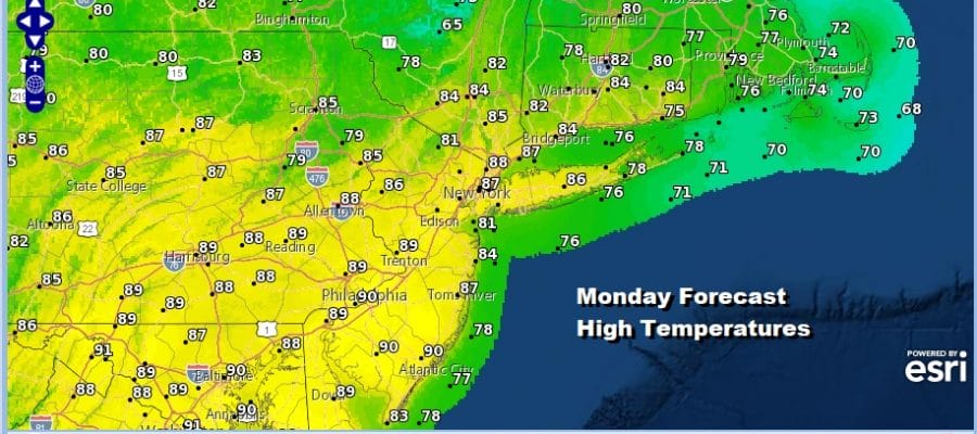
Warm Humid Monday Isolated Showers Thunderstorms Later Today

It is a new week and our very warm humid conditions continue today though we are going to see dew points a little lower today and humidity levels a shade lower as well. This lessens the juice in the atmosphere. We do have an upper low to the north and that is showing up on the satellite as lots of clouds across New England. Unlike yesterday we don’t seem to have a strong short wave trough rotating southward on the back side but instead a weaker one. This opens the door to some pop up isolated showers and thunderstorms later today into this evening but we are not anticipating widespread activity nor are we expecting any kind of severe weather outbreak. Highs today will reach the mid to upper 80s.
SATELLITE

REGIONAL RADAR

Regional radar is picking up on a rather solid area of rain in Northern New Hampshire and Maine where it is sorely needed after an abnormally dry and hot month of June. Local radars below are picking up on some showers that are moving through parts of Central New England to the southeast. Nothing is on the radar so far around much of the area from Eastern Pennsylvania to Southern New England.
LOCAL RADAR NEW YORK CITY

LOCAL RADAR PHILADELPHIA


The story this week and through the holiday weekend remains pretty much the same. First off other than pop up showers or thunderstorms over the next few days we don’t see much if any any rain in the forecast. Tuesday Wednesday and Thursday look for some sunshine each day with a few developing clouds and the chance for a pop up scattered shower or thunderstorm with highs in the 80s. Humidity levels will be on the moderate side.

Friday brings a back door cold front through with not much weather with it and a shot of lower humidity moving southward from upstate NY. Highs will be in the mid to upper 80s Friday with some sunshine. Saturday will be sunny and warm but rather comfortable with highs in the low to mid 80s and dew points in the 50s. That could hold on for Sunday as well making for a very nice 3 day holiday weekend. Little to no chance of shower or thunderstorm activity is being indicated in our forecast for now.
BE SURE TO DOWNLOAD THE FREE METEOROLOGIST JOE CIOFFI WEATHER APP &
ANGRY BEN’S FREE WEATHER APP “THE ANGRY WEATHERMAN!
MANY THANKS TO TROPICAL TIDBITS FOR THE USE OF MAPS
Please note that with regards to any severe weather, tropical storms, or hurricanes, should a storm be threatening, please consult your local National Weather Service office or your local government officials about what action you should be taking to protect life and property.


