DOWNLOAD MY NEW FREE JOESTRADAMUS WEATHER APP FOR ANDROID
THE APP IS ABSOLUTELY FREE TO ALL BUT CONSIDERING SUBSCRIBING TO PATREON FOR A WEATHER EXPERIENCE FREE OF ADS, EXCLUSIVE VIDEOS FOR MEMBERS ONLY AND MUCH MORE…STARTS AT $2 A MONTH..MESSAGE ME AT ANY TIME
Warmer Temperatures Some Sunshine Into Monday
Yesterday we saw a coating to an inch or two of snow from Route 195 in New Jersey & Route 76 in Pennsylvania southward thanks to warmer air arriving aloft and the bitter cold on the ground being slow to let go. Now we will see temperatures rise over the next 3 days (including today) as we should break into the 30s just about everywhere this afternoon. We are noticing some patchy clouds on the satellite loop this morning coming in from the northwest but that really is about the extent of today’s issues. The regional radar is nice and quiet for the most part.
EASTERN SATELLITE

REGIONAL RADAR

As the days warm the nights chill down less and lows tonight under mainly clear skies should mainly in the 20s with teens in the coldest spots. Then we will warm a bit further on Super Bowl Sunday with some sunshine and highs getting into the 40s. Monday we should able to climb into the 50s. There really isn’t too much happening until we get to Tuesday when a cold front should slide through with not much fanfare other than an shower with temperatures into the 50s.
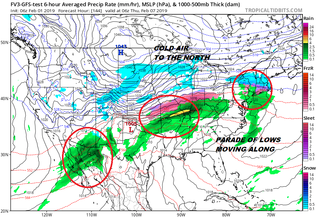
Later next week we start to look at the next series of weather systems moving along. A couple of systems try to line up with the first coming later Wednesday and another follows right behind on Thursday. Cold air will be spreading from the Plains east to the Great Lakes and Northeast and then bleed southward. This cold air is going to be shallow in nature and will not be present at the higher levels of the atmosphere unless you head up into Upstate NY. The other question is whether these two systems stay separate and distinct from each other and move along in wave fashion or is the second one going to become one dominant player.

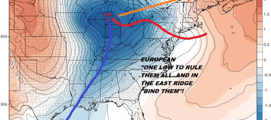
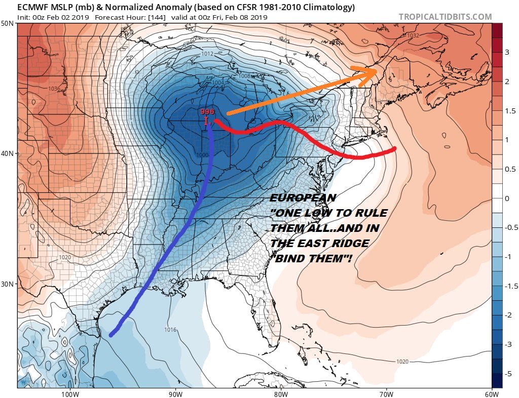
This has been the daily struggle between the global models lately. The GFS continues to insist on the colder flatter look which is entirely plausible. This might lead to an ice situation for the Northeast particularly just inland. Each wave goes by brings the cold air a little further south at low levels. On the other hand we have the more wrapped up European’s idea of one wave to basically rule them all.
The outcome of this series of systems this week might have a big say in the rest of the winter in spite of what any glorified rodent says today. In the meantime enjoy the exit out of the deep freeze this weekend. Just getting back above 30 will feel like a beach day.
MANY THANKS TO TROPICAL TIDBITS FOR THE USE OF MAPS
Please note that with regards to any tropical storms or hurricanes, should a storm be threatening, please consult your local National Weather Service office or your local government officials about what action you should be taking to protect life and property.


