
DOWNLOAD MY NEW FREE JOESTRADAMUS WEATHER APP FOR ALL DEVICES
THE APP IS ABSOLUTELY FREE TO ALL BUT CONSIDERING SUBSCRIBING TO PATREON FOR A WEATHER EXPERIENCE FREE OF ADS, EXCLUSIVE VIDEOS FOR MEMBERS ONLY AND MUCH MORE…STARTS AT $2 A MONTH..MESSAGE ME AT ANY TIME
Valentines Day Sunshine 40s No Hearts For Snow Lovers
Another day begins with here with some sunshine and patchy clouds. We are still riding the influence of the old storm from 2 days ago as the upper air feature moves through the northeast and slowly lifts out. Temperatures this morning bottomed in the mid 20s to lower 30s. We should see the winds ease somewhat today and there should be enough sun to take temperatures into the 40s and produce some more snow and ice melt assuming you still need it.
REGIONAL RADAR

The activity today on the regional radar is much less than yesterday as far as snow showers go. We had some running around yesterday afternoon and evening. This should not be the case today.
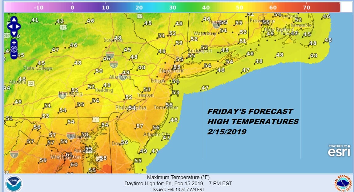
Friday we look at a cold front approaching with clouds and some passing showers. There could be a couple tomorrow morning as a weak warm front goes by and again tomorrow evening as the cold front goes by. Highs should reach the 50s everywhere including sea breeze prone areas. The front passes and then we look to Saturday for the first of 3 weather systems heading our way.

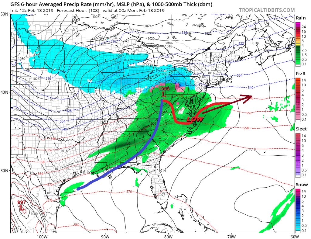
Today’s NAM model takes the first low pretty far south but this could still move northward a bit and push snow into Southern Pennsylvania & Southern New Jersey southward into Maryland & Delaware. This has been the jackpot zone this winter. It is hard to see a shift so far north that it brings snow up to areas north of there. Then the next system comes Sunday night into Monday.
This one comes further north but also there isn’t much in the way of cold air here to work with. The outcome of the second will depend on the outcome of the first so there isn’t much to gain by trying to out guess the atmosphere right now.
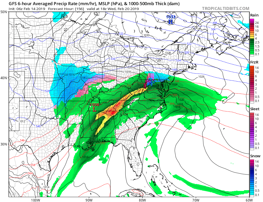
System number 3 is for next Wednesday. If this looks familiar it is because it looks just like what we just went through back on Tuesday. This could be a bit of a repeat performance depending on how much cold air can drain down from Canada. Of course that will depend on the outcome of system number 2 which will depend on the outcome of system number 1 which will depend on…well you get the drill here.
Snow lovers should prepare themselves for the reality that other than the kind of systems we have seen this winter which basically sneak in to some places..or a repeat of last Tuesday, there is nothing in the weather pattern that suggests a change anytime in the short or medium range outlook. NOTHING!
MANY THANKS TO TROPICAL TIDBITS FOR THE USE OF MAPS
Please note that with regards to any tropical storms or hurricanes, should a storm be threatening, please consult your local National Weather Service office or your local government officials about what action you should be taking to protect life and property.


