
DOWNLOAD MY NEW FREE JOESTRADAMUS WEATHER APP FOR ALL DEVICES
THE APP IS ABSOLUTELY FREE TO ALL BUT CONSIDERING SUBSCRIBING TO PATREON FOR A WEATHER EXPERIENCE FREE OF ADS, EXCLUSIVE VIDEOS FOR MEMBERS ONLY AND MUCH MORE…STARTS AT $2 A MONTH..MESSAGE ME AT ANY TIME
Quiet Time Weak Systems Chance Rain Snow Monday
With the departure of yesterday’s storm system we have remnant gusty winds and leftover clouds. A few weak upper air disturbances are moving across Pennsylvania and New Jersey late this afternoon producing scattered snow showers in the colder air and snow or rain showers as they near the coast late this afternoon & evening . They should move through and not last long.
REGIONAL RADAR

You can see the patches showing up on both local radars below. Much of ir is not reaching the ground. Some places you might see a handful of flurries and that will be that. Winds are gusting to 30 to 35 mph at times with temperatures holding in the upper 30s and lower 40s.
LOCAL RADAR NEW YORK CITY

LOCAL RADAR PHILADELPHIA


We should see skies partially clear out tonight as temperatures by morning head down into the 20s. Thursday should be nice with more sun, fewer clouds and highs in the 40s. Friday we have a cold front coming through and that could kick off some afternoon showers with highs in the 50s. Colder air follows for the weekend.

We have some weak systems in the flow moving along with the first one Saturday passing to the south and of little consequence here other than some high clouds. The next high is building in and that suppresses this system to the southeast. More important energy attempts to come out of the west for Sunday though the European keeps this system very flat and of no consequence here. Other models have a more intact system moving east and redeveloping off the Virginia coast Sunday night into Monday morning.
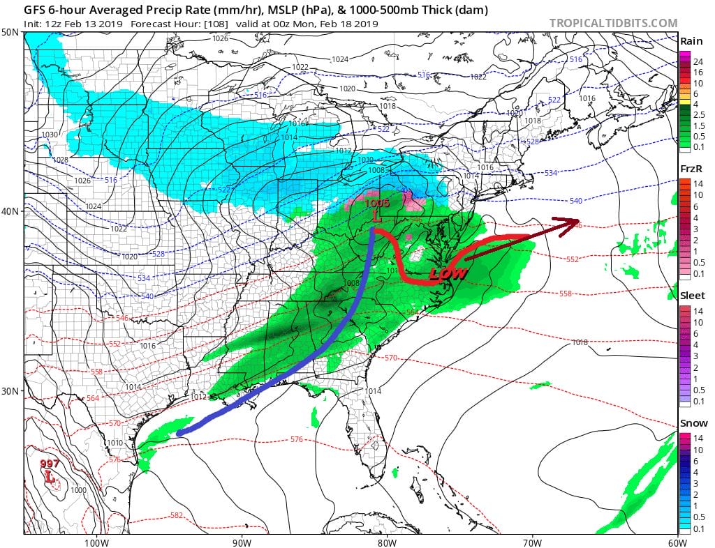
The upper air doesn’t inspire here as the flow is relatively flat and the upper energy is a bit of a yawner. This system could wind up being flatter and further south which is where most of the other models are. You can make a case where if the energy is weak this amounts to very little here. If the upper air energy is a bit more robust you will wind up with a primary further north and a shot of snow changing to rain here for Sunday night into Monday morning. A third system comes out for the middle of next week as it rides along a developing upper high along the East Coast.

Given the rather flat nature of the pattern it is hard for me to get energetic over any of these systems at this point. Longer range shows another trough driving into the west again later next week which means we warm up again late next week.
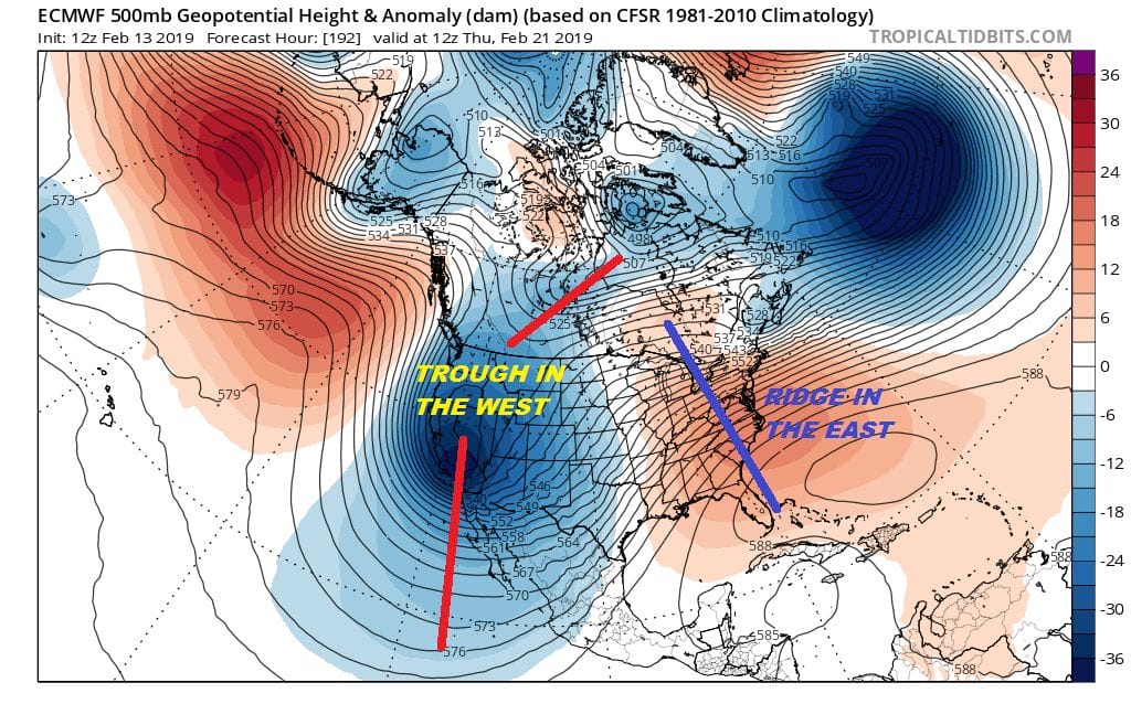
Nothing here even remotely suggests any long lasting cold other than seasonal temperatures before the ridge builds back into the East again. Half of February is over and it seems a stretch to see this pattern suddenly reverse as we move through the second half of the month. Chances for snow and time for this season continues to dwindle.
joMANY THANKS TO TROPICAL TIDBITS FOR THE USE OF MAPS
Please note that with regards to any tropical storms or hurricanes, should a storm be threatening, please consult your local National Weather Service office or your local government officials about what action you should be taking to protect life and property.