Tropical Storm Development Gulf of Mexico
Weather models remain very consistent with the idea of a tropical storm developing in the Northwest Caribbean and moving into the Gulf of Mexico early next week. Upper level winds would suggest that anything that winds up in the Gulf of Mexico is likely to turn to the northeast and head to the west coast of Florida next Tuesday. The National Hurricane Center now rates this as a 60 percent chance of development.
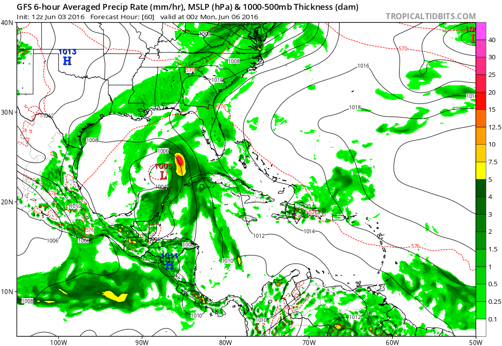
Tropical Storm Development Gulf of Mexico GFS MONDAY
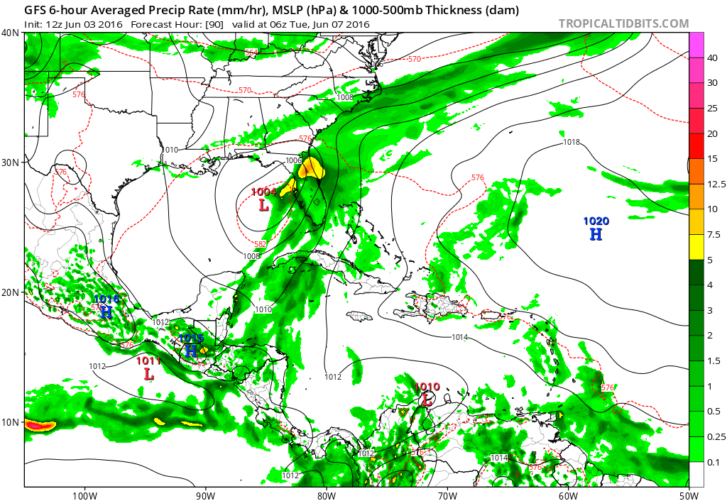
Tropical Storm Development Gulf of Mexico GFS MODEL TUESDAY
Today’s GFS model run does not give this system a true tropical look. Now that could be just a model bias. It also could be a wind shear issue. The GFS model has the system under a small area of light wind shear but there is strong southwest shear on the western side of the surface low center. This could be the reason why the system does not have that typical tropical look to it.
Tropical Storm Development Gulf of Mexico
GFS MODEL WIND SHEAR FORECASTS
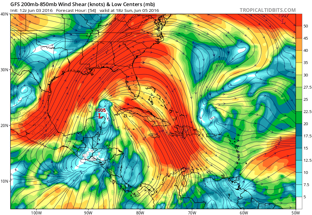
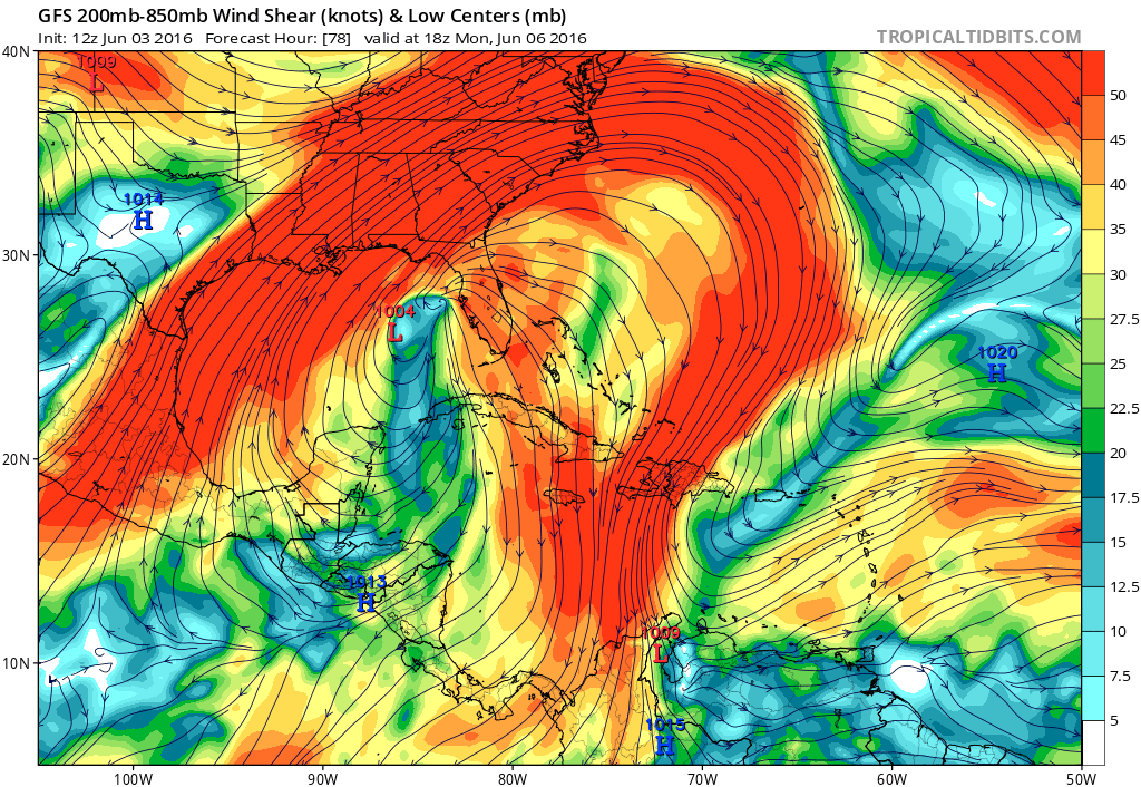
The area in orange is showing strong winds of 40 knots or higher on the west side of the surface low. The area in blue shows winds of 20 kts or less. The surface low sits under the low wind shear but there is strong wind shear on either side, assuming the model is correct on this. This system may wind up behaving more like a subtropical system then a truly tropical system. However this is something that we won’t know until the system gets going over the weekend. The outcome could be heavy rains on the east side of the low which is forecast to move toward and over Florida later next Tuesday.
Tropical Storm Development Gulf of Mexico
GFS MODEL UPPER AIR TUESDAY

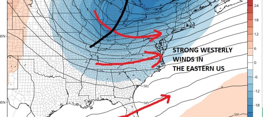
The upper air profile early next week shows a deep upper low in Eastern Canada and a very strong westerly flow all the way down to Florida. This broad look argues strongly against any of the rains from this system ever making it up the east coast. Rainfall for Central and North Florida and the Southeast US could be substantial.
Tropical Storm Development Gulf of Mexico
GFS MODEL RAINFALL

VIDEO ANALYSIS OF WEEKEND SEVERE WEATHER THREAT & TROPICAL SYSTEM IN GULF OF MEXICO
JOESTRADAMUS HURRICANE SEASON GUEST FORECAST

MENTION JOE CIOFFI AND GET A 5% DISCOUNT
FiOS1 News Weather Forecast For Long Island
FiOS1 News Weather Forecast For New Jersey
FiOS1 News Weather Forecast For Hudson Valley
NATIONAL WEATHER SERVICE SNOW FORECASTS
LATEST JOESTRADAMUS ON THE LONG RANGE
Weather App

Don’t be without Meteorologist Joe Cioffi’s weather app. It is really a meteorologist app because you get my forecasts and my analysis and not some automated computer generated forecast based on the GFS model. This is why your app forecast changes every 6 hours. It is model driven with no human input at all. It gives you an icon, a temperature and no insight whatsoever.
It is a complete weather app to suit your forecast needs. All the weather information you need is right on your phone. Android or I-phone, use it to keep track of all the latest weather information and forecasts. This weather app is also free of advertising so you don’t have to worry about security issues with your device. An accurate forecast and no worries that your device is being compromised.
Use it in conjunction with my website and my facebook and twitter and you have complete weather coverage of all the latest weather and the long range outlook. The website has been redone and upgraded. Its easy to use and everything is archived so you can see how well Joe does or doesn’t do when it comes to forecasts and outlooks.
Just click on the google play button or the apple store button on the sidebar for my app which is on My Weather Concierge. Download the app for free. Subscribe to my forecasts on an ad free environment for just 99 cents a month.
Get my forecasts in the palm of your hand for less than the cost of a cup of Joe!
![]()

