Tropical Depression Could Form Later Today Eastern Atlantic
Tropical Depression Could Form Later Today Eastern Atlantic
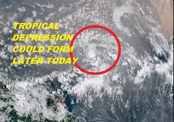
Satellite loops this morning show that the tropical wave in the Eastern Atlantic remains well organized and it appears that this system could become a tropical depression later today. You can see the system in the lower right on the wide Atlantic tropical loop below. It appears that a circulation is developing as the system moves along to the the west. It is a little early for systems to form out in this part of the Atlantic but certainly not unheard of. Ocean water temperatures there have actually been a bit below average for weeks though they have inched closer to normal recently. They are certainly supportive of a tropical system. Conditions are favorable for further development for the next few days but when the system reaches the area just northeast of the Leeward Islands it will encounter a more hostile upper air environment. This system is no threat to land at the moment.
WIDE ATLANTIC TROPICAL SATELLITE

We are still watching another system southwest of Bermuda that has gotten a bit more concentrated overnight but still looks rather disorganized. There is still some time for this to develop some but that strong cold front that is about to end out heat and humidity is also likely to either tear this system apart or kick it away to the northeast. We are not overly concerned about it.
WESTERN ATLANTIC TROPICAL SATELLITE

We will take a look at this again later today when the National Hurricane Center updates later today. Meanwhile we can say goodbye to our humidity and hello to some really beautiful Canadian air. JOESTRADAMUS has more on this in his latest outlook.
FiOS1 News Weather Forecast For Long Island
FiOS1 News Weather Forecast For New Jersey
FiOS1 News Weather Forecast For Hudson Valley