Strong Thunderstorms Friday Usher In Canadian Pines Fresh Air
Strong Thunderstorms Friday Usher In Canadian Pines Fresh Air
Once again we are sitting in a hot humid air mass this afternoon but thunderstorm activity so far seems to be minimal except for some showers in Coastal South Jersey along a sea breeze front and some scattered cells inland. The odd pop up storm could develop into this evening but they will be few and far between. The main player is a cold front on Friday that will produce a line of thunderstorms that will put an end to this heat and humidity run that began last Friday. Before that however is another very warm and humid night with temperatures in the low to mid 70s by Friday morning.
EASTERN SATELLITE

REGIONAL RADAR

The regional and local radars are showing some scattered pop up downpours and thundertorms. You cal also see the narrow band of showers in the Southern half of New Jersey lining up along and just west of the Garden State Parkway due to the sea breeze front that lies just west of the parkway and is creating an effective boundary for showers to develop. These come and go fast and they should be gone before sundown.
LOCAL RADAR NEW YORK CITY

LOCAL RADAR PHILADELPHIA


Friday’s cold front come right into tropical air mass. The indexes that measure how unstable the atmosphere paint a picture that is ripe for some thunderstorms Friday as the cold front passes. The Storm Prediction Center has a marginal risk of severe weather cutting across most of Connecticut northeastward through Eastern New England. We might see that area extended southward a bit. Temperatures on Friday will be into the 80s held back by clouds before the thunderstorms arrive.
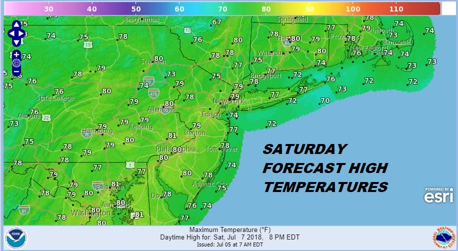
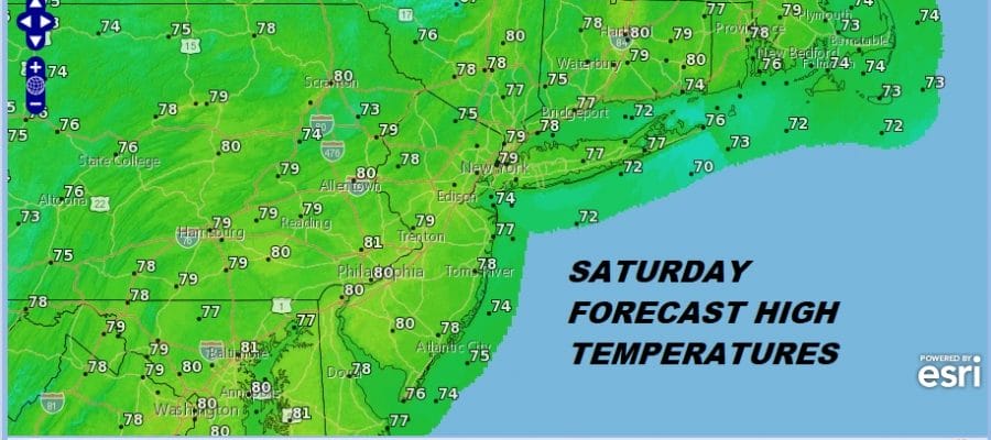
Once that line passes skies will clear out quickly late in the day from west to east and then it is on to a beautiful weekend of sunshine and low humidity. Many areas Saturday won’t get out of the 70s. Sunday will be a little warm with highs into the 80s but the humidity will still be low.
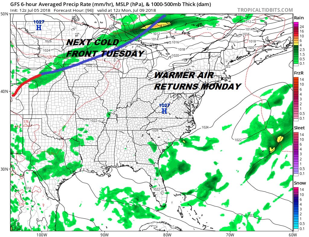
Monday the high moves to our south and temperatures will start to rise again. With the northern part of the jet stream more active going forward we will see weather fronts coming through that will prevent any heat and humidity from lasting for more than a day or two A front in the Upper Great Lakes Monday will pass through late Tuesday allowing temperatures to ease somewhat on Wednesday of next week.
TROPICAL DEPRESSION 2 has formed in the far Eastern Atlantic but it is no threat to any land. JOESTRADAMUS has the latest on this depression and the outlook going forward.
 GET JOE A CIGAR IF YOU LIKE

LATEST JOESTRADAMUS ON THE LONG RANGE


