Strong Thunderstorms Friday Beautiful Sunny Dry Weekend
Strong Thunderstorms Friday Beautiful Sunny Dry Weekend
Today is the 7th day of the steam bath weather that we have been dealing with. At least the extreme high temperatures have been less of an issue as each day has passed though highs today will reach the upper 80s to a few lower 90s. It has been the insanely high humidity that has been out of control. Today will be another day of watching for the possibility of thunderstorms popping up though it seems that the risk today is lower than it has been any day this week. For much of the day and for much of the area it should be rain free.
EASTERN SATELLITE

Satellite loops this morning show some clouds around in what is a tropical sky. The radar activity right now is fairly quiet with most of the thunderstorm activity well inland and west in parts of Pennsylvania.
REGIONAL RADAR

LOCAL RADAR NEW YORK CITY

LOCAL RADAR PHILADELPHIA


Friday we see a cold front coming through with widespread thunderstorms. It appears the front wants to time out during the middle of the day. A strong high with a solid push of cool air coupled with a rather vigorous upper trough lends to the prospect of strong thunderstorms when the front passes. Temperatures Friday will reach into the 80s. Everything suggests the front moves right along and we clear out from west to east later in the afternoon and evening and the weekend looks almost perfect.
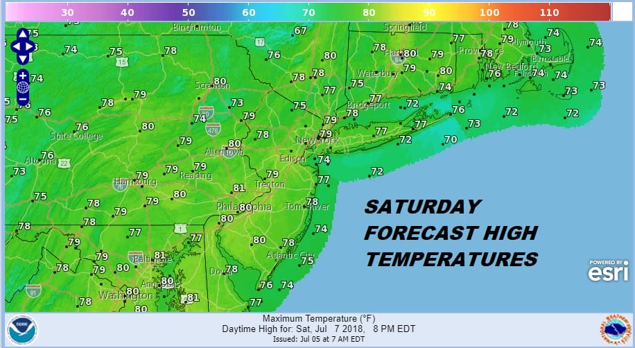
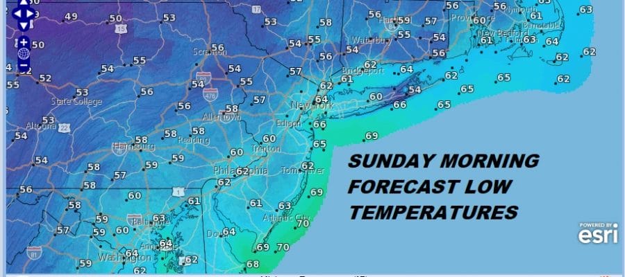
Saturday brings air where you will be able to smell the Canadian pines! Highs will be in the 70s and dew points will be in the 40s making for extremely low relative humidity and of course blue skies and sunshine. Saturday night into Sunday morning it will be great sleeping weather with open windows and no air conditioners. Lows will be in the 50s to lower 60s.

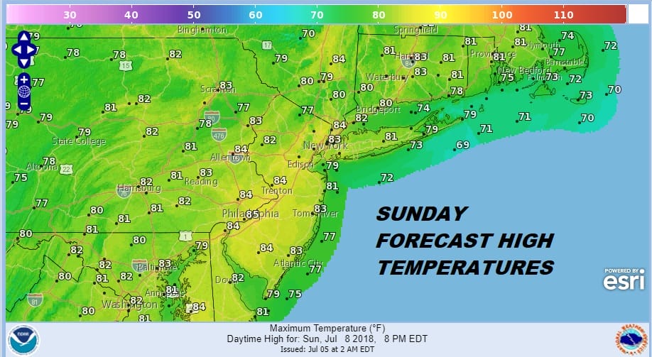
Sunday will be a terrific day with sunshine and highs in the upper 70s and lower 80s with low humidity. You really can’t get much better than this during July. The overall upper pattern DOES NOT favor a return to prolonged heat and humidity like we just went through which means weather fronts will be passing through every 2 to 3 days. We will explore what appears to be a rather interesting long range outlook a bit later today.
 GET JOE A CIGAR IF YOU LIKE

LATEST JOESTRADAMUS ON THE LONG RANGE


