
Tropical Depression 2 Continues Toward South Carolina

MENTION JOE CIOFFI AND GET A 5% DISCOUNT
Tropical Depression 2 Continues Toward South Carolina
Little Change In Strength So Far
Tropical Storm Warnings For South Carolina
...DEPRESSION FORECAST TO BECOME A TROPICAL STORM OVERNIGHT OR
SATURDAY...


SUMMARY OF 1100 PM EDT...0300 UTC...INFORMATION
-----------------------------------------------
LOCATION...29.0N 75.9W
ABOUT 355 MI...575 KM SE OF CHARLESTON SOUTH CAROLINA
ABOUT 360 MI...580 KM SE OF HILTON HEAD ISLAND SOUTH CAROLINA
MAXIMUM SUSTAINED WINDS...35 MPH...55 KM/H
PRESENT MOVEMENT...WNW OR 300 DEGREES AT 12 MPH...19 KM/H
MINIMUM CENTRAL PRESSURE...1009 MB...29.80 INCHES
Very little has changed in the structure of Tropical Depression 2 as continues on a west northwest course toward the South Carolina coast. The system should arrive there on Sunday. It is fighting cool ocean waters off the southeast US coast though it has a chance to strengthen some as it nears the gulf stream. Wind shear conditions aloft are light and favorable for some strengthening though the outflow is not ideal. In any event this system will at worst become a minimal tropical storm before landfall.
Tropical Depression 2 Continues Toward South Carolina HRRR MODEL SATURDAY 1PM
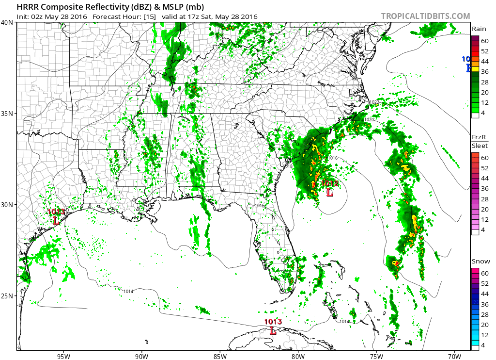
The latest HRRR model has the depression offshore Saturday afternoon and shows little change in strength. My feeling is that if it becomes a tropical storm it will do late tomorrow into Sunday morning when it crosses the gulf stream. Beyond that this is a minor event and warnings are up as a precautionary measure.
SUMMARY OF WATCHES AND WARNINGS IN EFFECT:

A Tropical Storm Warning is in effect for...
* Savannah River to Little River Inlet South Carolina

A Tropical Storm Warning means that tropical storm conditions are
expected somewhere within the warning area within 36 hours.
Tropical Depression 2 Continues Toward South Carolina
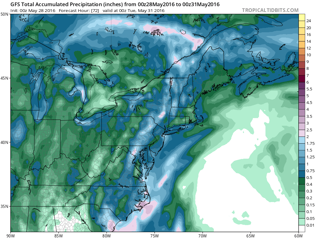
As for our weather and the impact here, assuming the depression moves ashore, the remnant low will either get left behind or kicked away to the east northeast. Some of that moisture could get involved with a cold front coming through here Monday morning and enhance our rainfall a bit. The gfs precip totals through Monday evening put is in the 1/2 inch to an inch range. The timing of the rain would be from the early morning hours Monday until early Monday afternoon. Weather conditions could improve Monday afternoon from west to east. We will have more on this later today.
FiOS1 News Weather Forecast For Long Island
FiOS1 News Weather Forecast For New Jersey
FiOS1 News Weather Forecast For Hudson Valley
NATIONAL WEATHER SERVICE SNOW FORECASTS
LATEST JOESTRADAMUS ON THE LONG RANGE

NOMINATED FOR AN APPY AWARD FOR BEST WEATHER APP!!
Weather App

Don’t be without Meteorologist Joe Cioffi’s weather app. It is really a meteorologist app because you get my forecasts and my analysis and not some automated computer generated forecast based on the GFS model. This is why your app forecast changes every 6 hours. It is model driven with no human input at all. It gives you an icon, a temperature and no insight whatsoever.
It is a complete weather app to suit your forecast needs. All the weather information you need is right on your phone. Android or I-phone, use it to keep track of all the latest weather information and forecasts. This weather app is also free of advertising so you don’t have to worry about security issues with your device. An accurate forecast and no worries that your device is being compromised.
Use it in conjunction with my website and my facebook and twitter and you have complete weather coverage of all the latest weather and the long range outlook. The website has been redone and upgraded. Its easy to use and everything is archived so you can see how well Joe does or doesn’t do when it comes to forecasts and outlooks.
Just click on the google play button or the apple store button on the sidebar for my app which is on My Weather Concierge. Download the app for free. Subscribe to my forecasts on an ad free environment for just 99 cents a month.
Get my forecasts in the palm of your hand for less than the cost of a cup of Joe!
![]()

