DOWNLOAD MY NEW FREE JOESTRADAMUS WEATHER APP FOR ANDROID
THE APP IS ABSOLUTELY FREE TO ALL BUT CONSIDERING SUBSCRIBING TO PATREON FOR A WEATHER EXPERIENCE FREE OF ADS, EXCLUSIVE VIDEOS FOR MEMBERS ONLY AND MUCH MORE…STARTS AT $2 A MONTH..MESSAGE ME AT ANY TIME
Times Square Rain New Year’s Eve Wet Colder Midweek
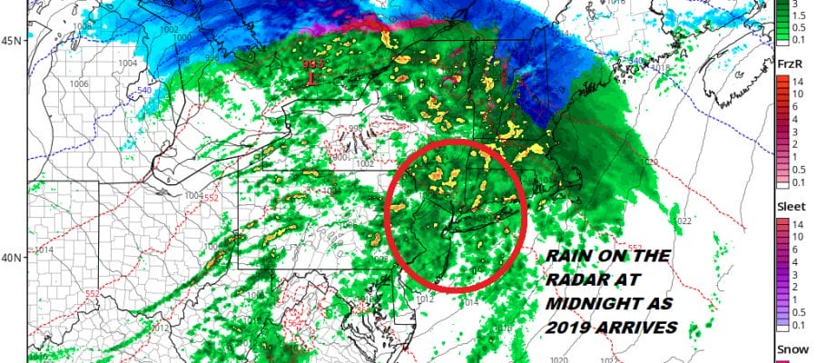
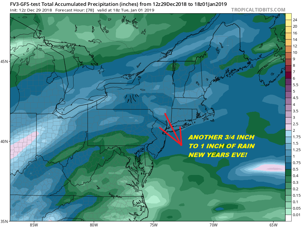
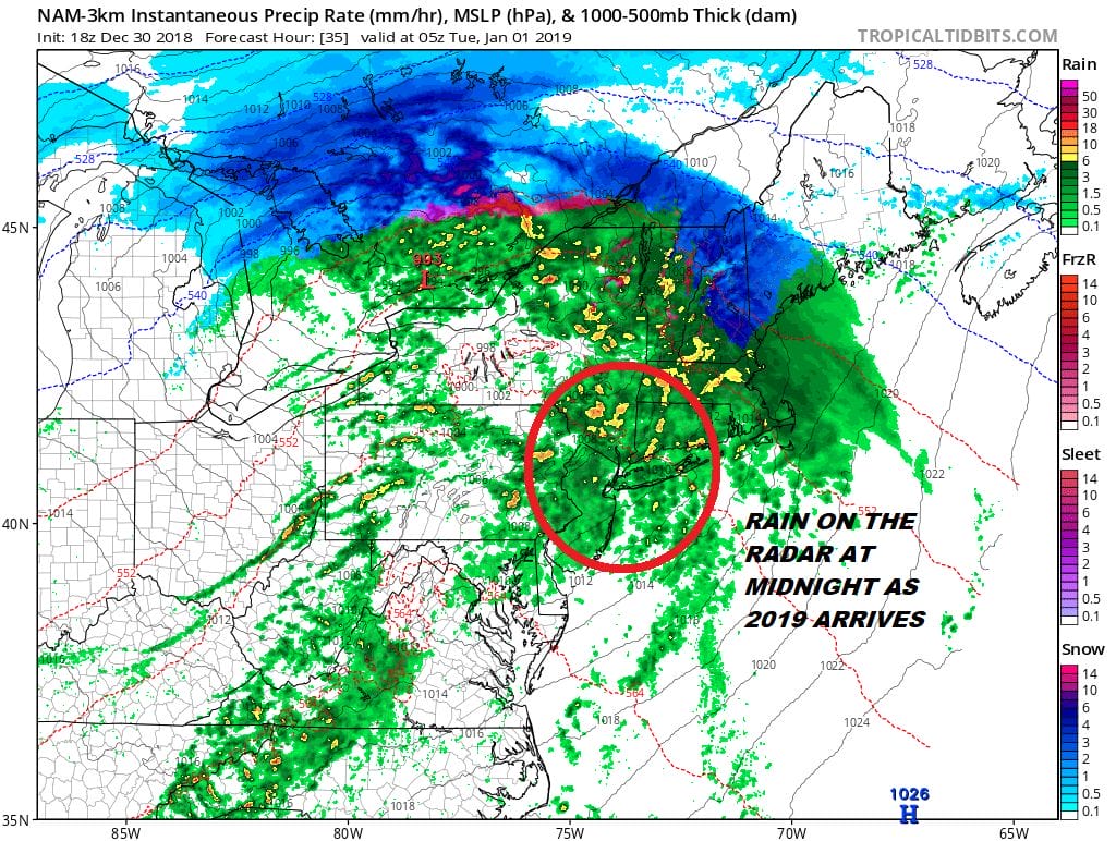
Why not finish what has been a very wet year with more rain! If your plan is to celebrate New Year’s Eve by either travelling to an indoor venue or if you are celebrating the arrival of the New Year outdoors at Times Square in NYC, expect to get wet. Another storm is coming out of the Gulf and heading for the Great Lakes. This is going to bring warm air streaming up the East Coast and rising temperatures at least. Rain will be all over the radar at midnight with temperatures in the upper 40s to lower 50s in NYC. I’d rather be dry and indoors. 3/4 quarters of an inch of rain to an inch seems to be a good bet here.
Before that we have tonight with skies clearing out this evening but we will be seeing clouds returning by morning as they increase from south to north. Rain will be developing from south to north during the day Monday reaching NYC by late afternoon and areas north and east in Southern New England during the early evening.
Once we get past the worst of this rain wise it will be moving out before daybreak Tuesday. There will be some leftover warm air for the start of New Year’s Day. Developing sunshine will take temperatures into the 60s by midday before colder air starts to come in. Skies will be mostly Clear Tuesday night and by Wednesday morning we will be down in the mid 20s to lower 30s. Wednesday we will see sunshine with highs in the low to middle 40s. Then our attention turns to the next system coming out of the Plains.

There is uncertainty on several levels here regarding the weather for late week. Colder air Wednesday tries to hang on Thursday as weather models struggle with just exactly what we will be dealing with storm wise. The GFS has a weaker looking more suppressed upper air feature here with a weak low that comes out on Thursday with an area of precipitation. Other models show more robust development with this low which also means it comes with warmer air for the coast and more snow well inland. Then there is the slower deeper European model which waits until Friday to bring out a strengthening storm to the Ohio Valley and warm air plus rain along the East Coast again. We are content to just punt here until models can settle down on which way this is going to go.
MANY THANKS TO TROPICAL TIDBITS FOR THE USE OF MAPS
Please note that with regards to any tropical storms or hurricanes, should a storm be threatening, please consult your local National Weather Service office or your local government officials about what action you should be taking to protect life and property.


