DOWNLOAD MY NEW FREE JOESTRADAMUS WEATHER APP FOR ANDROID
THE APP IS ABSOLUTELY FREE TO ALL BUT CONSIDERING SUBSCRIBING TO PATREON FOR A WEATHER EXPERIENCE FREE OF ADS, EXCLUSIVE VIDEOS FOR MEMBERS ONLY AND MUCH MORE…STARTS AT $2 A MONTH..MESSAGE ME AT ANY TIME
Rainy New Year Arrival Active Weather Pattern Continues
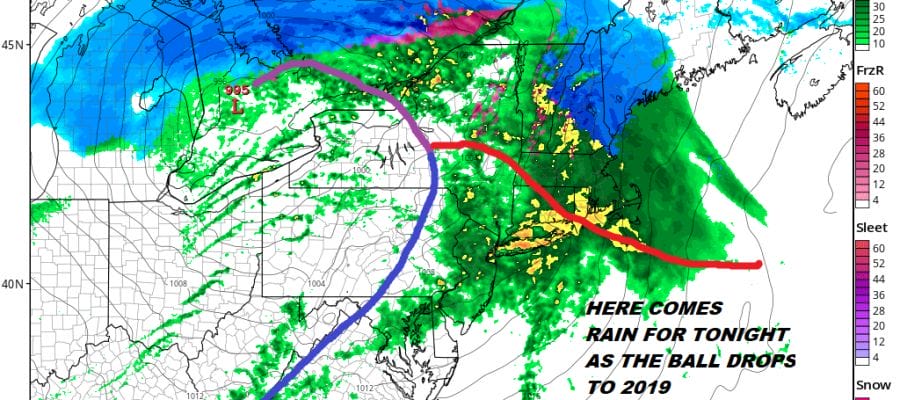
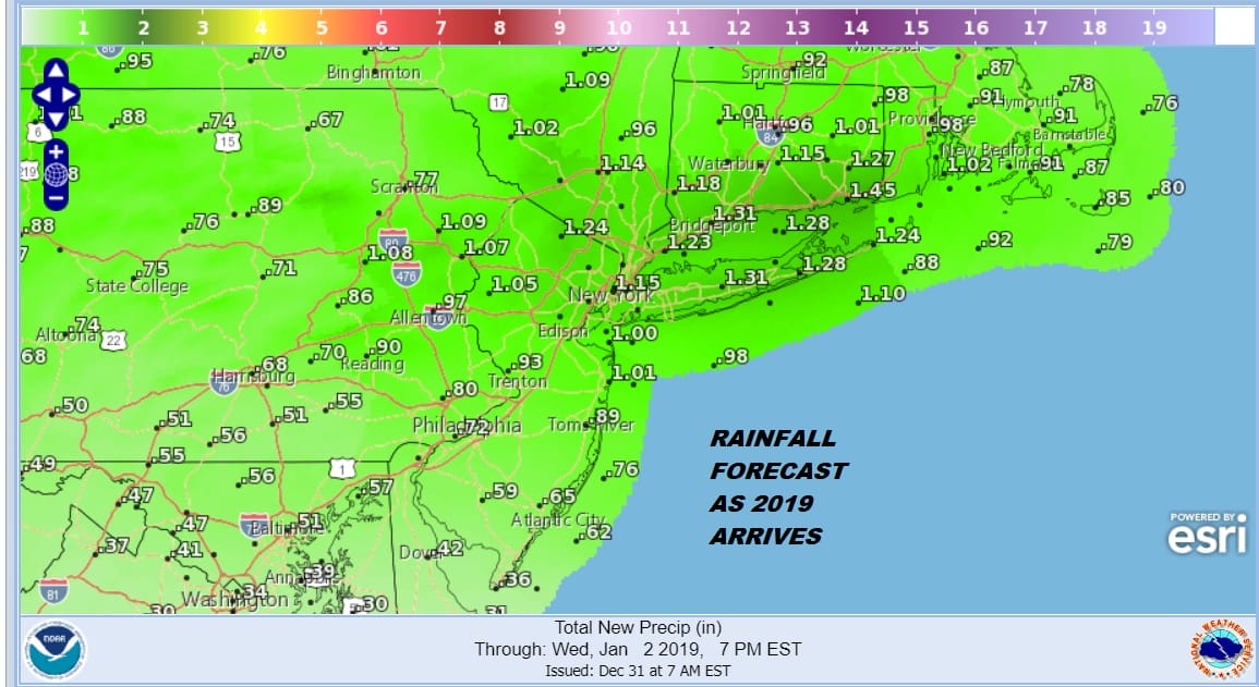
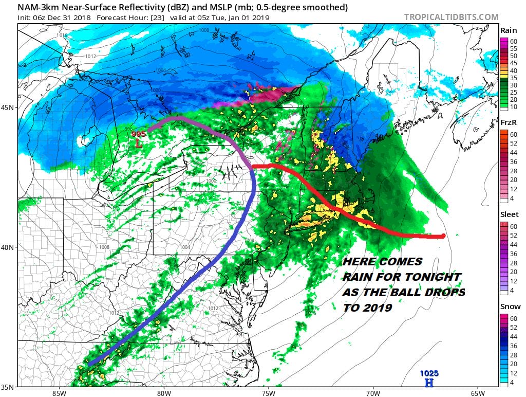
We await the arrival of rain that will develop during the mid to late afternoon and take us right through midnight as the New Year arrives. Clouds are advancing northeastward and they will thicken up as we head into the afternoon. This has been an exceptional year for rain up and down the East Coast with many areas either setting records for annual rainfall or finishing in the top 10 or top 5. For NYC this will likely finish as the 4th wettest on record. Islip on Long Island could finish at number 1 if it gets an inch and two thirds of rain tonight (pushing the envelope). Other stations around the area are in the top 5 or 10 wettest. Rainfall amounts tonight will be on the order of 3/4 inch to an inch and a half.
As for temperatures we are going to see them rise through the 40s and we could be sitting close to 50 or even into the 50s as midnight nears. The rain will be heavy at times tonight and the map below shows what the radar is going to look like at midnight. Standing outside at Times Square will be a soaking experience since umbrellas are not allowed.
Low pressure is going well to our north here and so is the chance for snow. New Year’s Eve and Day are usually part of a big ski weekend in the Northeast but the rain and warm air are going to shoot all the way up to near the Canadian Border. Only Northernmost Vermont New Hampshire and Northern Maine will see mostly snow out of this weather system.
EASTERN SATELLITE

REGIONAL RADAR

The regional radar is beginning to show an expansion of rain across the Central Appalachians into Southwestern Pennsylvania. The area is advancing rather quickly to the northeast. Rain arrives in Southern Pennsylvania by lunch time or very early afternoon, NYC & Northern New Jersey by 3 or 4pm and the Hudson Valley, Southern Connecticut & Long Island by 5 or 6pm. The rains will be ending from west to east between midnight and 2am.
LOCAL RADAR NEW YORK CITY

LOCAL RADAR PHILADELPHIA


Warm temperatures will be leftover Tuesday morning with highs reaching the upper 50s to near 60 degrees before the cold front moves offshore and temperatures begin to ease. Winds will be increasing on Tuesday and they will be strong and gusty during the afternoon New Years Day. We could see gusts to 40 mph at times. Colder air will take temperatures down to the upper 20s and lower 30s. Wednesday we will see some sunshine with highs in the upper 30s to some lower 40s.

The busy weather pattern continues and it continues with no real cold air to create snow issues. The next weather system in this busy pattern comes out of the Plains in apparently 2 pieces. The lead piece will arrive as cold air (such as it is) departs and that piece is likely to be weak and then a second stronger wave arrives for Friday night into Saturday with more rain though how far north the rain gets will be an issue. After this system goes by we will continue in this pattern where shots of cold air will be transient in nature going into next week. We are still waiting to see signs of a large pattern change occurring in the stratosphere extending its way down to the lower atmosphere to show up on weather models. So far the clues are there but there it may take a bit longer for weather models to sniff out these changes.
MANY THANKS TO TROPICAL TIDBITS FOR THE USE OF MAPS
Please note that with regards to any tropical storms or hurricanes, should a storm be threatening, please consult your local National Weather Service office or your local government officials about what action you should be taking to protect life and property.


