The Best Weather Weekend of the Summer
One of the things about this summer is that the weekends actually have been rather good and mostly rain free, With 4 summer weekends left we are going to not only extend the streak of good weekends, we are actually in my opinion going to see the best one so far because it will be a combination of sunshine, reasonable temperatures and low humidity. The dry air is beginning to arrive today as dew points (used to calculate relative humidity) will be falling today. The satellite picture starts out clear today. There might be a few patchy clouds developing later today. The cool upper air flow adds a little instability to the mix and an isolated pop up shower can’t be ruled out but that really will be it. Temperatures today will be in the low to mid 80s. Radars for the most part will be on vacation through the weekend.
SATELLITE

REGIONAL RADAR

Tonight will be the first of several cool nights where you can sleep with the windows open and the air conditioners turned off. Look for clear skies with morning lows in the 50s in many inland areas with low to mid 60s in warmer urban centers and along the coast. Saturday looks great with lots of sunshine and highs in the upper 70s to lower 80s in most places.

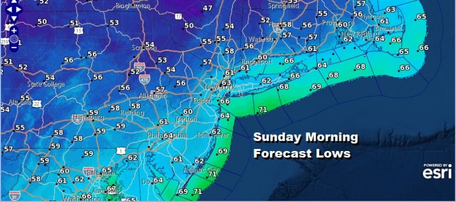
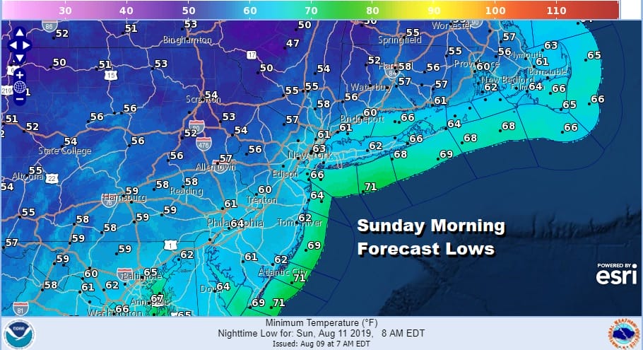
Saturday night into Sunday morning will be the coolest morning area wide that we have seen since back in June. Skies will be clear into Sunday morning and the core of the cooler dry air mass will be directly overhead. Sunday morning you will be waking up to widespread 50s with low 60s in the warmer urban locations and along the coast.
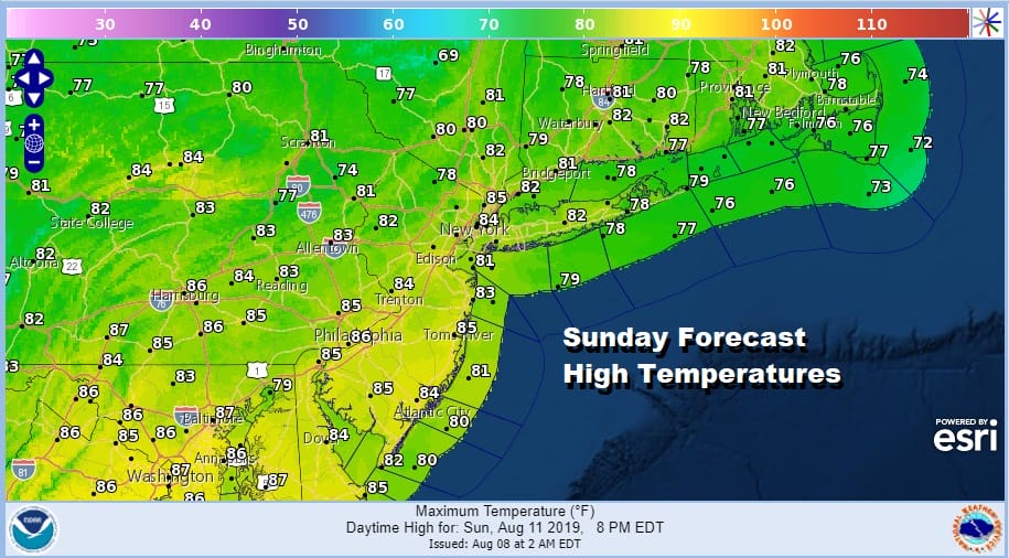
Sunday will be bright sunny and dry with highs in a range of 80 to 85 with most areas topping out in the lower 80s.
We may be able to stretch out the dry air for one extra day on Monday though the dew points will likely come up a little bit. Look for sunshine for much of the day Monday but clouds will start to arrive later in the day ahead of 2 waves of low pressure, most highs in the 80s.
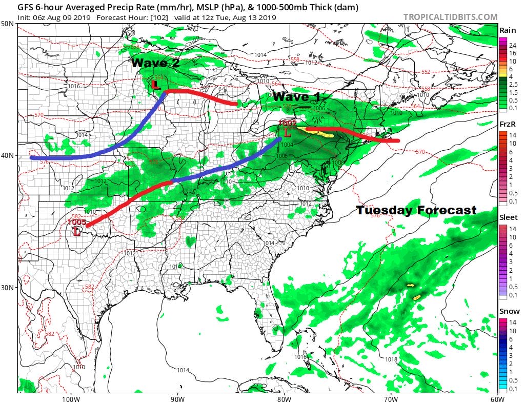
Monday night into Tuesday we have the first of 2 waves of low pressure heading east out of the Midwest. The surface low will track near or just to our north with sets up the possibility for rain and thunderstorms late Monday night into Tuesday morning as the first wave approaches with a warm front. Tuesday humidity levels will be high and then we wait for the cold front so perhaps we could see some thunderstorms later in the day Tuesday. Could this be another severe weather threat? It is certainly not impossible. The second wave that follows will move through on Wednesday as a frontal boundary eventually settles to our south for later next week.
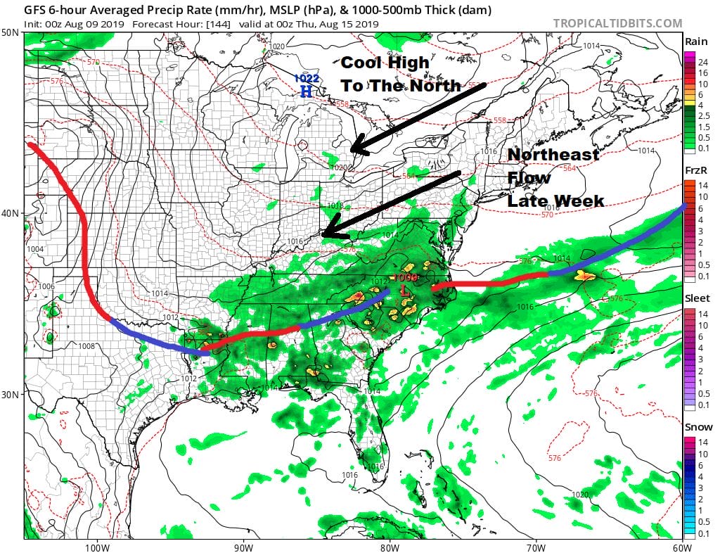
This pattern with a cool high to the north and a northeast flow for later next week is an interesting one. Clouds and rain will be to our south with dry air to the north so the position of that frontal boundary is important. Also lower pressures off the southeast coast of the US might set the stage for low pressure to form sometime late next week in that area. This time of year under certain conditions you could see something tropical form there. This is a long range speculation on my part but I would expect that the silence we have in the tropics is not going to last for much longer.
MANY THANKS TO TROPICAL TIDBITS FOR THE USE OF MAPS
Please note that with regards to any tropical storms or hurricanes, should a storm be threatening, please consult your local National Weather Service office or your local government officials about what action you should be taking to protect life and property.


