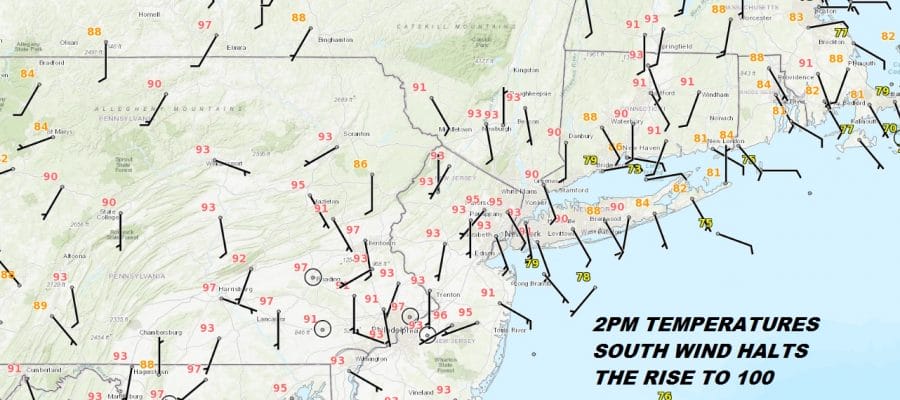
Temperatures Peaked Today South Wind Halts Rise
Temperatures Peaked Today South Wind Halts Rise
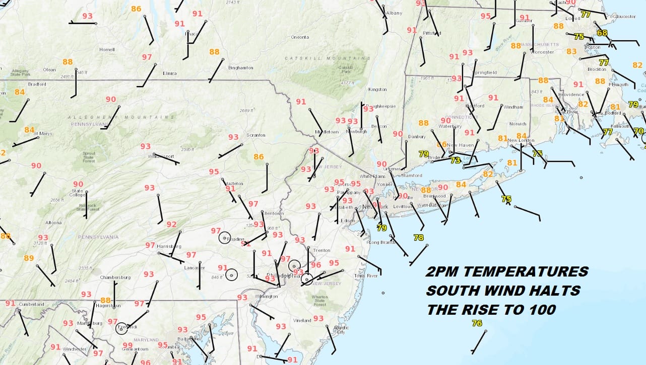
During the first part of the day temperatures were well ahead of yesterday’s pace and seemed to be on their way to the upper 90s to near 100 but the south wind and in some cases southeast winds have kicked which effectively puts a halt on the temperature rise and in fact they may ease in the next few hours along coastal areas. All of this is coming with lots of sunshine and high humidity so regardless it remains uncomfortable.
EASTERN SATELLITE

REGIONAL RADAR

Tuesday it seems may be in the 90s well inland but areas closer to the coast will be in the 80s on Tuesday as it seems that south or southeast wind will be there to temper the temperature rise. Also it seems that a disturbance dropping down from upstate NY could set off some thunderstorms late in the day. The GFS model seems to be the most bullish on this idea. The same risk holds for Wednesday. It does seem that the worst of the heat was yesterday and this morning. Real relief arrives on Friday.
GFS 8PM FRIDAY JULY 6, 2018
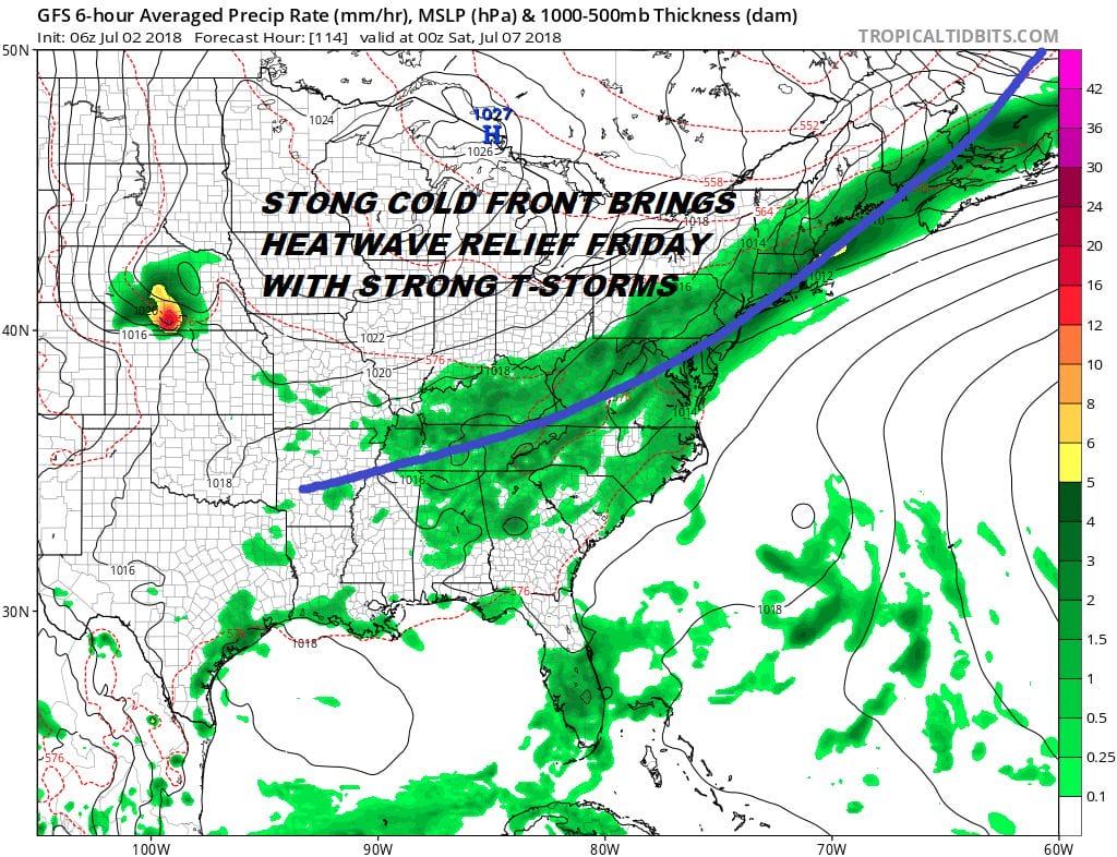
This cold front for Friday comes with some fairly strong upper air dynamics which could put us at risk for strong thunderstorms later in the day. What follows is a great weekend of sunshine and low humidity. Saturday’s highs will be in the 70s to near 80 and Sunday’s highs will be in the upper 70s to lower 80s.
 GET JOE A CIGAR IF YOU LIKE

LATEST JOESTRADAMUS ON THE LONG RANGE


