Sunshine 50s Springlike Sunday Rain Returns Monday Night Tuesday
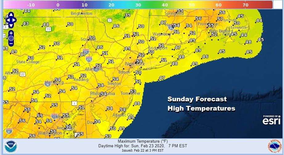
We are capping off two very good days of weather with a springlike feel today. Satellite pictures show us in the clear cloud wise today. We will enjoy a good deal of sunshine. Temperatures are going to respond quite nicely to this abundant sun and send temperatures up into the 50s just about everywhere with the exception of south facing shorelines in Southern New England and Long Island as well as the immediate New Jersey shore where the sea breeze will likely take hold during the afternoon at some point. There temperatures will be in the 40s. It is a good day and a good Sunday so spend it outdoors if you can. The radars are quiet everywhere in the Northeast down to the Middle Atlantic states.
SATELLITE

REGIONAL RADAR

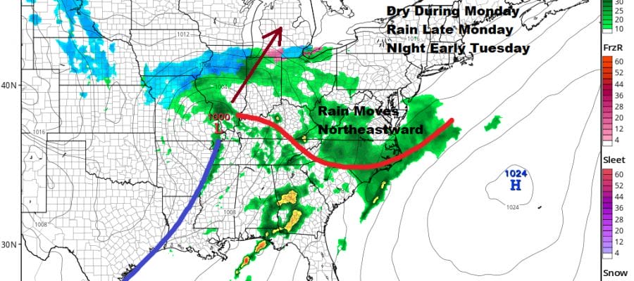
Tonight we should be able to hold on to clear skies for most of the night which will send temperatures down into the 20s inland but warmer urban centers will likely bottom somewhere in the mid to upper 30s. This takes us to Monday which I think will be dry during the day. Sunshine early will give way to increasing and thickening clouds.
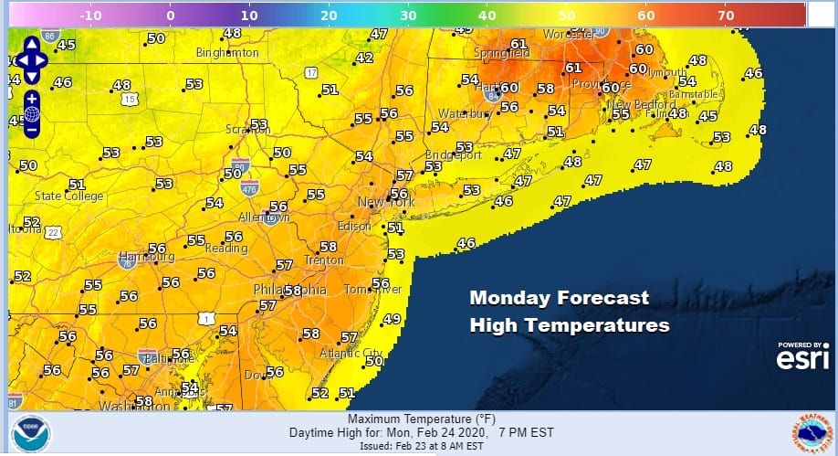
Temperatures will be very mild everywhere in the mid 50s to near 60. Temperatures north and east of NYC may actually be higher with a more sunshine and we could see low 60s at least in Southeastern New England.
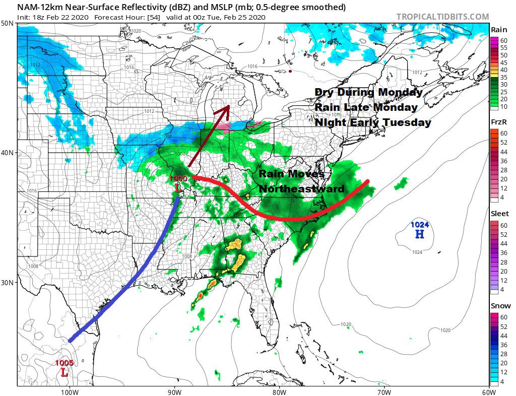
There isn’t much that has changed in the sequence of event for later Monday night through Wednesday night. Low pressure heads to the lower Great Lakes with a cold front swinging eastward like a giant arm. Some rain or showers will move through Monday night into Tuesday afternoon. Then we catch a break and wait for the cold front to approach on Wednesday. Another wave develops on that front and we get into some rain here Wednesday afternoon into Wednesday night.
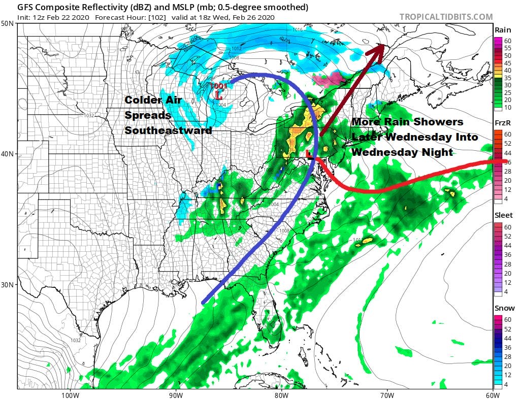
Temperatures on Tuesday will be cooler with a bit of an onshore wind developing so highs may wind up just being in the 40s. Wednesday temperatures will depend on whether a warm front gets through our area or not so it could be one of those situations where it stays in the 40s north and east of NYC and reaches into the upper 50s and lower 60s south and southwest of Philadelphia. Rain should be long gone by Thursday morning with improving weather conditions to follow but we will also see colder weather conditions for the end of the week and into next weekend. It would seem that Friday and Saturday will be a repeat of Thursday and Friday of this week with temperatures by day mostly in the 30s
DOWNLOAD THE FREE METEOROLOGIST JOE CIOFFI WEATHER APP & ANGRY BEN’S FREE WEATHER APP “THE ANGRY WEATHERMAN!
MANY THANKS TO TROPICAL TIDBITS FOR THE USE OF MAPS
Please note that with regards to any severe weather, tropical storms, or hurricanes, should a storm be threatening, please consult your local National Weather Service office or your local government officials about what action you should be taking to protect life and property.


