One More Nice Day Before Rains Return Colder Late Week
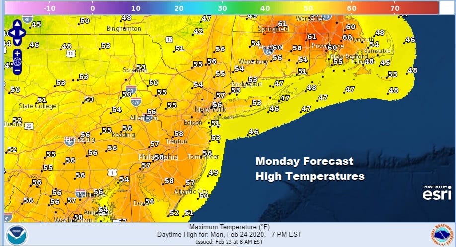
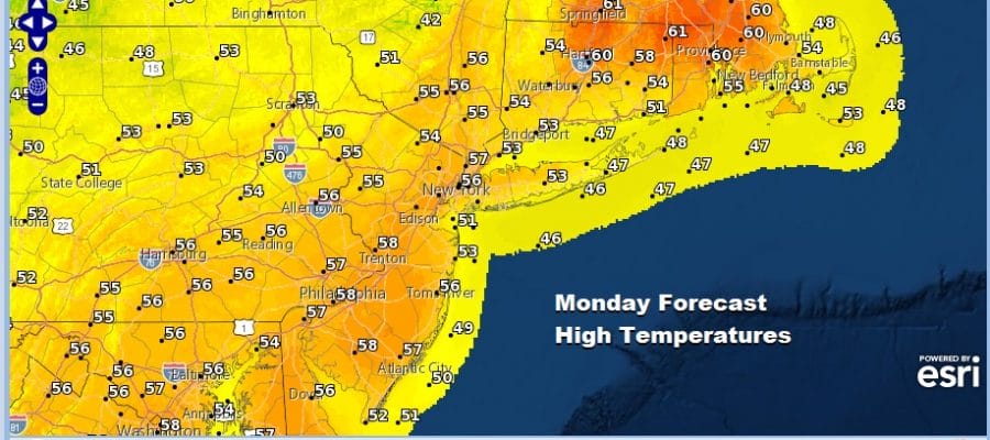
It appears we have one more nice day of weather before we go into a period of unsettled conditions for Tuesday into Thursday. High pressure is offshore and we going to see sunshine this morning before clouds start to move in and increase for this afternoon. The further north and east you go, the higher the temperatures will be today. That’s why you are seeing forecast highs into the 60s for Southeastern New England because sunshine will last into this afternoon while highs to the south from Southern New Jersey to Maryland and Virginia will be in the mid to upper 50s with less sun and clouds arriving sooner. Rain should hold off in all areas until tonight as low pressure moves northeast into the Ohio Valley. For now we have nothing of consequence showing up on the regional radar. That should change later today as rain develops across North Carolina and Virginia.
SATELLITE

REGIONAL RADAR

Tonight we will get into some rain from south to north though it is likely to be patchy in nature. Low pressure in the Ohio Valley is going to redevelop to the east This sets up an onshore flow for Tuesday so look for temperatures to be significantly cooler with highs just mainly in the 40s in most places.
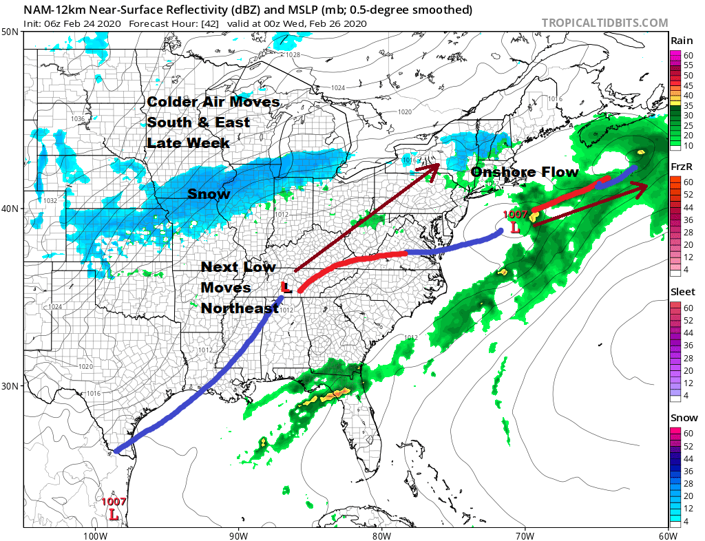
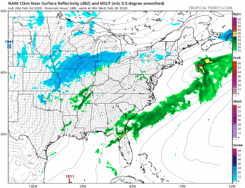
Another one of these transient shots of colder air will be driving eastward Wednesday into Thursday. Ahead of this will be another low that will intensify as it moves northeast. This is another system that tracks inland so it is rain for most areas coming in later Wednesday and Wednesday night. Colder air behind this could change rain over to snow in Upstate NY and New England.
Temperatures Wednesday may have a bit of a struggle but most highs should reach the upper 40s to mid 50s. Rainfall amounts over the next few days don’t look overly exciting. It appears to be on the order of a half to three quarters of an inch of rain spread out over about 60 hours. There will be some dry periods in between with just some light rain, drizzle and/or fog.

For snow lovers this time it will be the Midwest in the areas surrounding the Great Lakes and Northern Ohio Valley and late this week the Northeast and once again it will be mainly north and east of I-90 across Upstate NY and interior Northern New England. This is how it has been all winter long and this time is no different. Colder drier air arrives Thursday on gusty northwest winds. There could be a few snow showers scattered around giving some areas a chance to get a trace of snow before the month ends. Some sun returns for Friday and the weekend. Temperatures Thursday will be in the 40s and dropping. Friday and Saturday highs will be just in the 30s. Then we watch temperatures start their rebound for Sunday March first. There is no change in the long range pattern going into the first week of March.
BE SURE TO DOWNLOAD THE FREE METEOROLOGIST JOE CIOFFI WEATHER APP &
ANGRY BEN’S FREE WEATHER APP “THE ANGRY WEATHERMAN!
MANY THANKS TO TROPICAL TIDBITS FOR THE USE OF MAPS
Please note that with regards to any severe weather, tropical storms, or hurricanes, should a storm be threatening, please consult your local National Weather Service office or your local government officials about what action you should be taking to protect life and property.


