Sunny Sunday Monday Night Tuesday Morning Snow Threat Looms
Sunny Sunday Monday Night Tuesday Morning Snow Threat Looms Noreaster 3 Up The Coast

My early call snow forecast map from yesterday remains in effect with no changes at the moment. Overnight model runs did what they always do and that is jog back and forth with the usual 60 or so mile shift in maximum snow amounts. This morning we are seeing the beginnings of the new model cycle with various models shifting westward with some aggressively raising snow amounts for all areas. Before we get there however we have what appears to be a good looking day today with lots of sunshine and much less cloud cover than what we have experienced the last several days. Temperatures are going to make their way into the 40s and winds will be less than they have been in the last two days.
US SATELLITE

REGIONAL RADAR

We are looking at clear skies overnight with lows in the mid 20s to lower 30s. Then it begins on Monday with increasing clouds and highs into the 40s. We look for snow to develop late Monday evening from south to north and then snow into Tuesday morning. This all falls at night so there are no sun angle issues. This should taper off and end Tuesday morning from west to east with weather conditions improving Tuesday afternoon.
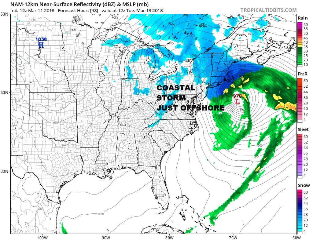
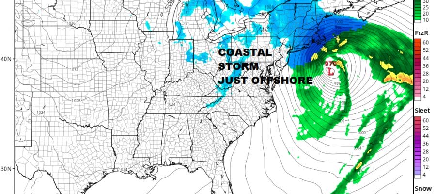
Latest NAM model remains consistent with the idea of coastal amounts being higher this time around verses inland areas. I don’t see any reason to change amounts from my original forecast for the time being. Remember shift the storm east or west 60 miles and we will shift the snow lines east to west as well.
 GET JOE A CIGAR IF YOU LIKE

FiOS1 News Weather Forecast For Long Island
FiOS1 News Weather Forecast For New Jersey
FiOS1 News Weather Forecast For Hudson Valley


