Storm Systems Moving East Next 3 Days
Storm Systems Moving East Next 3 Days
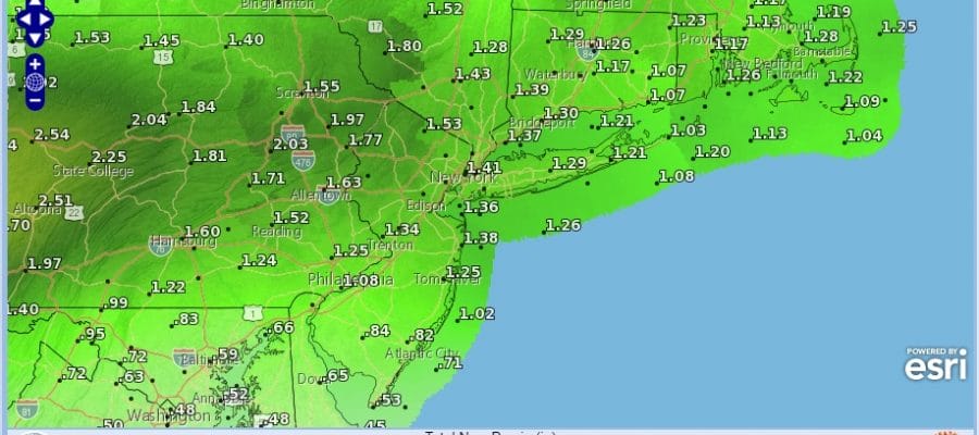
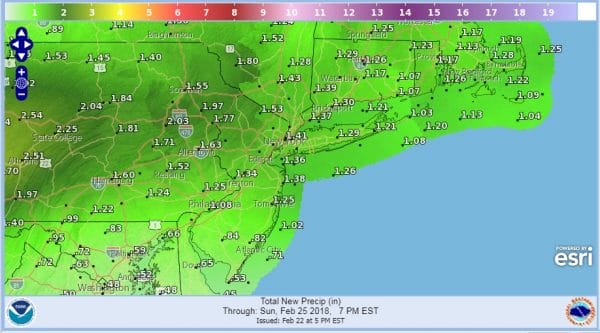
The first of 3 weather systems is moving out to the east and the precipitation with this first system is all but done in most areas. The amount of sleet freezing rain and snow has been minimal. Ahead of us we have a cold cloudy night. The 40 degree temperature changes of the last 24 hours are unusually large and from 70 to 30 degrees is a big change indeed for this area. Weather over the next 3 days will be generally on the grim side with lots of clouds and waves of rain from time to time. When it is all said and done we could wind up with 1 to 2 inches of rain between now and Sunday evening.
RAINFALL FORECAST NEXT 4 DAYS
The latest satellite picture shows the large sweep of clouds from the Gulf States into the Midwest and Plains which is only going to inch eastward. Weather conditions won’t really improve much until Monday when dry air finally replaces this moist flow from the Gulf States.
US SATELLITE
REGIONAL RADAR
LOCAL RADAR NEW YORK CITY
LOCAL RADAR PHILADELPHIA

The last of any rain is moving out to the east now and we don’t expect much precipitation overnight. However we will see a second wave of rain move through Friday arriving during the morning commute and continuing on and off into Friday evening. For the northwest counties of New Jersey and the Hudson Valley mainly north of route 84 there could be a few hours of freezing rain. Since today’s didn’t amount to much I’m suspecting that Friday’s won'[t amount to much either. Saturday dayside we could see a short break where it is cloudy with just occasional passing scattered showers. Saturday night and Sunday however we will see more widespread rain and shower activity. Temperatures Friday will be in the upper 30s and lower 40s. Over the weekend highs should reach the upper 40s to upper 50s in most areas.
 GET JOE A CIGAR IF YOU LIKE
FiOS1 News Weather Forecast For Long Island
FiOS1 News Weather Forecast For New Jersey
FiOS1 News Weather Forecast For Hudson Valley


