
Spring Swings

MENTION JOE CIOFFI AND GET A 5% DISCOUNT
Spring Swings EURO MODEL TODAY’S UPPER AIR JET STREAM
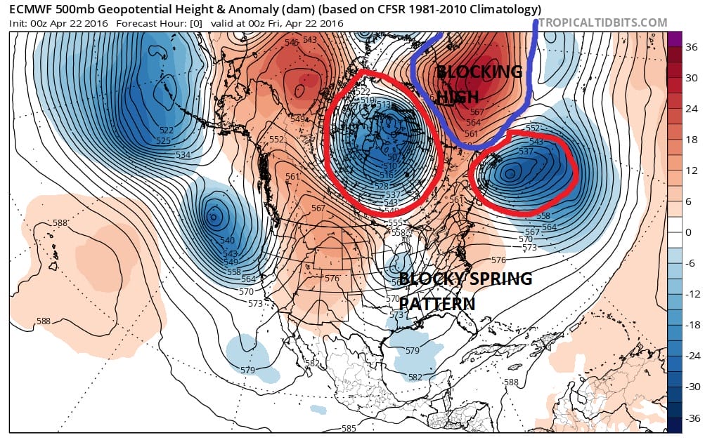
We are going into the weeekend with the atmosphere about as blocky as we have seen in quite awhile. You can from the European model profile of the current atmosphere see the strong blocking high sandwiched in between 2 strong vortexes. One is in Central Canada and the other is southeast of New Foundland. In between those two systems is a ridge in the east which is where we are sitting at the moment. One thing about blocks is that if it lines up just right you are either miserable for days or sunny for days and we have been in the latter for the last 10 days.
Spring Swings JET STREAM PATTERN EURO MODEL WEDNESDAY 4/27/2016
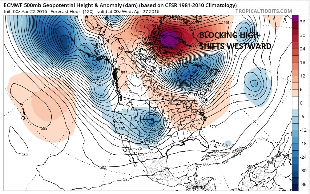
Blocks don’t last very long however. At most they might influence the weather pattern for a week or two before they either break down or move into another position. In this case the Greenland block migrates northwest and westward over the North Pole. This starts to open up the log jam in the northeast next week. The issue for Monday is low pressure going by to our north which means Monday will be very warm with highs in the 70s to near 80 with some sunshine. The boundary between very warm and very cool air will set up across upstate New York and Central New England in my view. That boundary doesn’t sink southward until Tuesday when it will turn cooler.
Spring Swings GFS MONDAY FORECAST 2PM TEMPERATURES
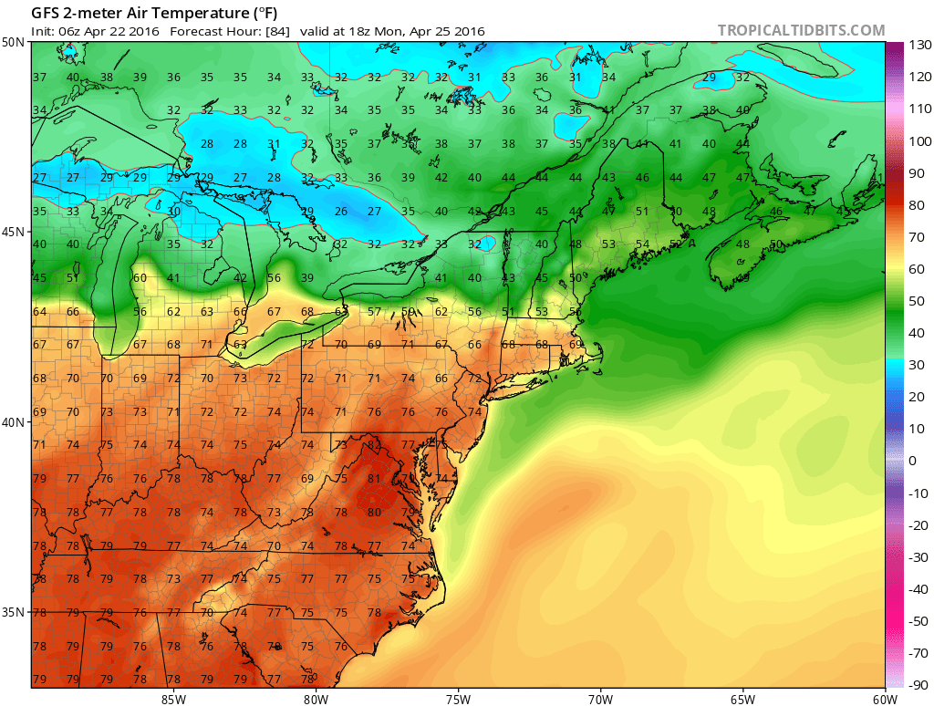
You can see the temperature differential on Monday’s gfs 2pm temperatures. It looks like the front lies right along or just north of Interstate 90 in upstate New York and New England. 40s and 30s to the north of that and 70s and 80s to the south! You have to love spring with frontal boundary setups like this. No rain is forecast until late Monday night and Tuesday. Some showers and a thunderstorm are possible and then once the front moves by look for temperatures into the 50s and 40s during Tuesday afternoon and evening! Beyond this we will have to see whether there is opportunity for some rain later next week as weather systems start moving along from west to east in one fashion or another.
FiOS1 News Weather Forecast For Long Island
FiOS1 News Weather Forecast For New Jersey
FiOS1 News Weather Forecast For Hudson Valley
NATIONAL WEATHER SERVICE SNOW FORECASTS
LATEST JOESTRADAMUS ON THE LONG RANGE

NOMINATED FOR AN APPY AWARD FOR BEST WEATHER APP!!
Weather App

Don’t be without Meteorologist Joe Cioffi’s weather app. It is really a meteorologist app because you get my forecasts and my analysis and not some automated computer generated forecast based on the GFS model. This is why your app forecast changes every 6 hours. It is model driven with no human input at all. It gives you an icon, a temperature and no insight whatsoever.
It is a complete weather app to suit your forecast needs. All the weather information you need is right on your phone. Android or I-phone, use it to keep track of all the latest weather information and forecasts. This weather app is also free of advertising so you don’t have to worry about security issues with your device. An accurate forecast and no worries that your device is being compromised.
Use it in conjunction with my website and my facebook and twitter and you have complete weather coverage of all the latest weather and the long range outlook. The website has been redone and upgraded. Its easy to use and everything is archived so you can see how well Joe does or doesn’t do when it comes to forecasts and outlooks.
Just click on the google play button or the apple store button on the sidebar for my app which is on My Weather Concierge. Download the app for free. Subscribe to my forecasts on an ad free environment for just 99 cents a month.
Get my forecasts in the palm of your hand for less than the cost of a cup of Joe!
![]()

