Some Sunshine Gusty Breeze No Major Storms Through The Weekend
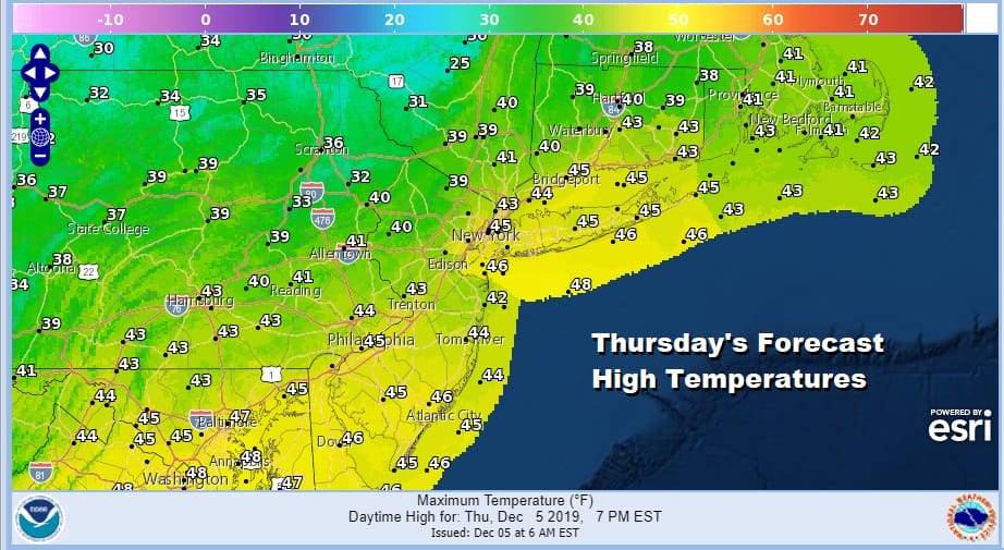
We managed to get through all the clouds of yesterday and a showers that were running around last night. Now it is on to a day where we should see more in the way of sunshine but a gusty wind will develop as the day weathers on adding a bit of a chill to the air. Highs will be in a range of 40 to 45 though the winds will make it feel a lot colder. In the meantime we have some late effect action going on this morning in parts of Upstate NY & Western Pennsylvania which is typical in a set up like this so expect nothing unusual here.
SATELLITE

REGIONAL RADAR

Regional radar is plcking up on the snow shower activity around the lakes with some bands approaching the Catskills and Northeast Pennsylvania. This all running ahead of a cold front moving through this morning and once the front passes look for those winds to pick up.
LOCAL RADAR NEW YORK CITY

LOCAL RADAR PHILADELPHIA


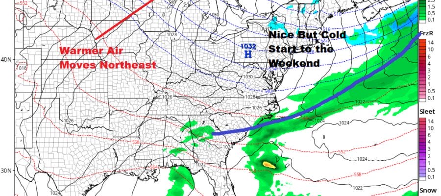
Tonight we should clear with lows in the mid 20s to near 30 with a bit of a breeze continuing at least for awhile. Friday brings another front with some clouds and the risk for a passing rain or snow shower in the afternoon and evening. Rain showers will occur near the coast and either one inland. Highs will be in the 40s before another cold shot arrives for Saturday.
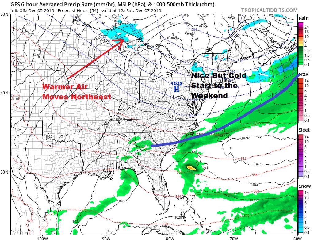
The weekend looks to be nice but it will be cold on Saturday. We will have a good amount of sunshine but highs won’t be getting out of the 30s. Sunday look for sunshine and some arriving high clouds with highs reaching into the 40s. The next high is going out off the Mid Atlantic coast which means we will warm up early next week 50s are likely Monday and Tuesday but also some rain is likely as well as a strong cold front approaches for late Tuesday.

The air that comes in behind this front is going to be cold and that next high will overtake much of the Eastern US. We also have a rather interesting upper air pattern developing with a split flow jet stream again with a Canadian connection to cold air and a Pacific connection to weather systems coming into California
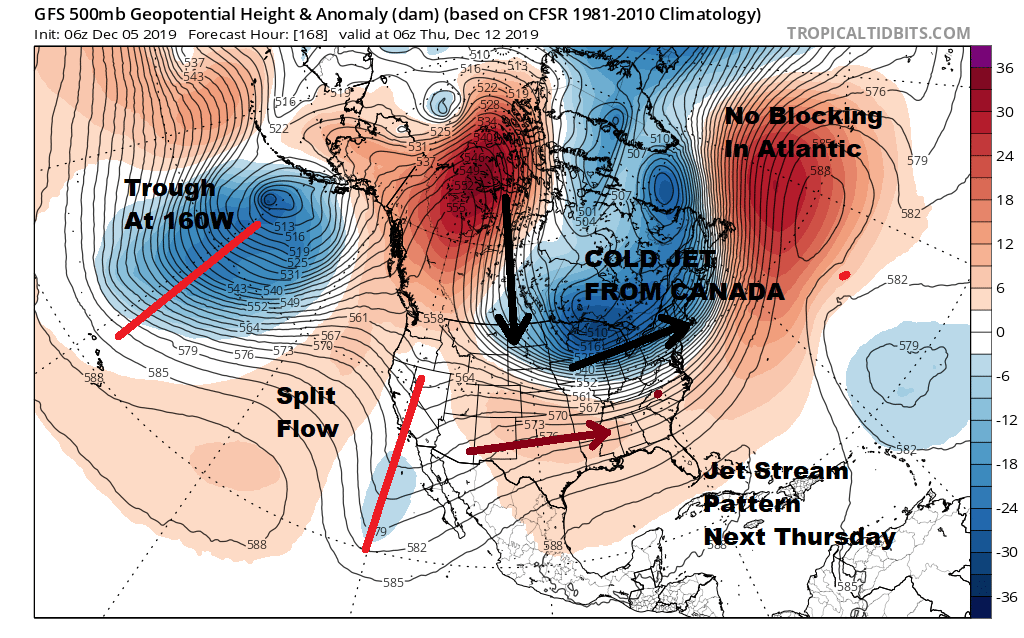
We also have a trough along 160 West at the longitude of Hawaii which creates troughing in the east. What we don’t have this time around is blocking so late next week and beyond will be a matter of timing of northern and southern jets and cold air masses as to whether it brings opportunities for snow or rain around mid month. The pattern does look active overall and that appears to continue in the long range so we will see what it brings.
BE SURE TO DOWNLOAD THE FREE METEOROLOGIST JOE CIOFFI WEATHER APP &
ANGRY BEN’S FREE WEATHER APP “THE ANGRY WEATHERMAN!
MANY THANKS TO TROPICAL TIDBITS FOR THE USE OF MAPS
Please note that with regards to any severe weather, tropical storms, or hurricanes, should a storm be threatening, please consult your local National Weather Service office or your local government officials about what action you should be taking to protect life and property.


