Arctic Front Moves Through Nice Weekend Active Weather Next Week
The next cold front is on the way today with the next round of changes. We are seeing lots of clouds around today with that odd break or two or sun around. The boundary zone is setting up to our north in upstate NY where some areas areas across Central and Western NY are going to see a few inches of snow. Temperatures for most of the downstate region and areas south into New Jersey and Southeastern Pennsylvania will reach the upper 40s and lower 50s. There is the chance for a passing shower but that is just about it as far as precipitation is concerned.
SATELLITE
REGIONAL RADAR
We are seeing some areas of precipitation showing up on the regional as well as the local radars. On the locals most is not even reaching the ground. On the regional radar the area of snow in upstate NY in most cases is reaching the ground as the area along I-90 gets a coating to a few inches.
LOCAL RADAR NEW YORK CITY
LOCAL RADAR PHILADELPHIA

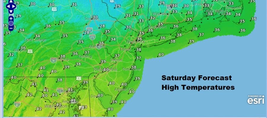
Once the front passes the temperatures fall and we are headed for the 20s tonight as skies clear. The weekend is looking good overall with sunshine for Saturday but highs won’t be getting out of the 30s in most places.
Sunday we will see sunshine most of the day though clouds will be arriving later on. Temperatures should be back into the 40s. Then even warmer air arrives for Monday and Tuesday but with that it looks like we will see two surges of rain.
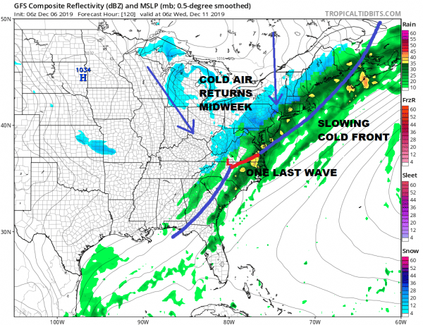
The first surge looks to come Sunday night into Monday and a second surge with an approaching cold front later Monday night and on Tuesday Highs both days will be in the 50s. However once the cold front passes on Tuesday the issue will be colder air behind it and a second wave developing on the front. This is why you see the rain change to snow on the last few frames of this loop.
Nine times out of 10 the front moves through and the rain just shuts off. It has to set up rather close to perfect for a change over at the end to happen and even if it does it rarely amounts to anything significant. The wave would have to be slower and colder air will need to move in faster for anything of consequence to happen Tuesday night into Wednesday morning. Either way the second half of next week looks to be cold and there are other storm systems that loom on the horizon later next week.
BE SURE TO DOWNLOAD THE FREE METEOROLOGIST JOE CIOFFI WEATHER APP &
ANGRY BEN’S FREE WEATHER APP “THE ANGRY WEATHERMAN!
MANY THANKS TO TROPICAL TIDBITS FOR THE USE OF MAPS
Please note that with regards to any severe weather, tropical storms, or hurricanes, should a storm be threatening, please consult your local National Weather Service office or your local government officials about what action you should be taking to protect life and property.


