Showers Moving Through Clearing Tonight Nice Cold Weekend
Showers are moving through from west to east and they will be moving offshore this evening. This is a cold front that is passing through and kept us in cloudy skies for much of the day. Behind the front is a shot of colder air that moves in for Saturday and for Sunday before a rather big warm up arrives for the first two days of next week. Once the showers are done we will gradually clear out tonight. It will be a cold night as lows by morning bottom in the upper 20s to near 30 with a gusty wind.
SATELLITE

REGIONAL RADAR

Regional and local radars are showing showers moving from west to east in a relatively narrow band. In upstate NY and into New England we are seeing some snow. A few inches of snow are possible in some areas. No snow will be falling in our area from Eastern Pennsylvania to Southern New England.
LOCAL RADAR NEW YORK CITY

LOCAL RADAR PHILADELPHIA


The weekend offers sunshine but it will be cold especially Saturday with highs just in the 30s in most places. Winds will ease however. Saturday night looks clear and cold. Sunday we will see sunshine most of the day as temperatures rebound into the 40s.
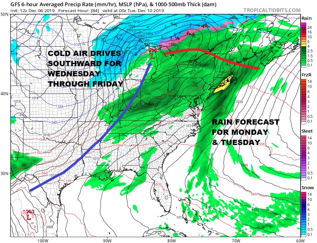
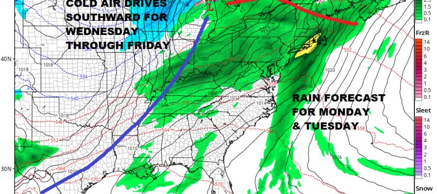
Monday brings a moist southwest flow of air and several rounds of showers with the first developing during the day on Monday and the more coming for Monday night and Tuesday. Temperatures will be warming up considerable as the warm front sets up to our north. This is also going to set the stage for considerable flooding thanks to the snow melt of last weeks 20 inch plus snowstorm in upstate NY and New England. A inch or more of rain is forecast for many areas upstate as well as in our area. Temperatures will be in the 50s on Monday and in the 50s to near 60 on Tuesday.

The next cold front moves through and there will be very cold Canadian air coming in behind it rather quickly. One last wave developing on the front offshore argues for a change to snow before ending. 9 times out of 10 these changeovers either never happen or if they do the consequences snow wise are minor. We will look closer at that possibility over the weekend otherwise we will be seeing rather cold air here for the middle and latter part of next week.
BE SURE TO DOWNLOAD THE FREE METEOROLOGIST JOE CIOFFI WEATHER APP &
ANGRY BEN’S FREE WEATHER APP “THE ANGRY WEATHERMAN!
MANY THANKS TO TROPICAL TIDBITS FOR THE USE OF MAPS
Please note that with regards to any severe weather, tropical storms, or hurricanes, should a storm be threatening, please consult your local National Weather Service office or your local government officials about what action you should be taking to protect life and property.


