DOWNLOAD MY NEW FREE JOESTRADAMUS WEATHER APP FOR ANDROID

THE APP IS ABSOLUTELY FREE TO ALL BUT CONSIDERING SUBSCRIBING TO PATREON FOR A WEATHER EXPERIENCE FREE OF ADS, EXCLUSIVE VIDEOS FOR MEMBERS ONLY AND MUCH MORE…STARTS AT $2 A MONTH..MESSAGE ME AT ANY TIME

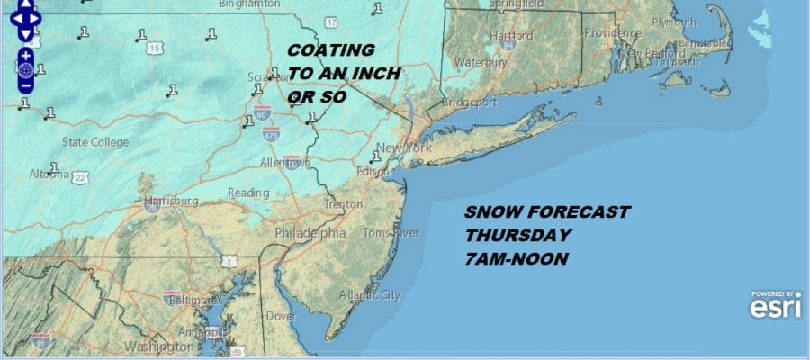
Snow Thursday Morning Coating to 1″ or So
I know that it’s the”or so” that everyone will probably worry about but this does look like a weak area of moisture that is currently sitting over the Great Lakes. Another high is building southward into New England and pushing eastward on the edge of this is some warmer air trying to move northeastward. Snow will likely be patchy on the radar overnight and it will arrive during the morning hours, probably after 6-7am in Western NJ (along and north of Route 78) and then shortly afterwards into the Hudson Valley and in Western Connecticut. There really isn’t much to this system from what we can see. Temperatures tonight will drop to the 20s to near 30 so before sunrise everyone is likely to be under 32. A coating to an inch seems reasonable here. For Long Island and areas to the south of Route 78 in New Jersey we will some flakes and some rain drops in the mix since the nature of the precipitation is light.
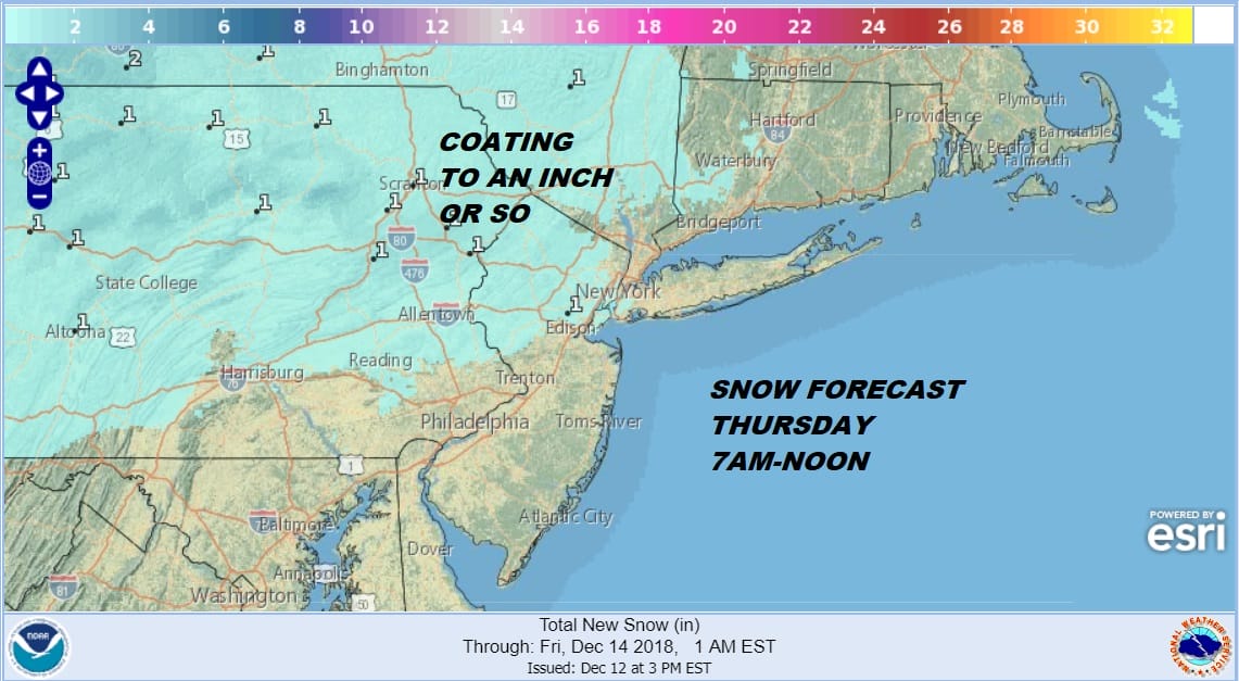
By noon or so this should all be done with leftover clouds in the afternoon. The satellite loop this evening shows high clouds streaming in from the west but it is not a solid overcast. There are a lot of thin spots around so skies may actually go partly to mostly clear for awhile this evening or even through half of the night.
EASTERN SATELLITE

The regional radar is quiet at the moment other than some light snow aloft that showing up in Western Pennsylvania south into Northwest Virginia. That area appears to be weakening as it moves eastward this evening. All other radars area quiet at the moment.
REGIONAL RADAR

Once this goes by we will then focus our attention on a stronger storm coming out of the Southern Plains. With the high going to the New England coast and an onshore flow developing we will likely sit in clouds. Temperatures should hold or even rise a bit Thursday night into the mid 30s and lower 40s and keep edging higher on Friday. When precipitation arrives with this system Friday night it will be all rain for everyone. Even areas inland that normally hold on to cold air longer will warm up and rain rather than freezing or frozen precipitation.

Rain will last through much of the day Saturday with an east wind and temperatures in the 40s. The blocky nature of the atmosphere will mean this system will be very slow to move out of the way. Rain and an east wind will likely continue into Sunday though I would suspect that the rain might be more on and off in nature. We may have to wait for another low to develop along the Delaware coast to finally clean things out around here for Monday. After that cold dry air comes in for Tuesday and Wednesday of next week.
MANY THANKS TO TROPICAL TIDBITS FOR THE USE OF MAPS
Please note that with regards to any tropical storms or hurricanes, should a storm be threatening, please consult your local National Weather Service office or your local government officials about what action you should be taking to protect life and property.

